Pike’s Peak (Again)

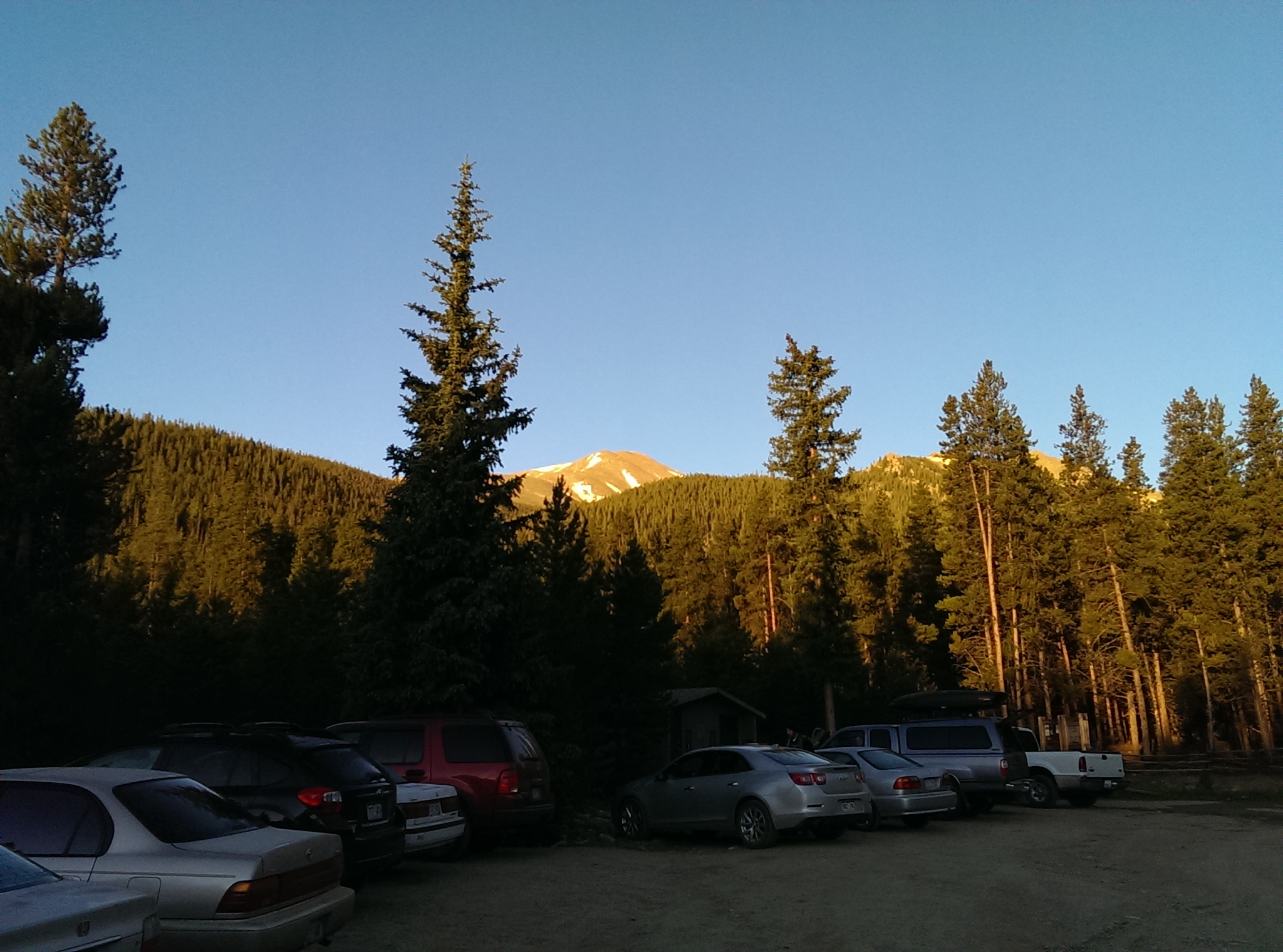
A couple weeks ago I was finally caught up on everything and had a Friday off work, so I decided to go backpacking and camp somewhere out in the national forest. I had a few options, but ended up going to the Crags trailhead on the west side of Pike’s Peak and hiking up the trail to Devil’s Playground.

It was definitely a good time for a hike in the mountains:
Nearby Aspens

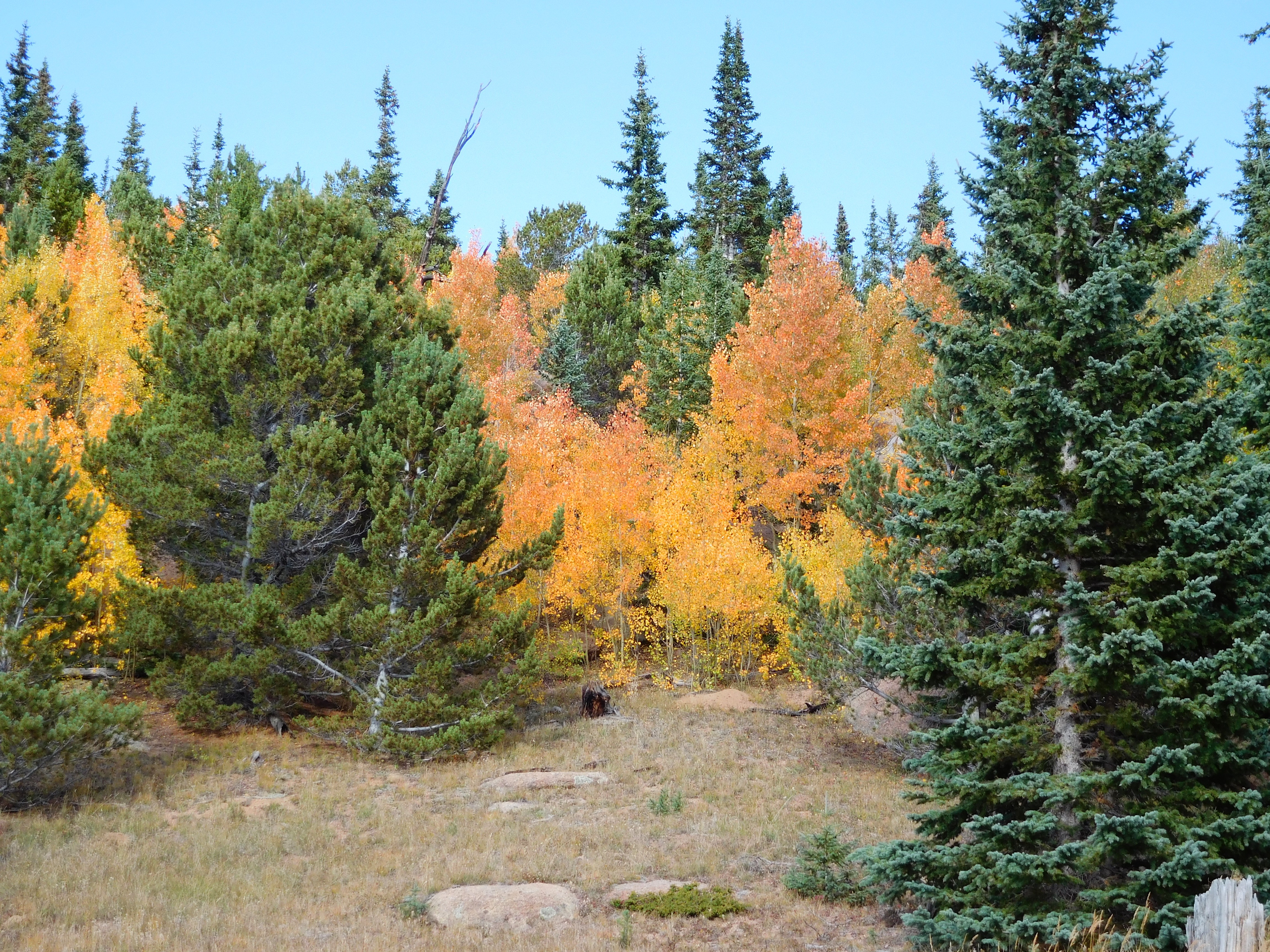
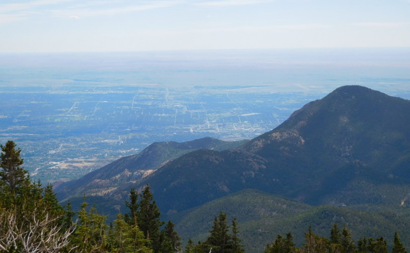
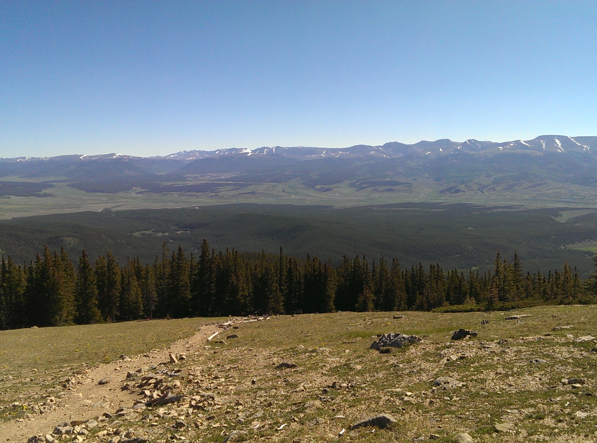
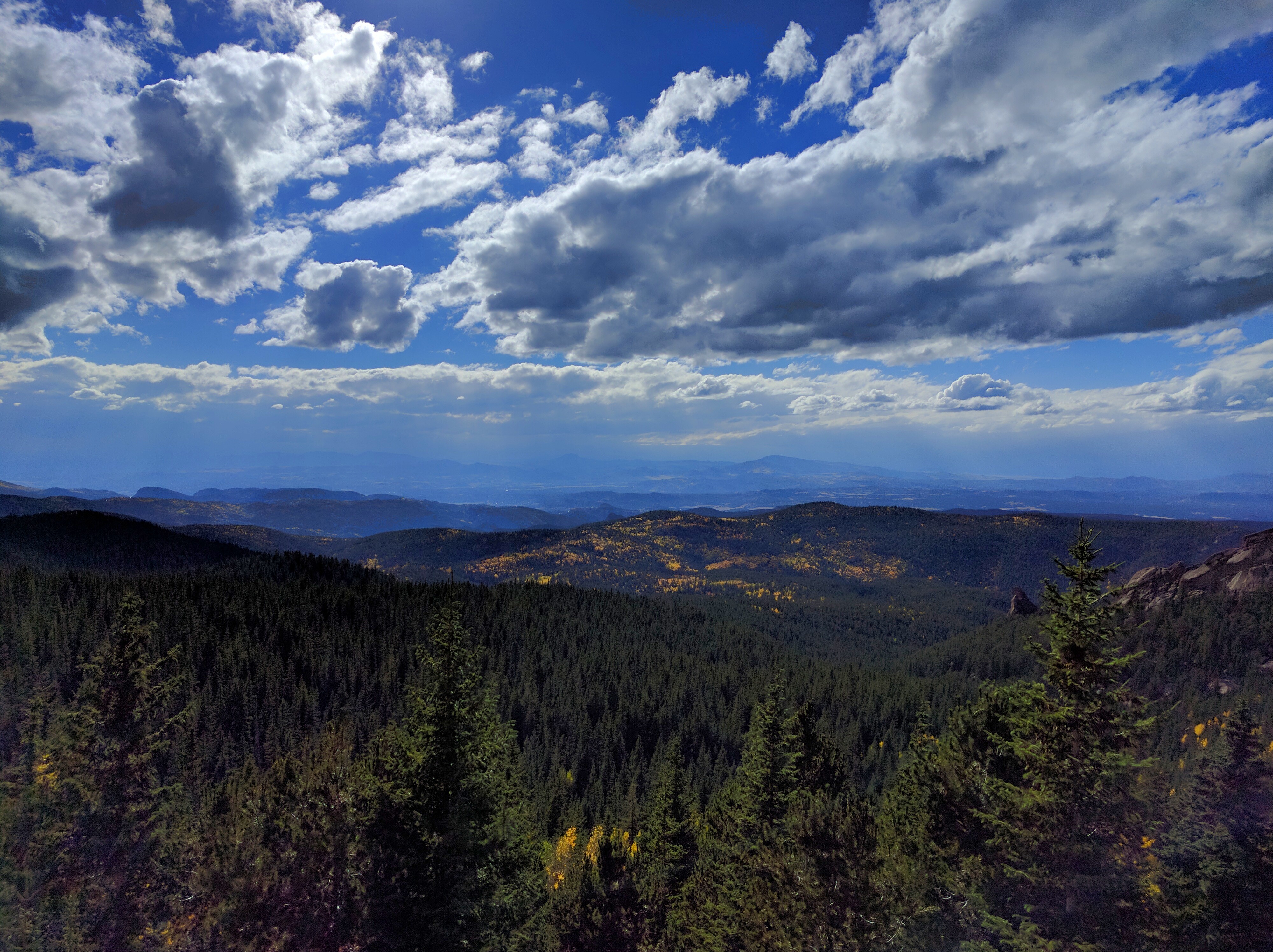
As I neared treeline the view out across the valley just got better:
Distant Aspens

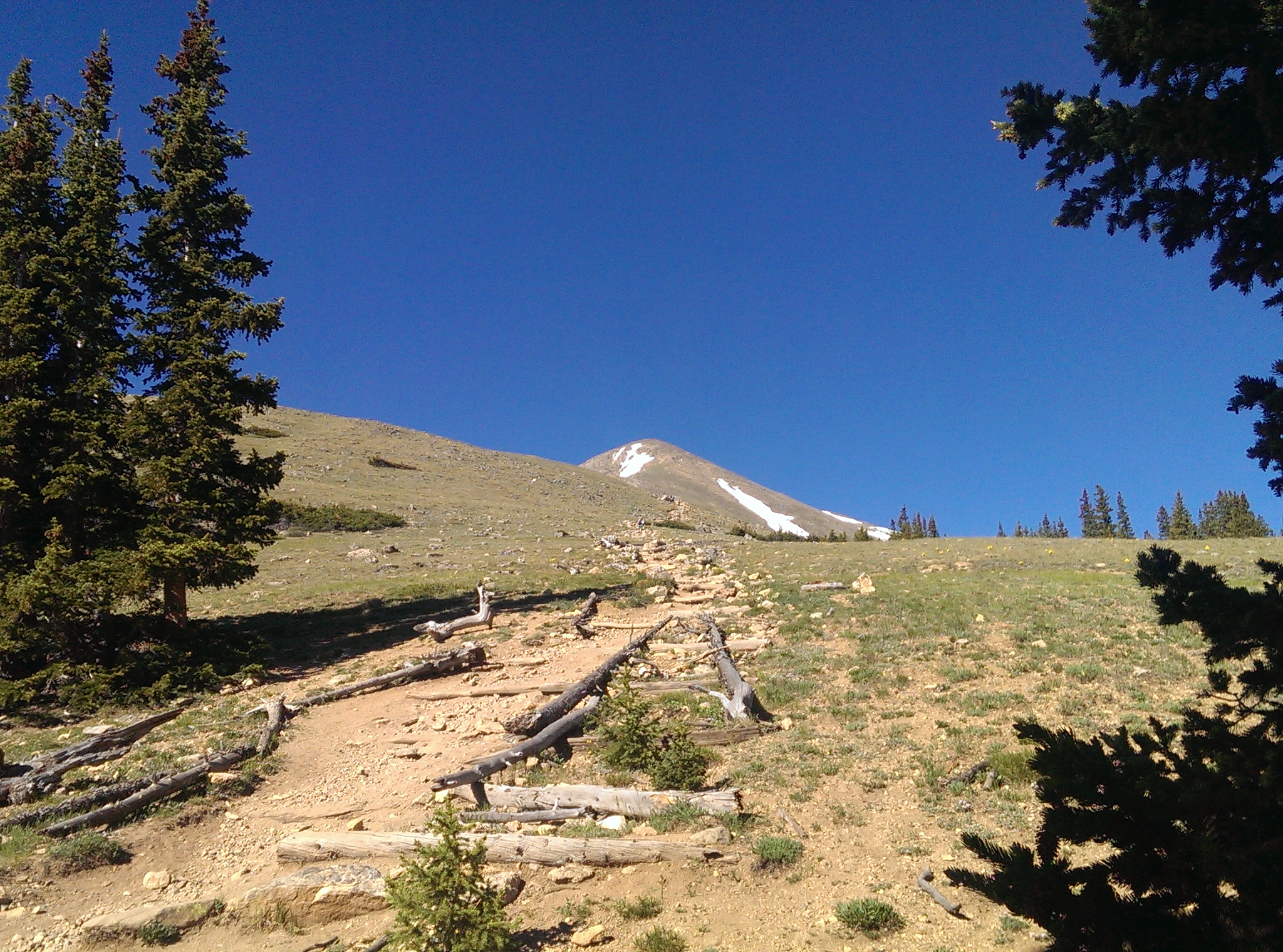
I camp in a hammock, so I had to stay below treeline. The trail leaves the trees around 11,700 ft elevation (according to my map, I didn’t check it), but there are trees up to a bit above 11,800 ft off trail to the north. I ended up hanging my hammock at 11,838 ft according to the GPS app on my phone.

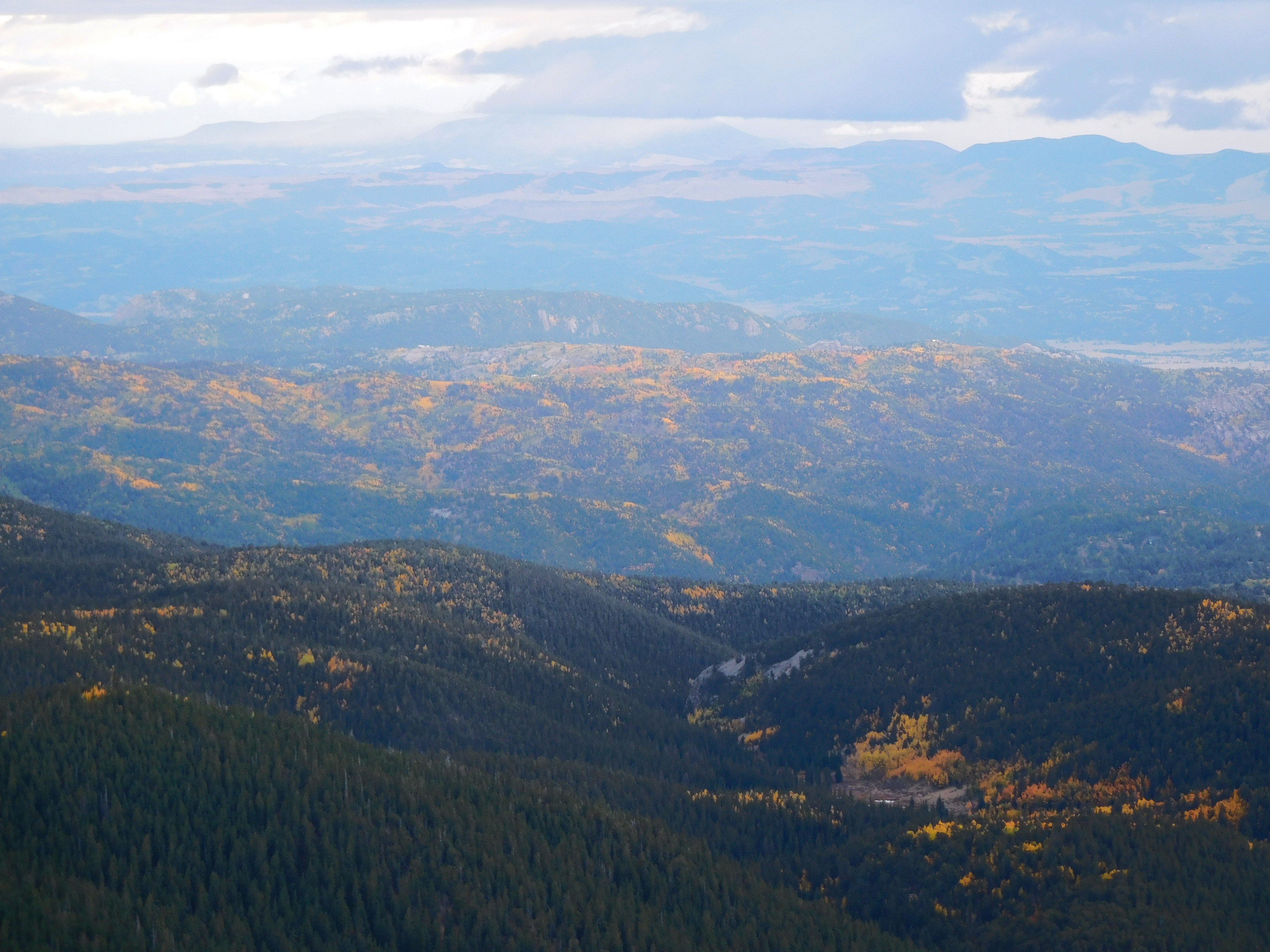
Once I had camp set up, I scrambled up the rocks to get to a nearby ridge. Naturally, there were more views of the aspens, even if the light was fading as clouds rolled in:
Distant Aspens 2

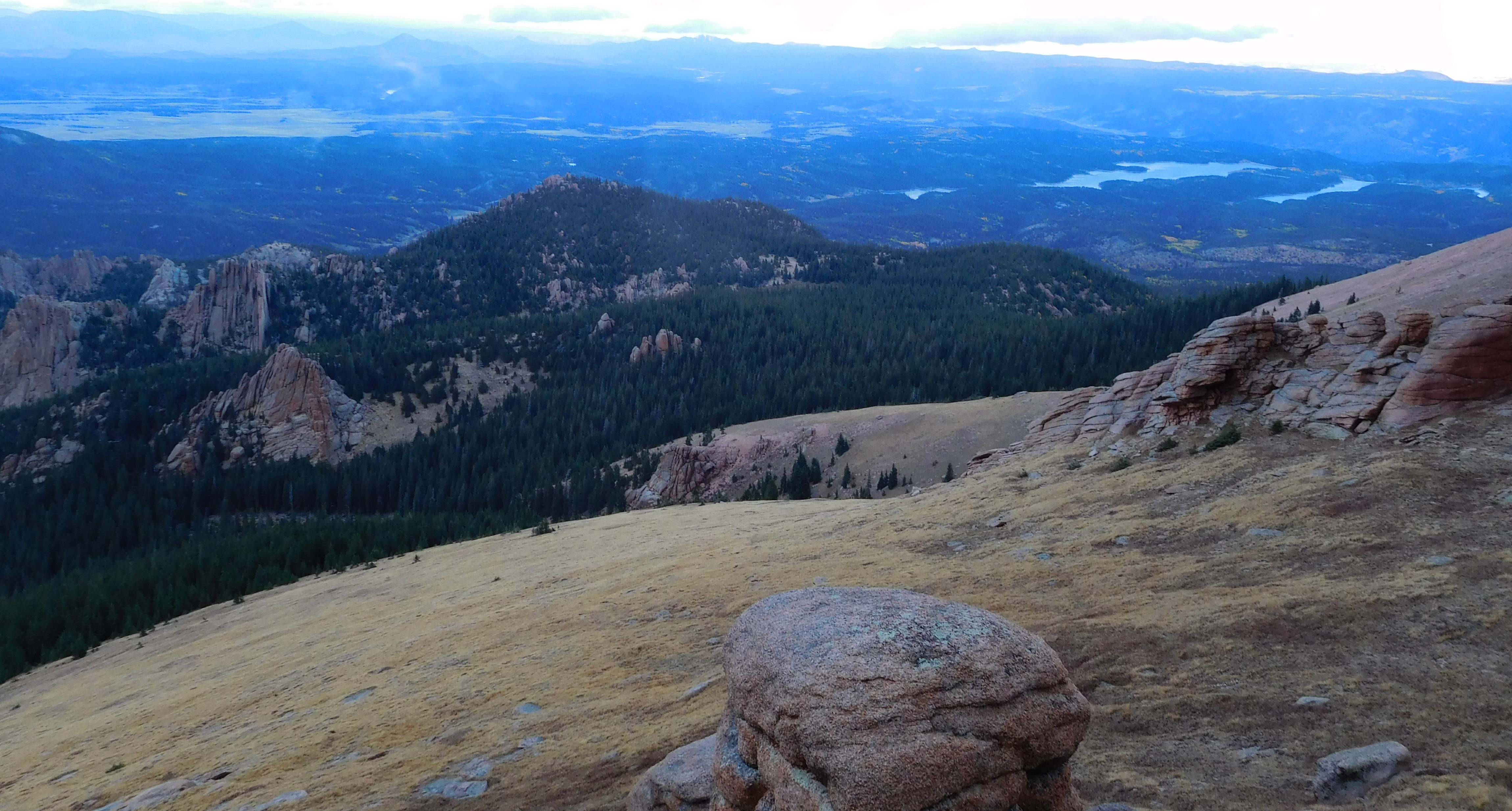
Here’s a shot of the catamount reservoirs to the right and the crags to the left:
Catamount Reservoirs

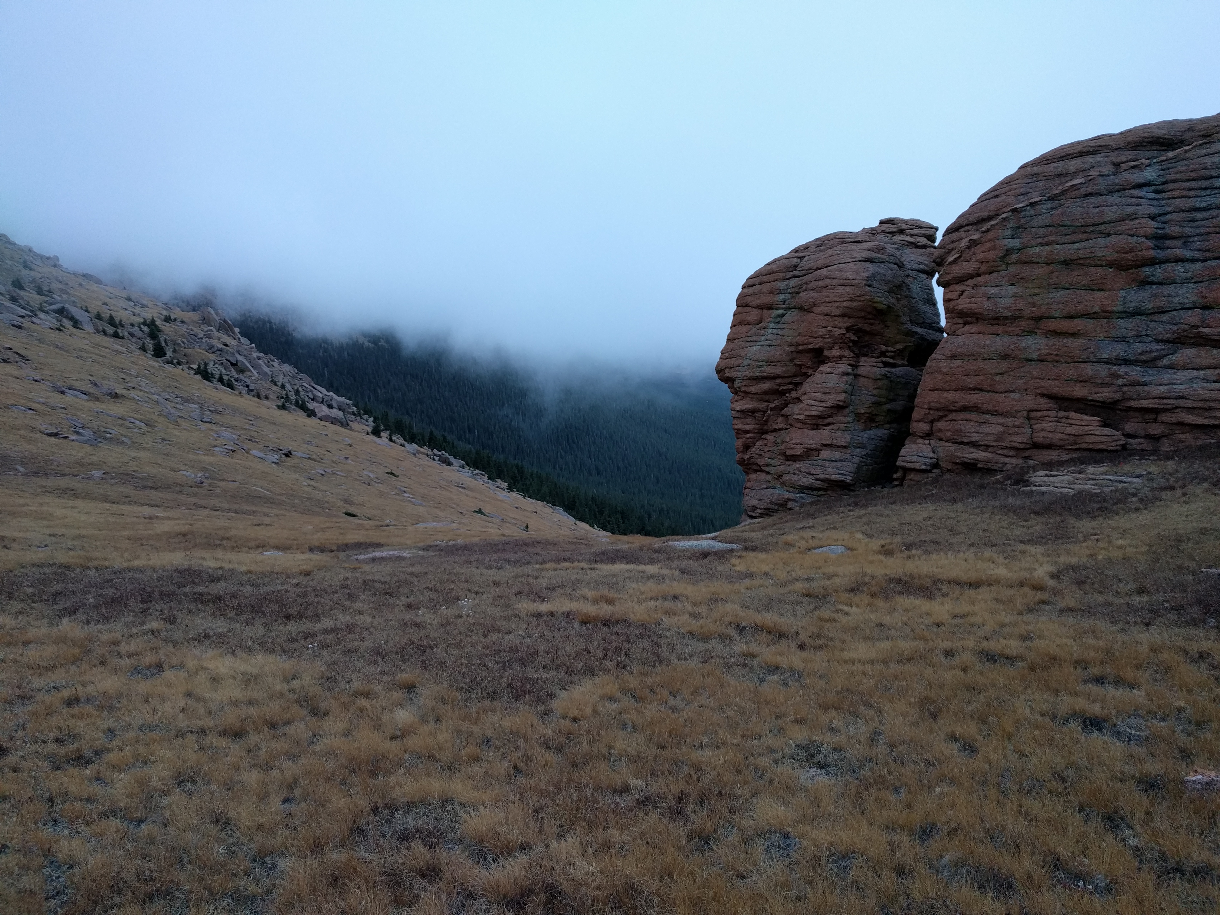
Unfortunately, due to the elevation I was at the clouds rolled right in on top of me:
Cloud

The temperature dropped noticeably as that cloud enveloped me, which really made me wish I’d remembered to grab my gloves. I had scouted out a nice flat rock to cook supper on while I watched the sun set, but since I couldn’t actually see the sun setting I found a rather more protected spot to eat. By the time I’d finished eating it was getting dark, my hands were freezing, and I still hadn’t hung the bear bag. Fortunately there weren’t any hungry critters daft enough to be out in the cold: the bag was at most 2 feet off the ground since I just walked the cord around a couple trees not too far from camp and hoped for the best. A motivated raccoon or ground squirrel probably could have gotten into it without much effort, never mind a bear.

By the time I had everything stowed and got back to my hammock it was snowing:
Snow

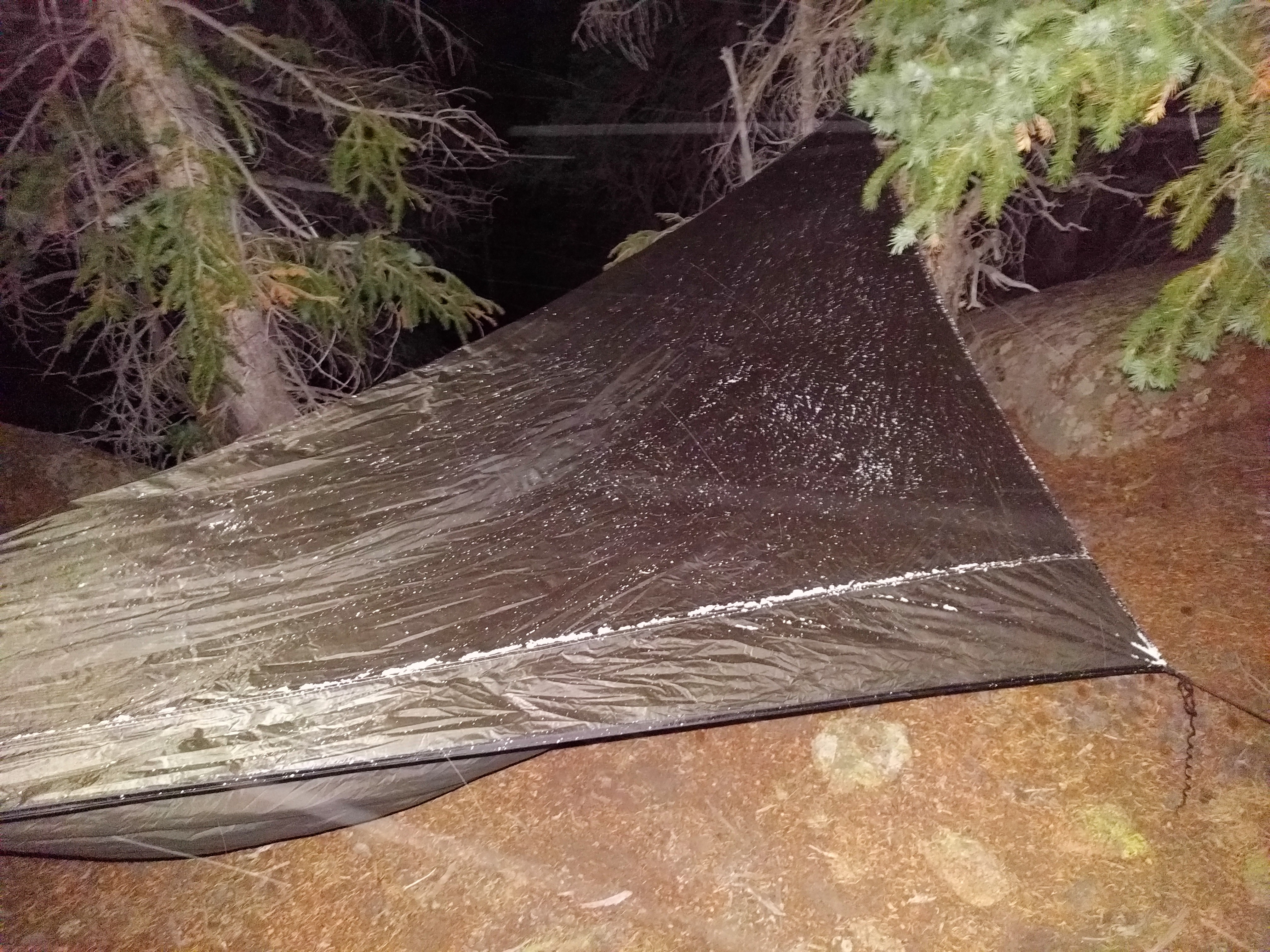
The snow was really just a light dusting, though it did last through the night and well into Saturday. It was a reasonably windy night, but I was surrounded by enough trees that it was rare that I actually felt a gust. My undercover and sleeping bag were sufficiently warm that I was nice and toasty all night long, though I didn’t get a great nights sleep (partly because I went to sleep at 9:00 pm and woke up in the middle of the night like I’d just been napping).

The low was probably in the high 20s (there was still snow on the ground in the morning, but the water bottle I’d left out wasn’t frozen solid), which is apparently cold enough to affect propane: propane bottles are supposed to make a sloshing sound when you shake them; mine was more of a swish. I couldn’t get my stove to light until I’d warmed the bottle of propane up a bit. I managed to get enough water out to (eventually) cook oatmeal for breakfast, but rinsing out the cup clearly wasn’t going to happen (the water froze to the inside of the cup as I swished it around).

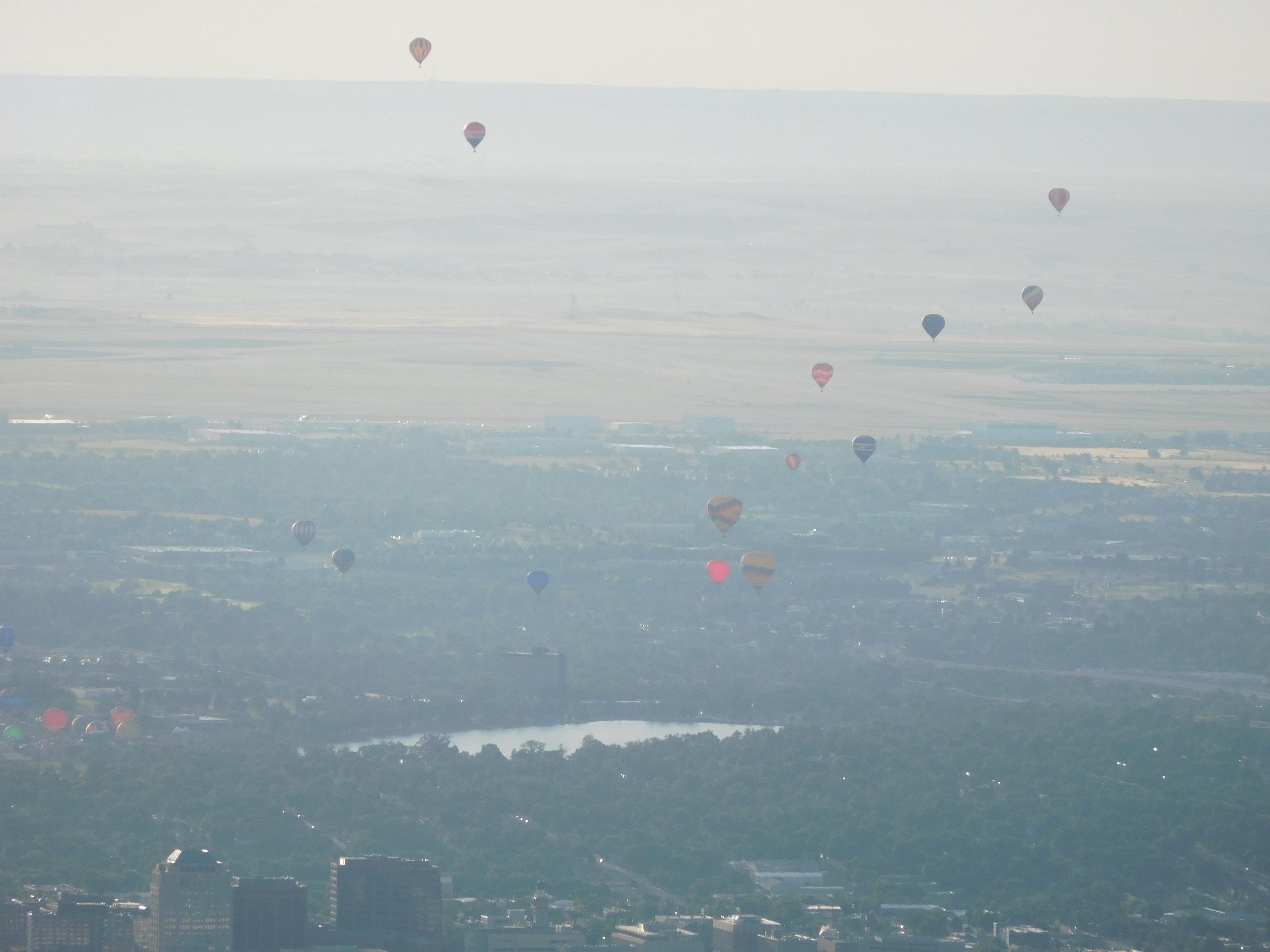
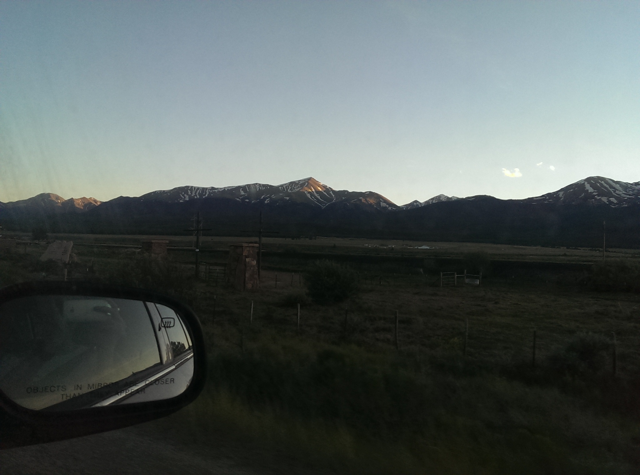
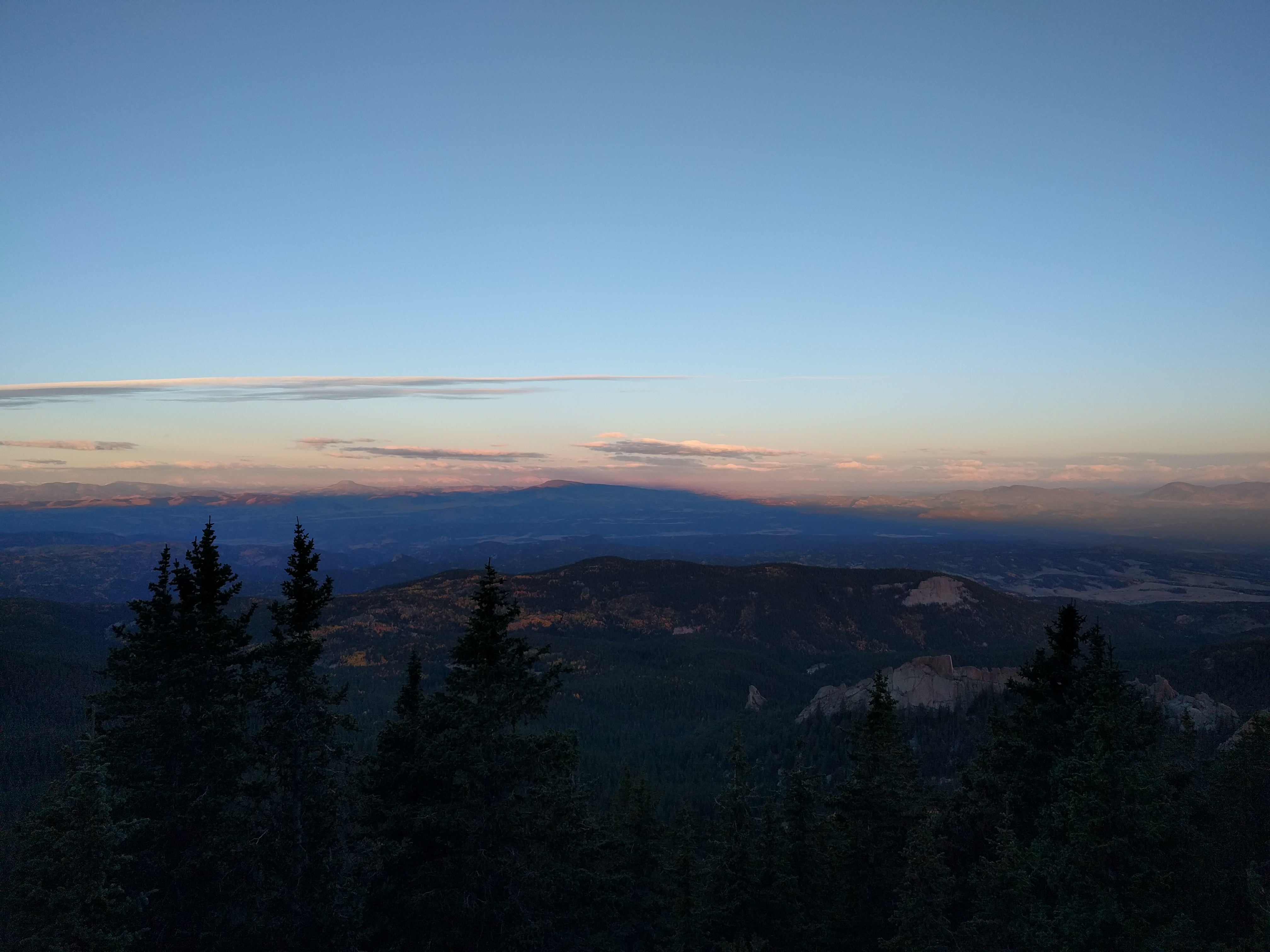
Pike’s Peak sure does have a big shadow at 7:00 am:
Shadow

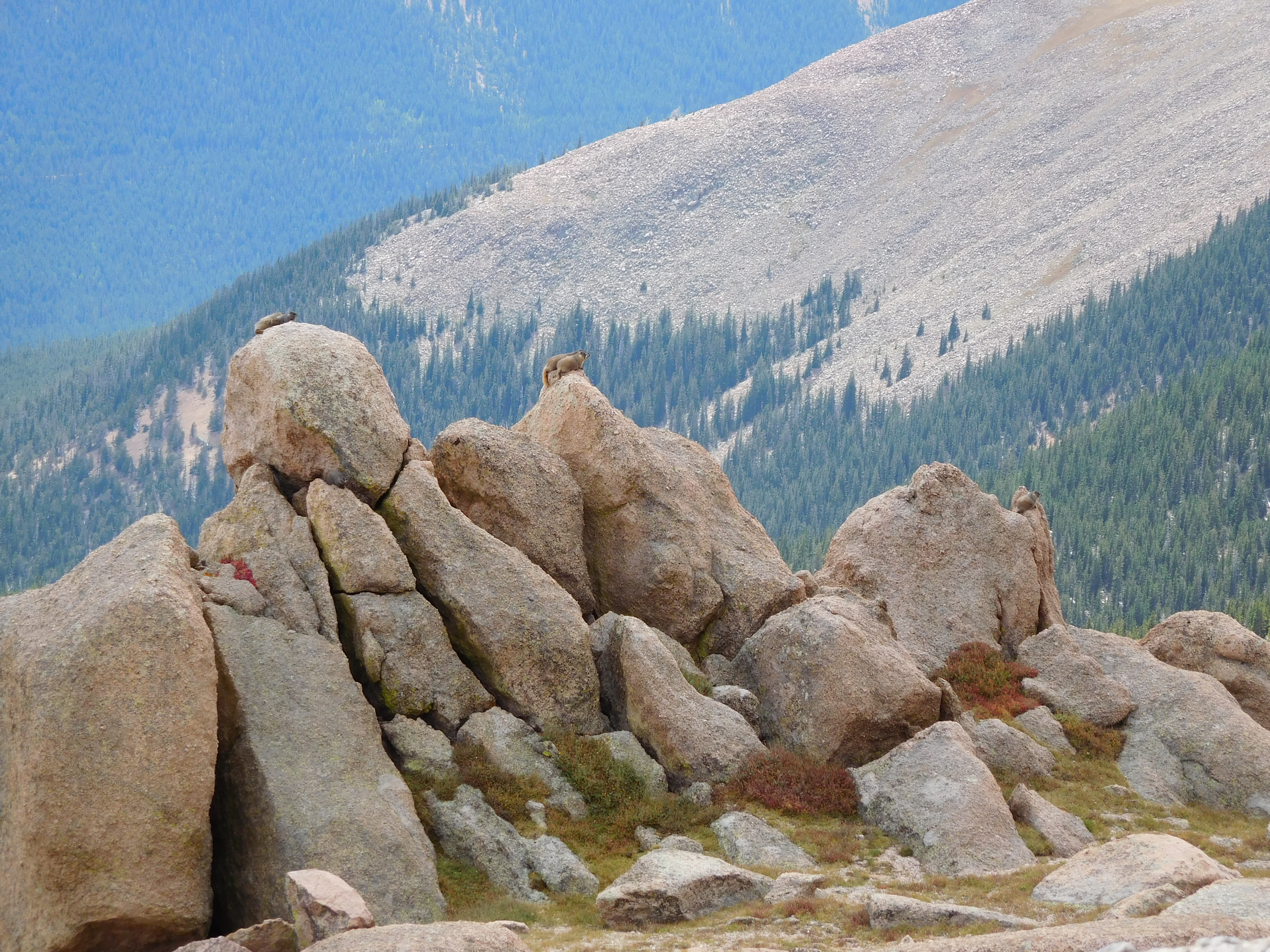
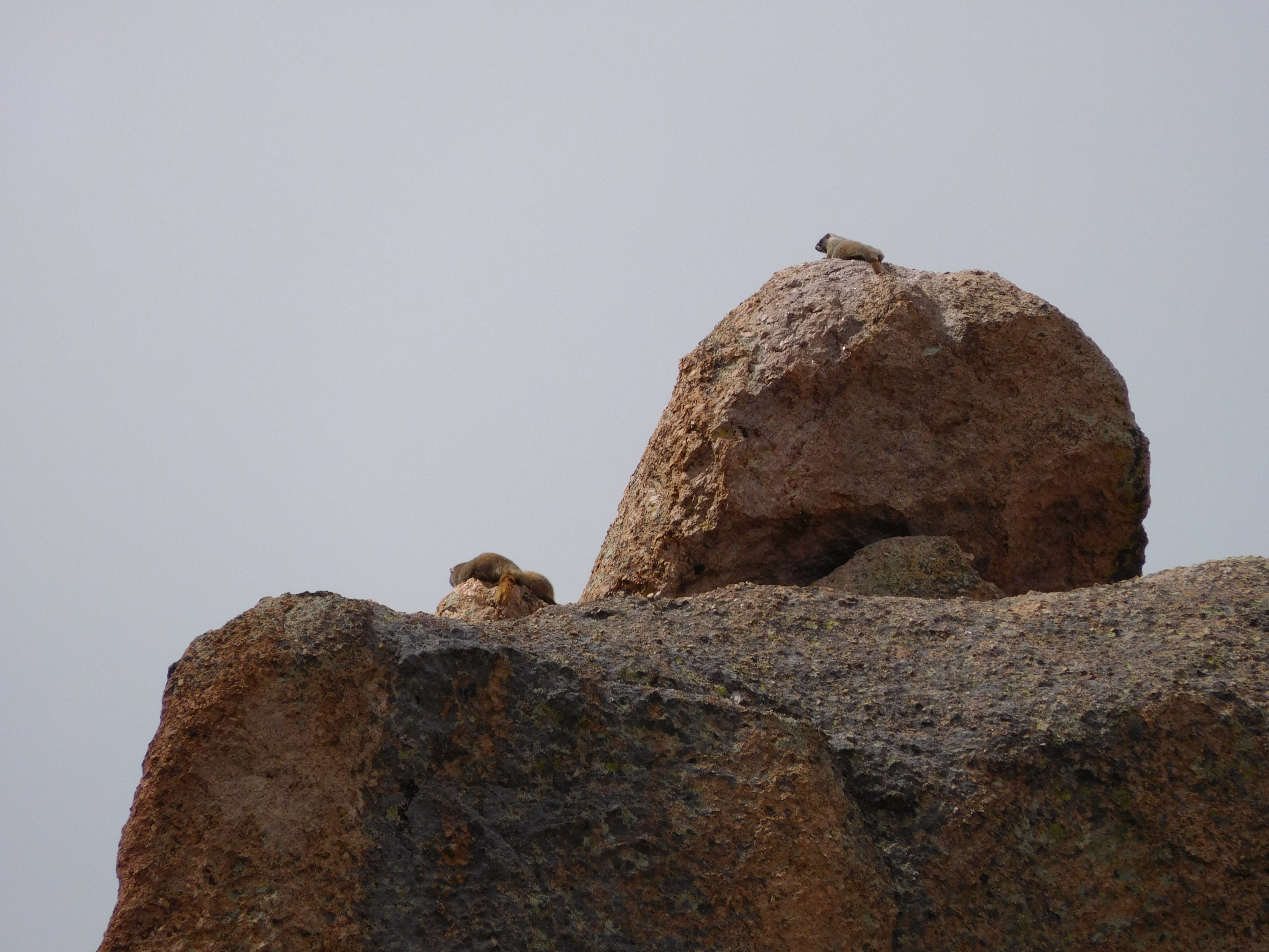
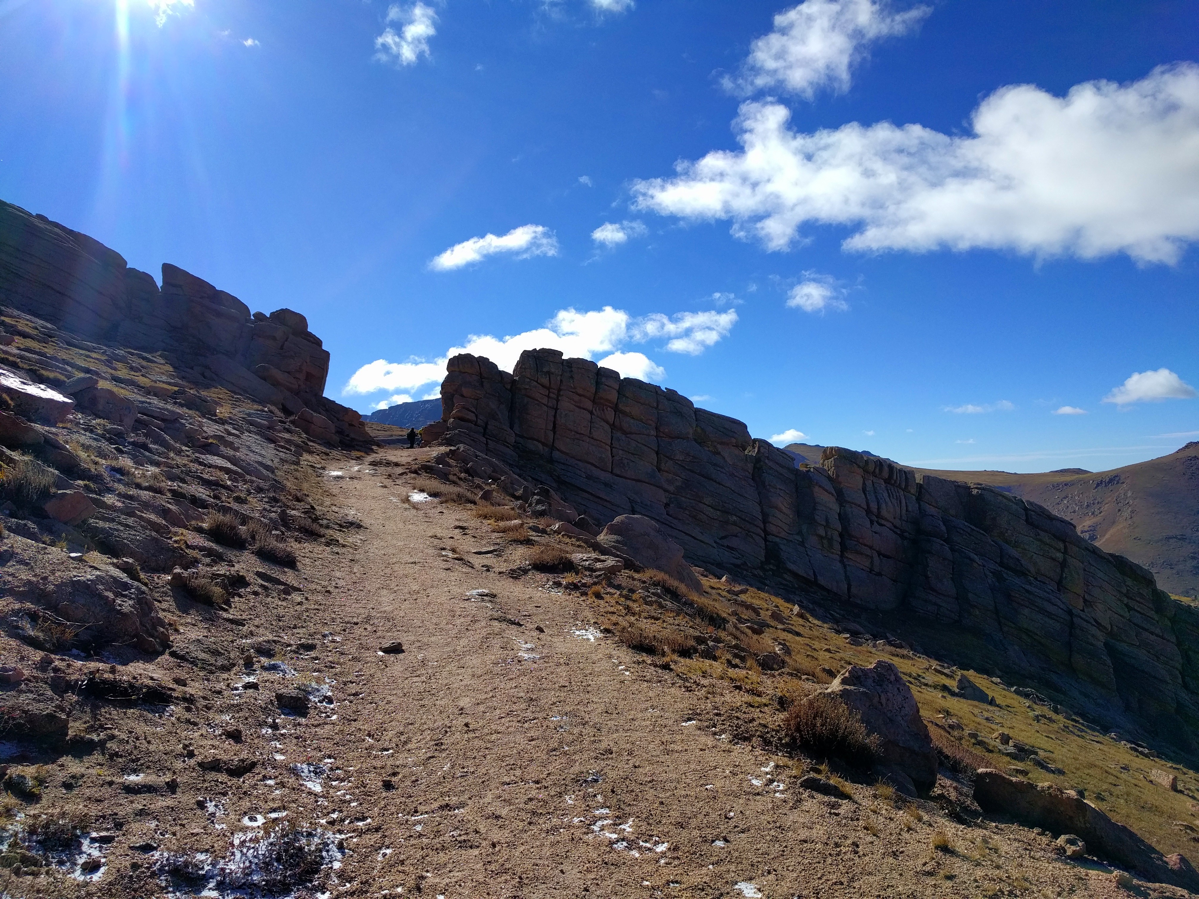
When I struck camp and started hiking my toes were not quite numb but painful, so I figured I’d just get to the top of the ridge, get some morning pictures from over 12,000 ft, then head back down. After probably half a mile of hauling my pack up the mountain my toes were doing fine, but my hands were cold. I eventually crested the ridge and started walking through Devil’s Playground, so named because of how lighting jumps between the rocks during thunderstorms (which I thankfully didn’t witness):
Devil's Playground

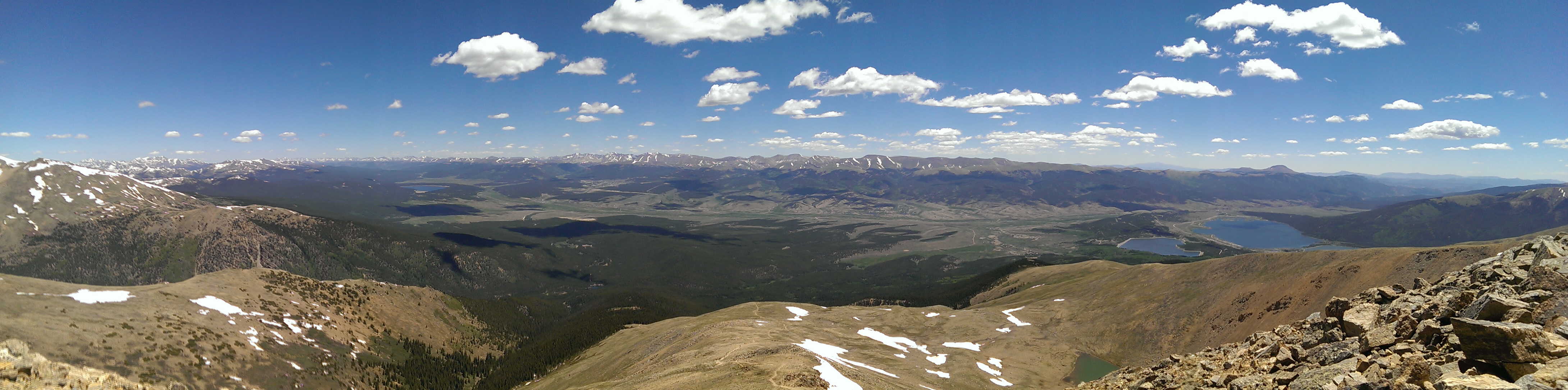
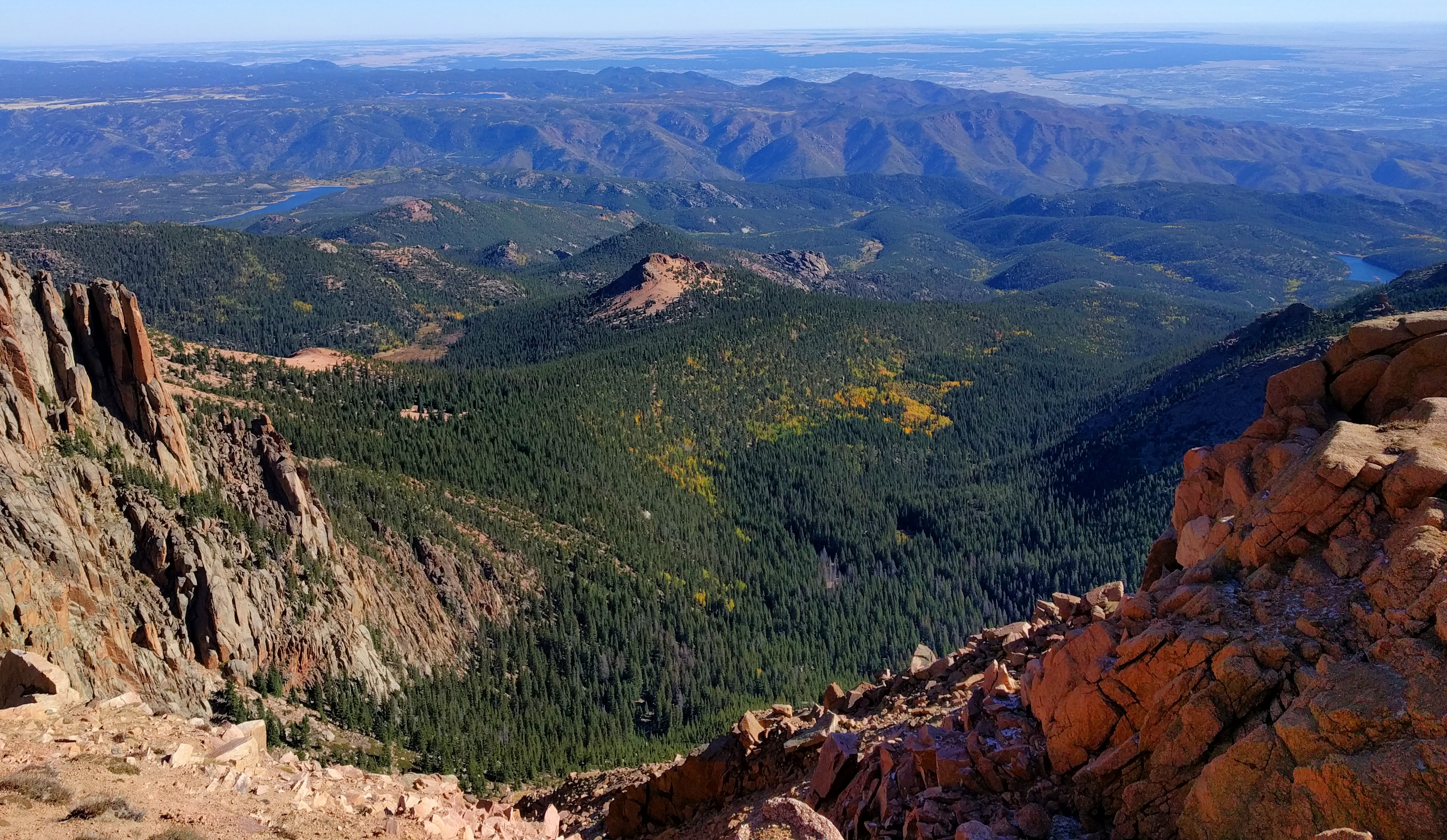
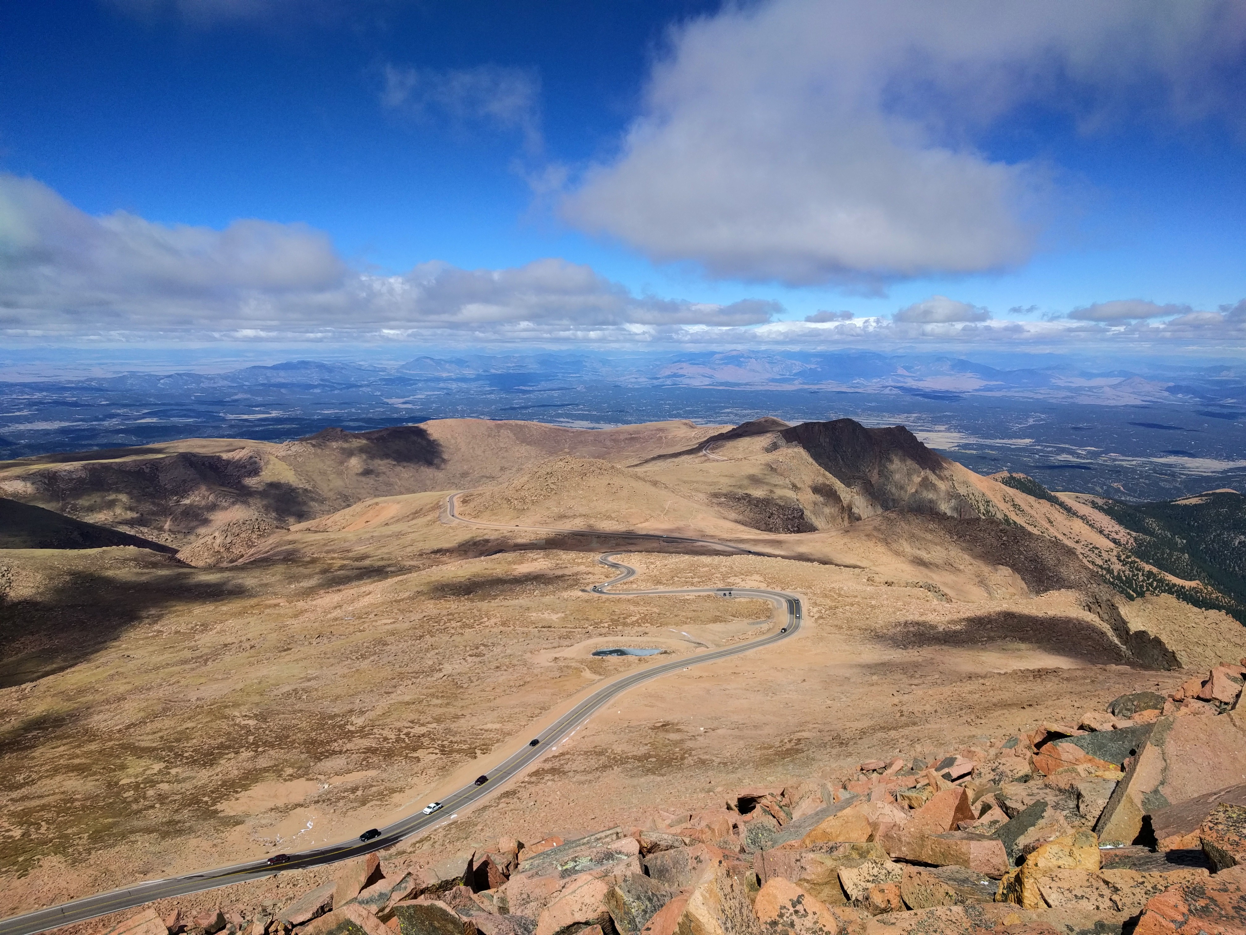
Once I’d made it through Devil’s Playground I got to thinking about it and realized I’d already covered around half the distance and over half the elevation gain, so I might as well push on to the peak. The wind was pretty brutal (and I still didn’t have gloves), but surely it wouldn’t be all that bad. I got a good view of Crystal Reservoir and the south side of the end of Rampart Range:
Rampart Range

Then, disaster:
Frozen Hose
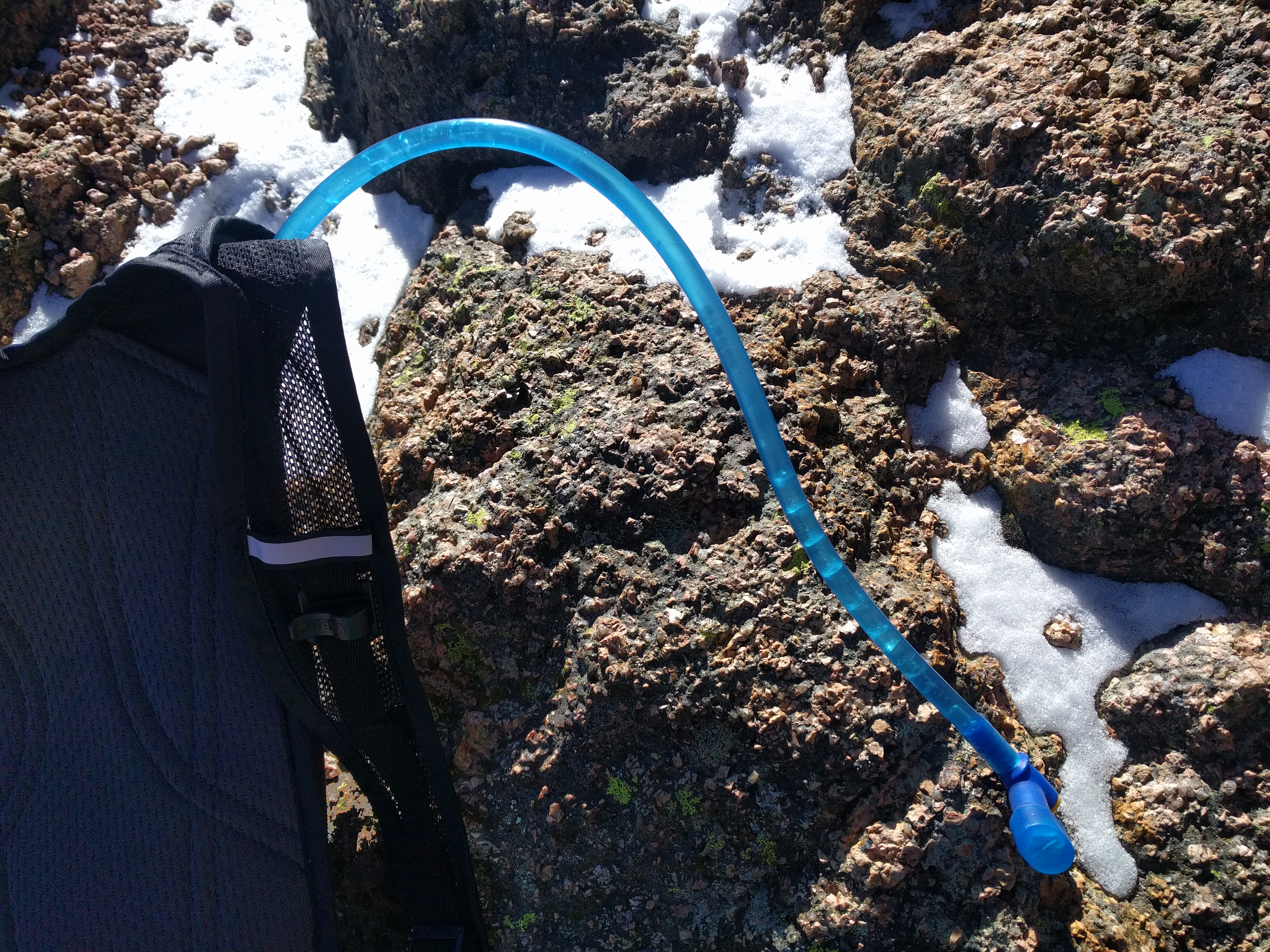
The lines across the hose are where the ice that’s filling the hose cracked as I extracted it from my pack. Once the hose had frozen (it was run across the top of my pack) it took me probably a quarter mile to find a spot that was sheltered at all, then I took off my rainjacket/shell, put the camelback on, then put the shell back on. By the time I got my pack on my hands didn’t even have the dexterity to manage the clip easily. It then took probably over half a mile of hiking before the hose had thawed enough for me to get a drink.

Road
The top half of the trail somewhat parallels the road. On the one hand it’s kind of frustrating to have cars driving by and have so many people on top, but on the other hand, there aren’t any other 14ers that have gift shops serving hot beverages on top.

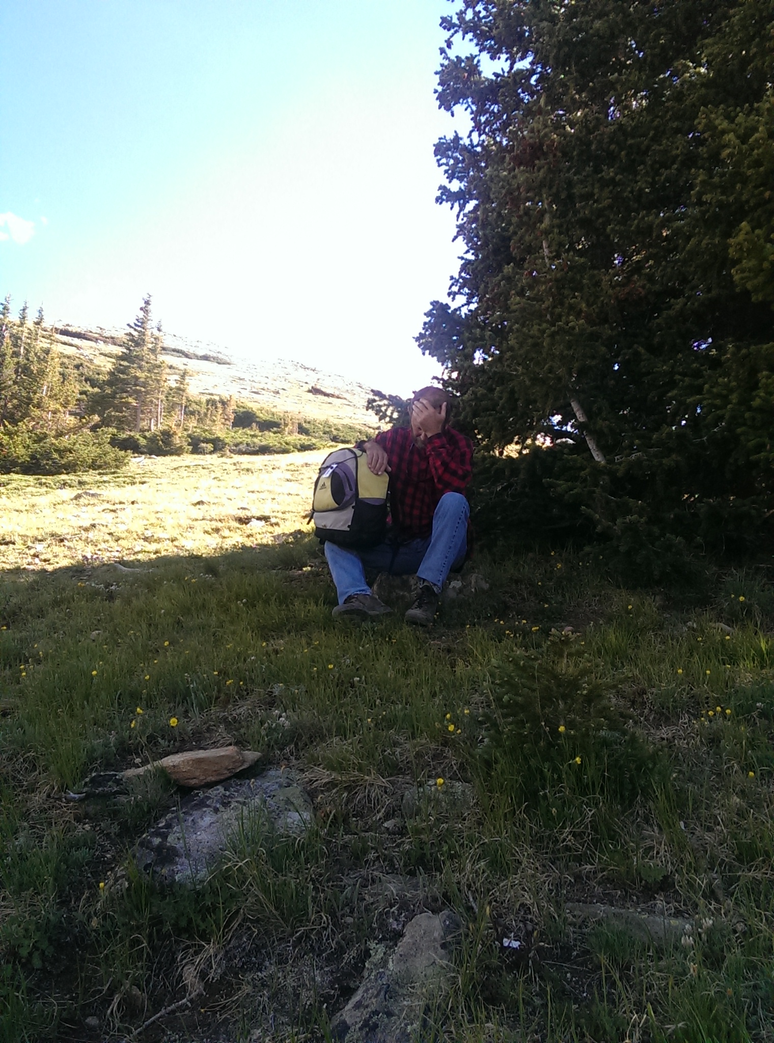
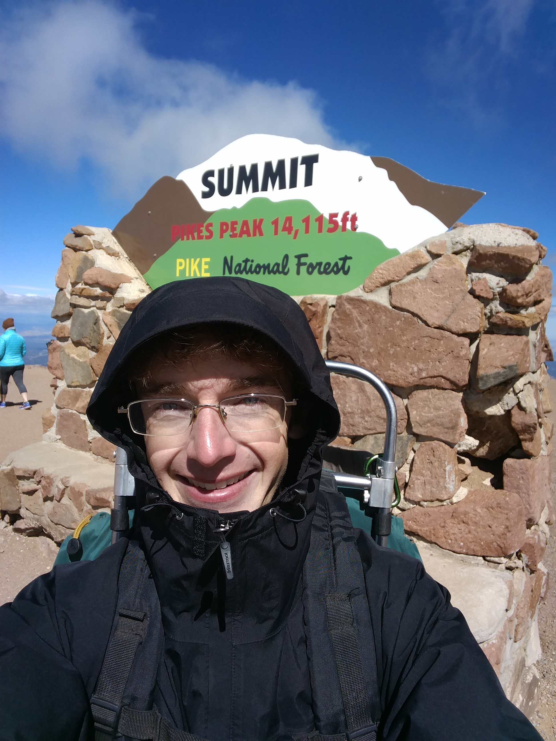
After spending an hour sitting inside the summit house and eating a donut (they were out of hot chocolate…) I was feeling much better. This is me finally not feeling absolutely miserable:
Sign Selfie

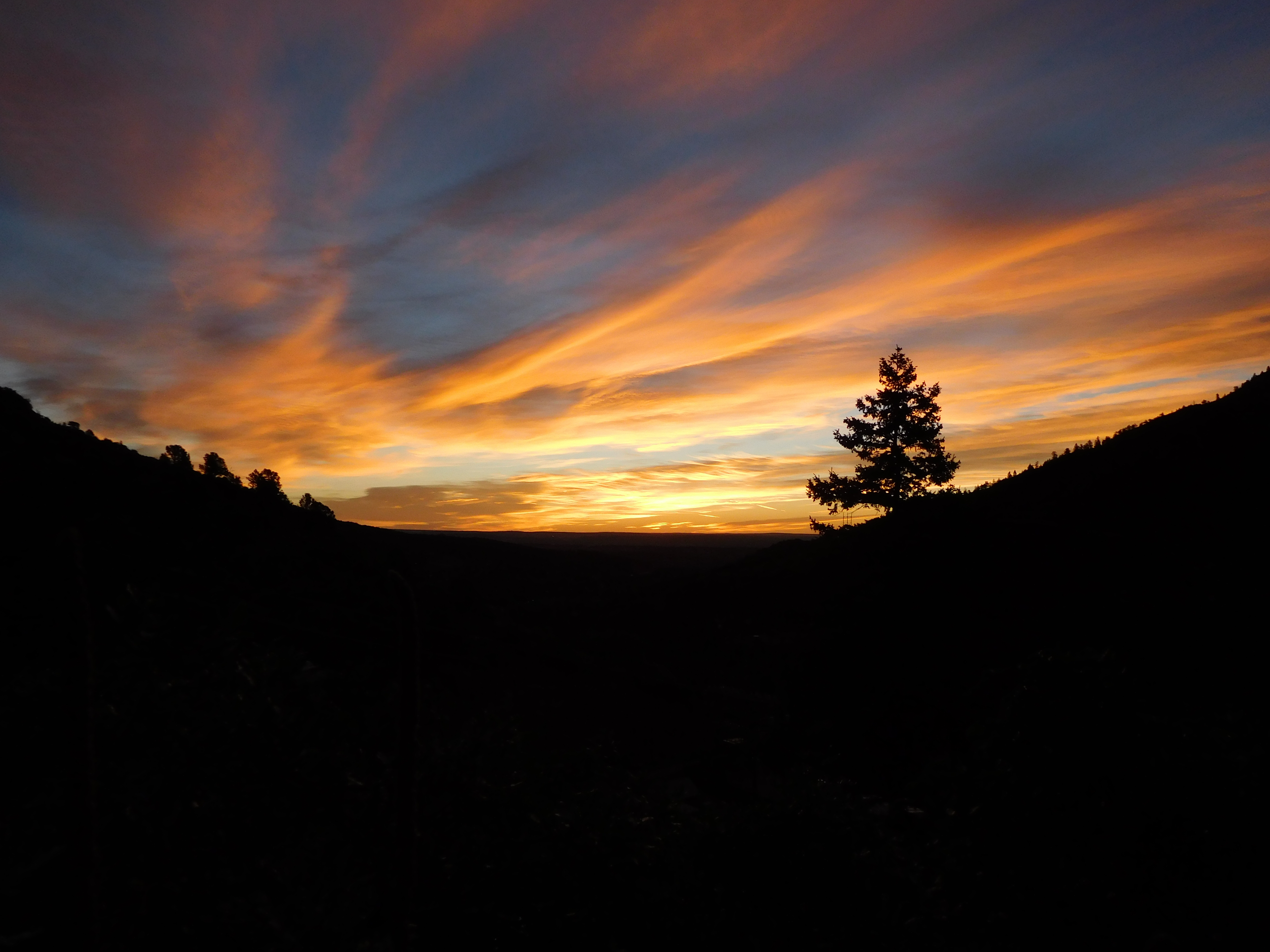
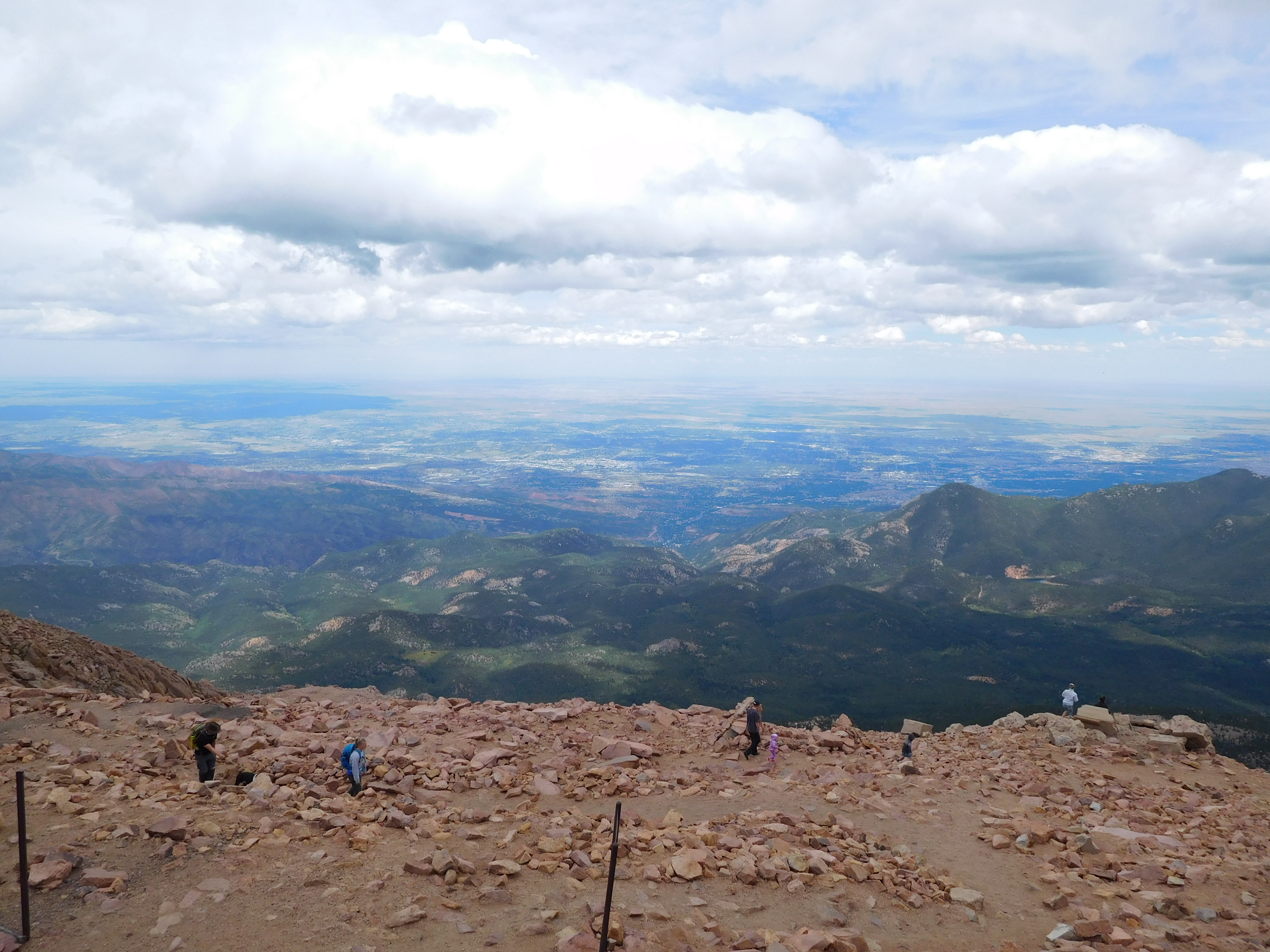
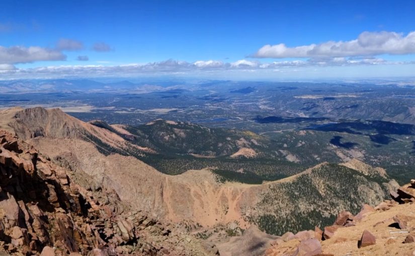
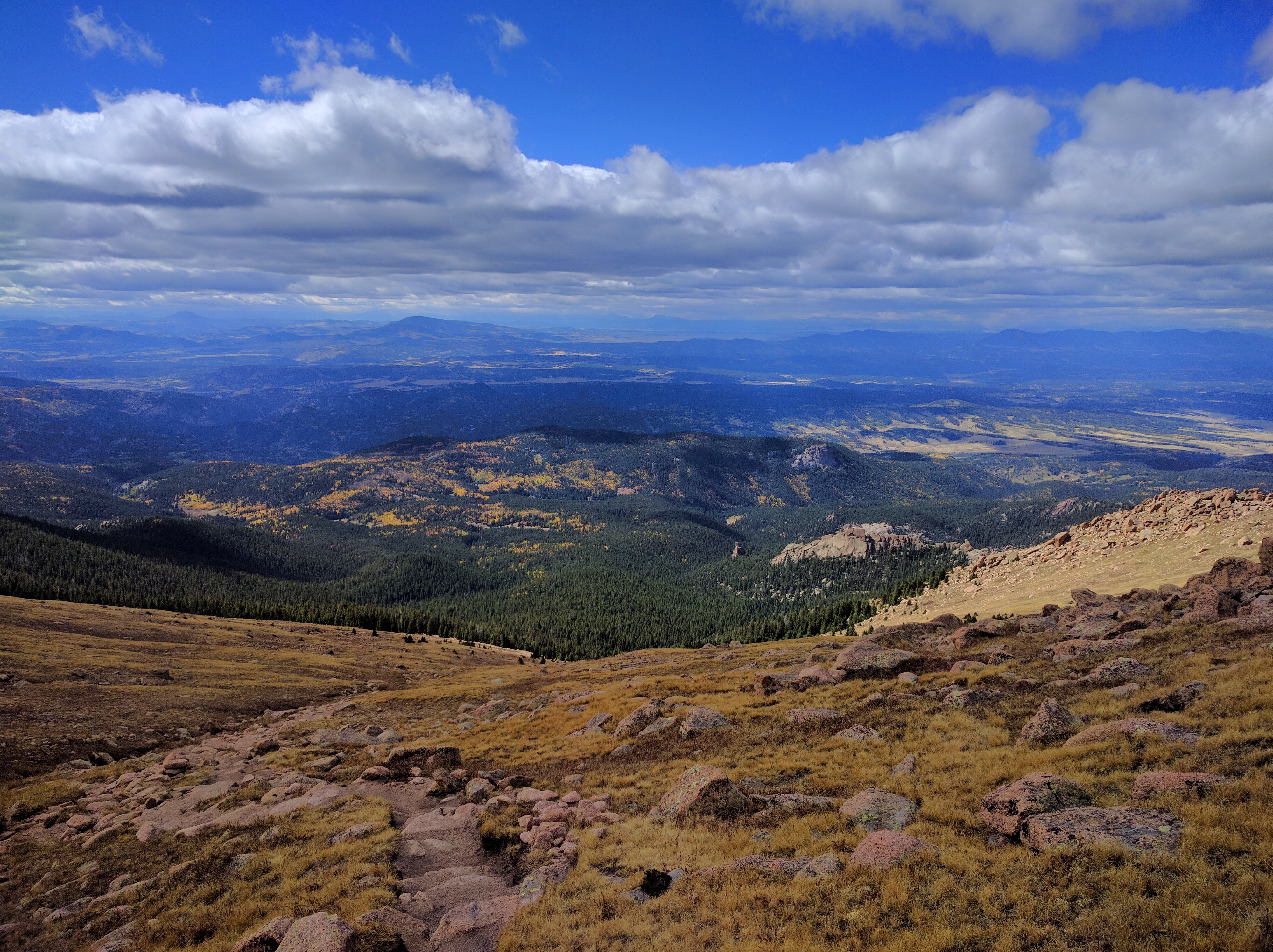
By the time I started back down the wind had tapered off somewhat and it was warming up (enough so that the snow was mostly melted). It wasn’t nearly as miserable as the hike up, but it was still a long hike (especially because I was carrying my backpack the entire way). After nearly two hours I reached the top of the slope I’d camped on and finally got a well lit picture of the valley:
Sunlit Distant Aspens

By the time I got back to my car the afternoon storm clouds were rolling in. It was certainly a longer hike than I’d planned on, but if I hadn’t been hauling my fully-loaded backpack (~25 pounds) around it would have been much faster. I don’t plan on backpacking that route again, but given proper equipment (gloves, a scarf) it shouldn’t be too bad a day hike.

Pike’s Peak

This last Monday (Labor Day) I hiked Pike’s Peak with a couple of my coworkers.

Trip Report

We met at the incline shuttle parking a little before 6:00 AM (when the shuttle is supposed to start, but it was about ten minutes late). The alternative was trying to find parking up Ruxton Avenue, but it was a holiday weekend and we expected the mountain to be crowded. It wasn’t that bad on Barr Trail, but there wasn’t any parking by the time the shuttle dropped us off. We hit the trail at about 6:20 just before the sun came up:
Sunrise

Also, Labor Day is when the hot air balloon festival is, so we had a distant view of the balloons as we ascended the first part of the trail:
Distant Balloons

Barr Trail is about 13 miles total distance and a bit under 8000 ft of elevation gain. The first half ascends steeply for about 3.5 miles then somewhat levels off, rising again just before Barr Camp (at ~6.5 miles, 10,000 ft elevation). Besides the sunrise and balloons we saw a deer (I didn’t get a picture), but it was otherwise an uneventful couple of hours of hiking. We paused briefly at Barr Camp (which was well populated) to eat a snack and dig out warmer clothes before continuing on up to A-Frame:
A-Frame

A-Frame is an open structure just below timberline. It’s about 9 miles up the trail and near 12,000 ft elevation. We reached it at 11:00 AM, about 4.5 hours into our hike, and took the opportunity for another snack break.

The last 3 miles took the longest: another 3 hours, putting us at the top at just before 2:00 PM for a total ascent time of 8.5 hours.
View from the Top

The top of Pike’s Peak is a somewhat unique experience among 14ers: there’s a gift shop and you can buy donuts. We pretty quickly got inside out of the cold, ate a couple donuts, used the facilities, and discussed getting back down. I was the only one inclined to hike back down: my coworkers hitchhiked thanks to the fact that there’s a road that goes up to the summit house (there’s also the cog railway, but you have to buy a ticket for that).

I was feeling pretty good when I started back down: my only concern was getting below timberline before the forecast rain (and potential lightning). I started down at about 2:30 PM, jogged a bit when the trail was open and smooth, and made timberline at about 3:30 PM. I was still doing well there, though I was getting lower on water than I wanted (I started with 3.5 liters, only had a liter left at this point). Unfortunately, jogging down large stretches of the three miles from there to Barr Camp wearing hiking boots left the bottom of my feet hurting and tired me out. I finally got back to the trailhead at about 6:45 PM, having spent about 12.5 hours on the mountain.

Fitbit Stats

I had my fitbit on for the hike. I racked up a bit over 56,000 steps for the day (it registered that as 27 miles, though I never calibrated my stride length) and 811 floors worth of altitude gain. That got me all the daily floors badges (the highest one is 700 floors for the “Rainbow” badge but there are apparently daily step badges for 60,000 steps and maybe more. I at least got the “Platform Shoe” badge for 55,000 steps in a day.

Wildlife

I didn’t get pictures of the deer early in the hike (didn’t think of it in time) or the softball-sized hornet nest by the trail a short distance above Barr Camp (wasps came out when I stopped to look at it, I decided to jog for a bit), but I did get a few decent wildlife pictures:

Mt Elbert

I don’t have a whole lot to write about it, but here are my pictures from the hike up Mt Elbert that my dad and I did last Sunday.

Mt Elbert is the tallest mountain in Colorado and the second tallest in the contiguous United States. It’s also one of the easier hikes according to 14ers.com. That doesn’t mean it’s exactly easy: no 14er really is (unless you count driving to the top of Pike’s Peak).

Where we went wrong is that my dad didn’t have time available to come spend a week at altitude: the best we could come up with was that he’d drive up Friday evening, we’d spend Friday night through Sunday morning in Leadville (10,000 ft), then do the hike on Sunday. That’s not at all enough time to properly acclimatize, but fortunately the weather report for Sunday predicted no storms so we could take all day if we needed to.

Good thing, because we needed to.

We left Leadville around 5:30 with the goal of making it to the trailhead by 6:00. This was the view from the road as we left Leadville, Mt Elbert is the pointy one to the left:
Leaving Leadville

We made it to the trailhead about sunrise (6:00 am), which was good because the parking lot was already filling up:
Sunrise at the trailhead

Getting to tree line took about two and a half hours. Dad set the pace for the entire hike, so this part was somewhat slow on the uphill but at least it wasn’t all that steep. We even had our own private cloud of mosquitoes because in the trees there wasn’t any wind and we certainly weren’t moving fast enough to leave them behind.

Once we left the trees the wind picked up so we finally escaped the mosquitoes, but that also meant I had to tighten the cord on my hat so it wouldn’t blow away when it caught the wind.
Looking up from treeline

I took this one shortly after we left the tree line when Dad remembered he hadn’t taken his advil at the tree line like he’d been promising himself. You can see Leadville in the distance to the left of the picture.
Looking down from treeline

This wasn’t the first panorama I took, but it was one of the first decent ones. If you look closely you can see where the trail came out of the trees. It doesn’t seem all that far away but there were a number of switchbacks and the altitude change was significant. This was nearly three hours after we got out of the trees and maybe 1,000 ft up from there (probably less).
First decent panorama

Poor Dad: too tired and out of breath to climb on the rock to sit down.
Dad resting

Here’s a view of Mt Massive to the north. Dad complained a few times that it was demoralizing looking up at the next mountain over, seeing how much higher it goes, then remembering that the mountain we were climbing was the taller of the two. This was about an hour and a half from the top.
Mt Massive

Here’s the view from the top of Colorado:
View from the top

I thought this was the neatest individual part of the view: looking down and seeing a whole valley laid out beneath me. The picture doesn’t really do it justice, but you can still see the road winding through and a stream of snowmelt, all beneath a horizon full of snow-covered mountains.
Valley

It took us about eight hours to get to the top: we started at 6:00 am and finally reached the summit around 2:00 pm. The suggestions I’d gotten from a friend of mine (who’s in excellent shape and does more extreme hiking/climbing than I’m inclined to try) included: get to the top by 11:00 am and try to be back below tree line by noon (because being above tree line when an afternoon thunderstorm comes in isn’t a good experience). He had also said that 1 mph was a comfortable pace, which it might have been for me on all but the steepest part (but I live at 7,000 ft and Dad had been up from sea level for all of 36 hours).

Entertainingly, the cell service at the top was excellent. The group just arriving in my panorama spent some time making video calls to people they knew so they could show people the mountain view.

We spent about 45 minutes on the top eating all our snacks, resting, and taking pictures, then started back down.

The view about 30 minutes down from the top:
Afternoon View
This would have been shortly before we spotted the first of the two marmots we saw. They weren’t nearly as friendly as the bird that followed us in the trees for a while, but I only have my cell phone for a camera and it doesn’t zoom well enough to be worth posting the results. Dad might not have gotten any pictures of them: I think he’d run out of memory on his camera by then.

We finally made it back down to the trees at about 5:00 pm. Cell service was getting a bit spotty as we got lower on the mountain so this was where I tried to call ahead to make sure our ride hadn’t given up on us but couldn’t get the call to go through.
Resting in a cloud of mosquitoes

We made it to the trailhead before the sun went down. Here’s the view from the highway as we started back to Colorado Springs:
Parting Shot

We didn’t take a quick swim in the stream to cool off at the bottom. For that matter, we carefully avoided getting wet when we had to cross it because snowmelt is cold. Once we got back to the trailhead and were all ready to leave we discovered that Mamaw’s car wouldn’t start because she’d left the GPS plugged in and on all day and it had drained her battery. Thankfully one of the people we’d met a couple times on the trail was still sitting in the parking lot waiting for his parents to make it down (they were two of three people we know we did the hike faster than) and he jumped it so we could leave.

Final timeline:
6:09 am – left the trailhead
8:50 am – reached tree line, took a short break
1:50 pm – reached the summit
2:38 pm – left the summit
4:50 pm – reached tree line, took a 15 min break
7:30 pm – got back to the trailhead

The altitude and climb (at least at the pace we went at) didn’t bother me at all, but I was still in miserable condition at the end of the day because we hadn’t eaten a great breakfast and I hadn’t packed enough food to spend all day on the mountain: we’d planned for getting down in time for a late lunch.

Things I’ll remember to take next time: gloves, handkerchief/kleenex, sunglasses, food, sunscreen, and maybe bug repellent