Manitou Incline

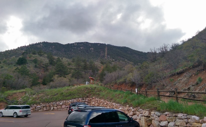
My mom came up to visit for Memorial Day weekend, which meant that I drove all the way up to the Denver airport and back today in the middle of the day. It was a wonderful sunny day and I-25 is east of the front range, so in effect I spent 30+ minutes each way watching the (occasionally snow-capped) mountains go by. Naturally, that led to the thought that “I should go hiking”, so while I ate a late lunch I looked up the Manitou Incline and discovered that there’s now free parking in town with a shuttle to get you up to the trailhead.

The header picture for this post is what the incline looks like from the parking lot under the trailhead. It’s the vertical line straight up the mountain a little to the right of center. As explained in the wikipedia article linked above, the incline is an old cog railway track that’s stripped down to the railroad ties and lightly maintained to make it a very steep (2000 vertical feet in about a mile) hiking trail used primarily by locals as a way to stay in shape.

Start time: 4:04 at elevation 6669
Incline Trailhead
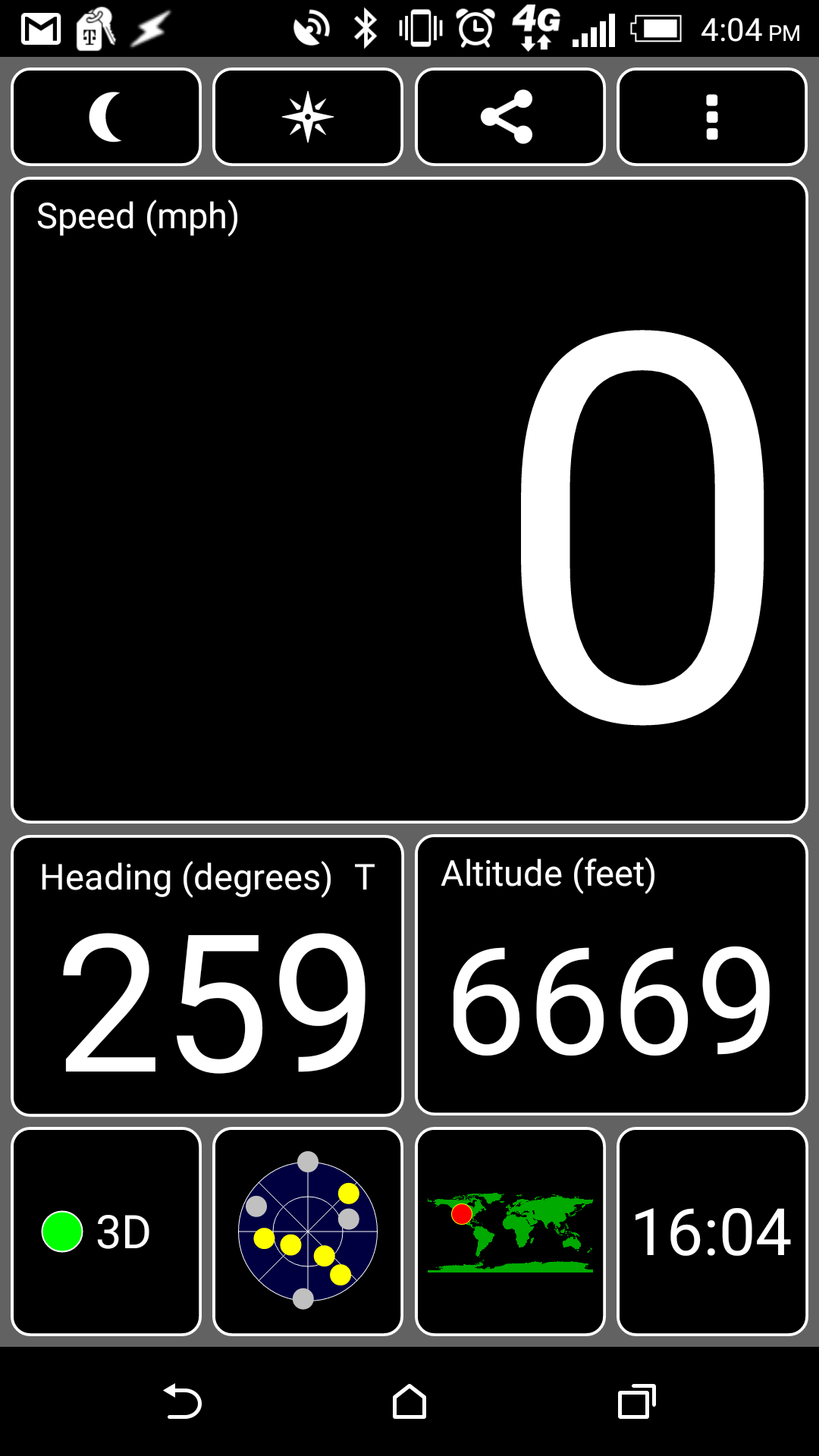
That’s a screenshot of the GPS app I have on my phone to show the timestamp (top right corner) and elevation (box on the lower right side). I was using the app to track my elevation gain as I went because there’s at least one false summit so just looking at how much there appears to be left isn’t a good indication of progress.

Part way up I spotted this critter:
Chipmunk
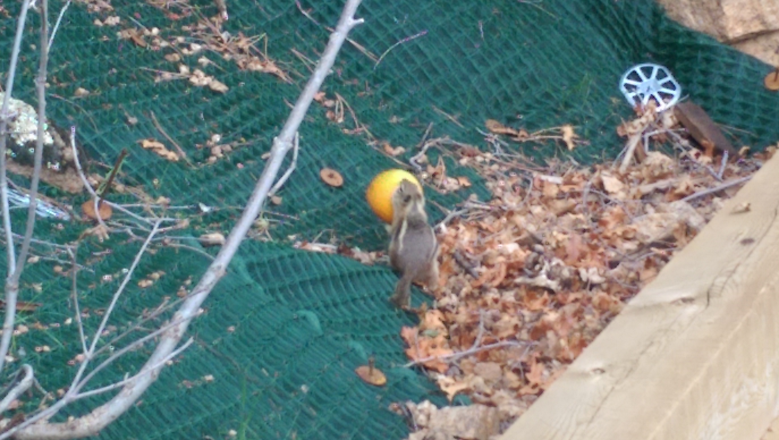
Someone had tossed a mostly emptied orange peel off the side of the trail and that chipmunk was nibbling the remaining fruit out of the peeling. It wasn’t too sure about me standing there watching it, so right before I got this picture it picked it up to haul farther away from the trail. The peeling was apparently light enough to carry but not light enough to carry easily, and when it jumped off a ledge to a lower bush it landed on/in the peeling and took several seconds to extract itself as the peeling started rolling downhill.

Top: 5:16 at elevation 8555
Incline Top

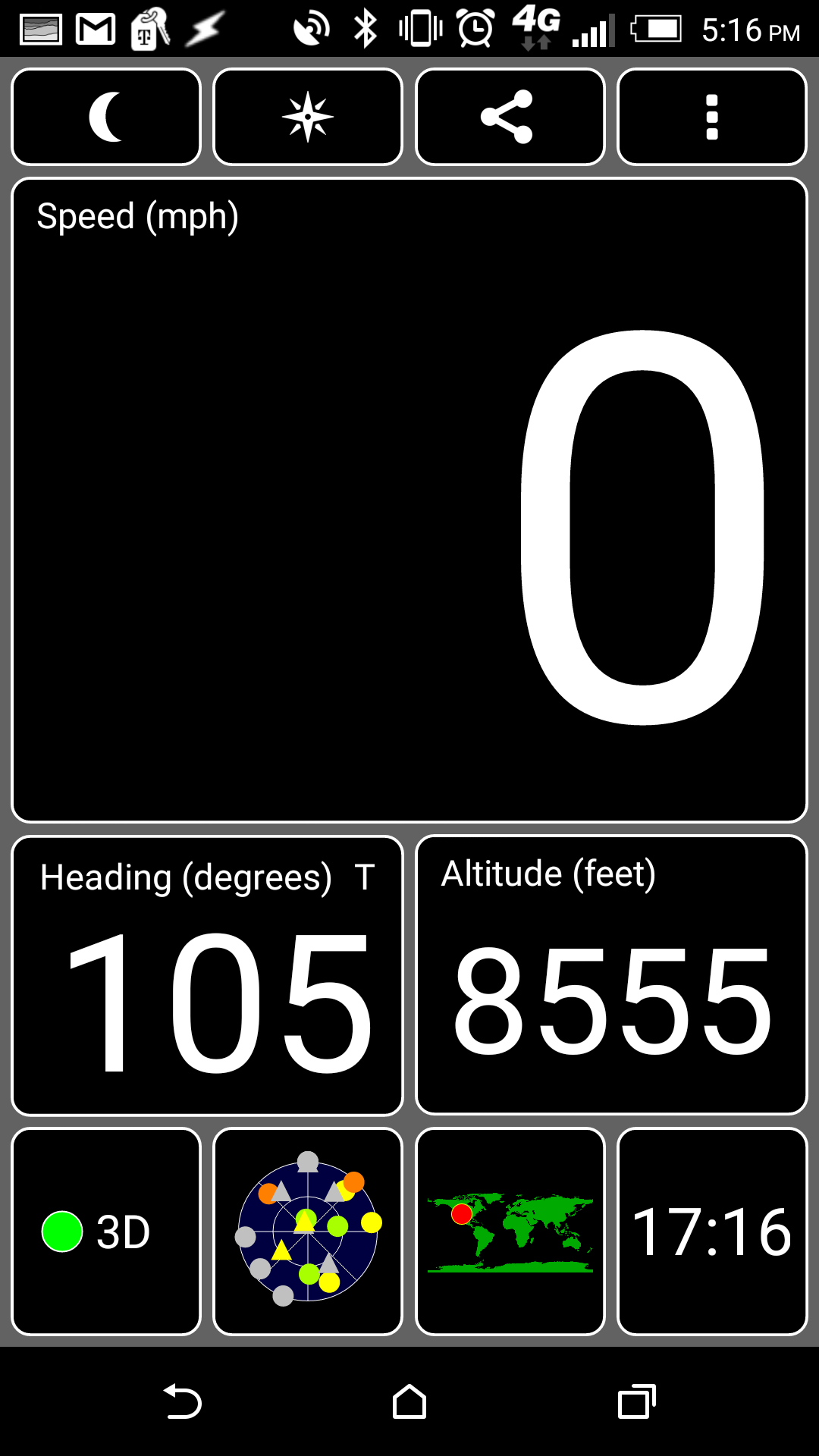
72 minutes is faster than the last time I hiked the incline (hiking with my dad, who wasn’t really aclimatized after coming up from sealevel to visit), but supposedly an average hiker should be able to do it in 40-50 minutes. In my defense it took me about half way up to settle into a pace that was sustainable (rather than walking at my normal pace and having to stop often to catch my breath), maybe I’ll do better just from that next time I do it. Alternately, maybe I’ll be in better shape next time and will do better just from that.

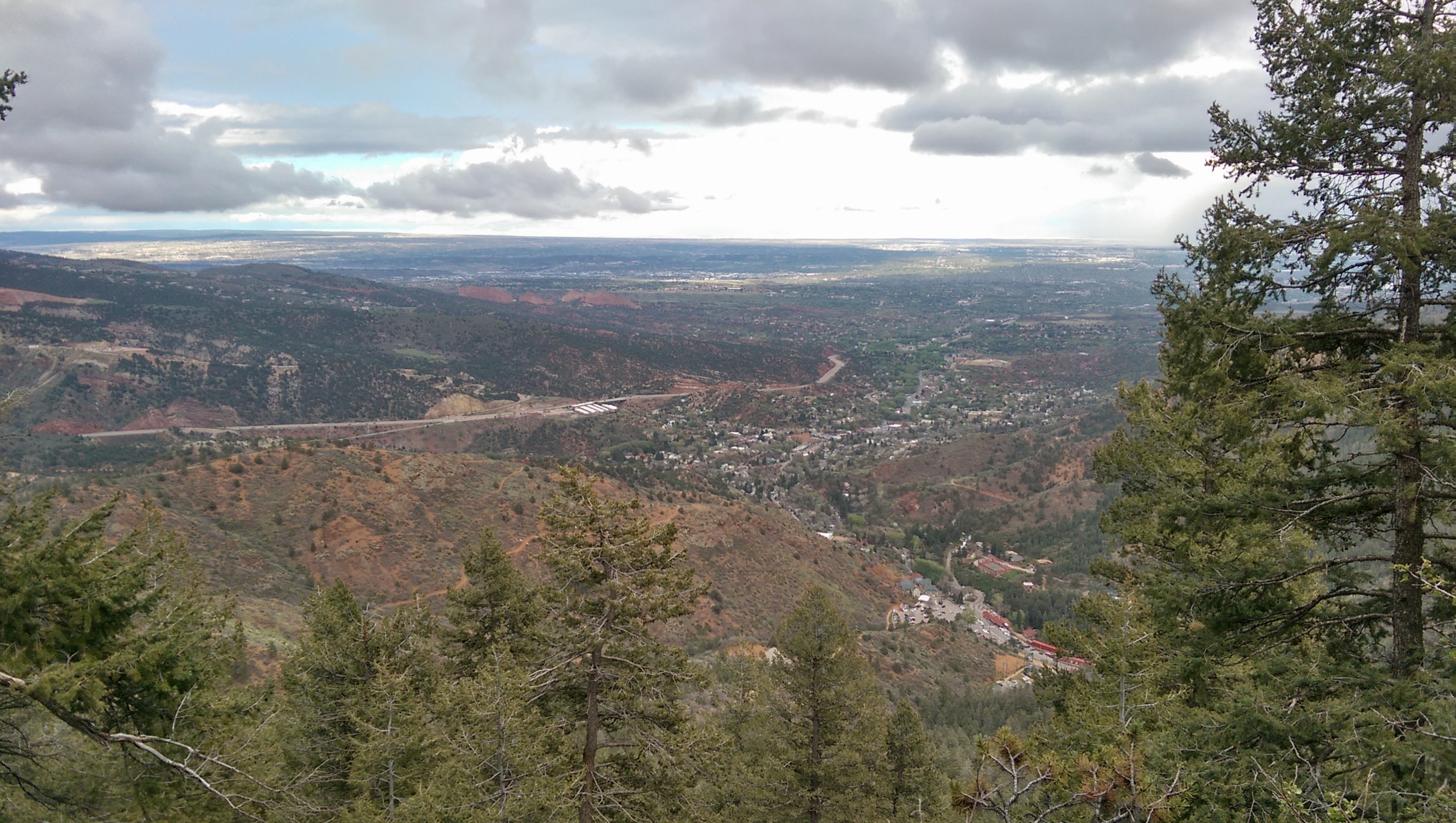
There’s a nice view of Colorado Springs from the top of the incline:
Colorado Springs
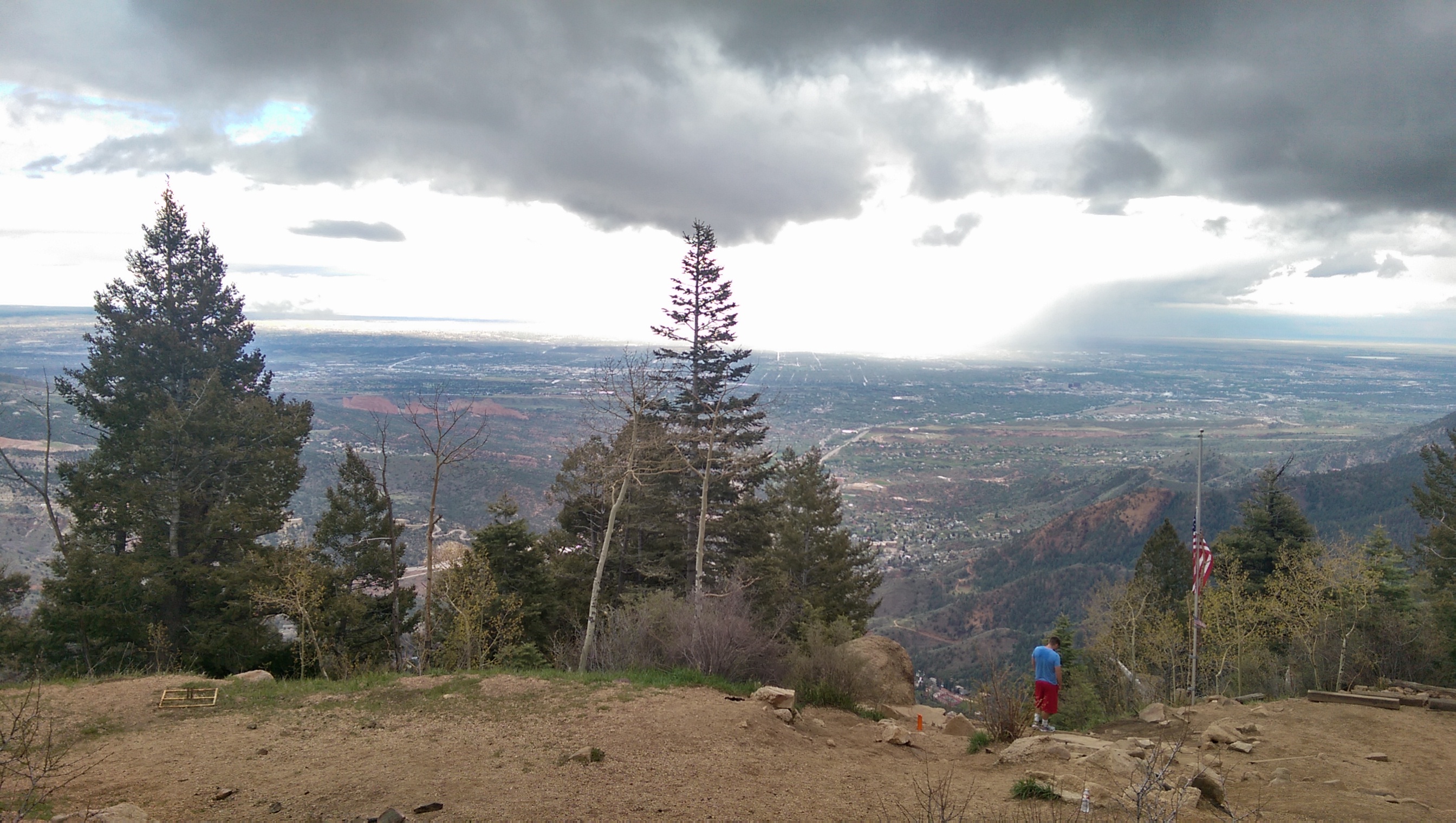
Unfortunately the lighting conditions (overcast where I was, sunny in parts of the city) made it hard to take decent landscape pictures with my phone. To the left of the tree in the center of the picture you can see the high rock ridges of Garden of the Gods.

Here’s the incline from the top. Note how the trail is almost perfectly straight down the mountain:
Incline from the top

Low Clouds
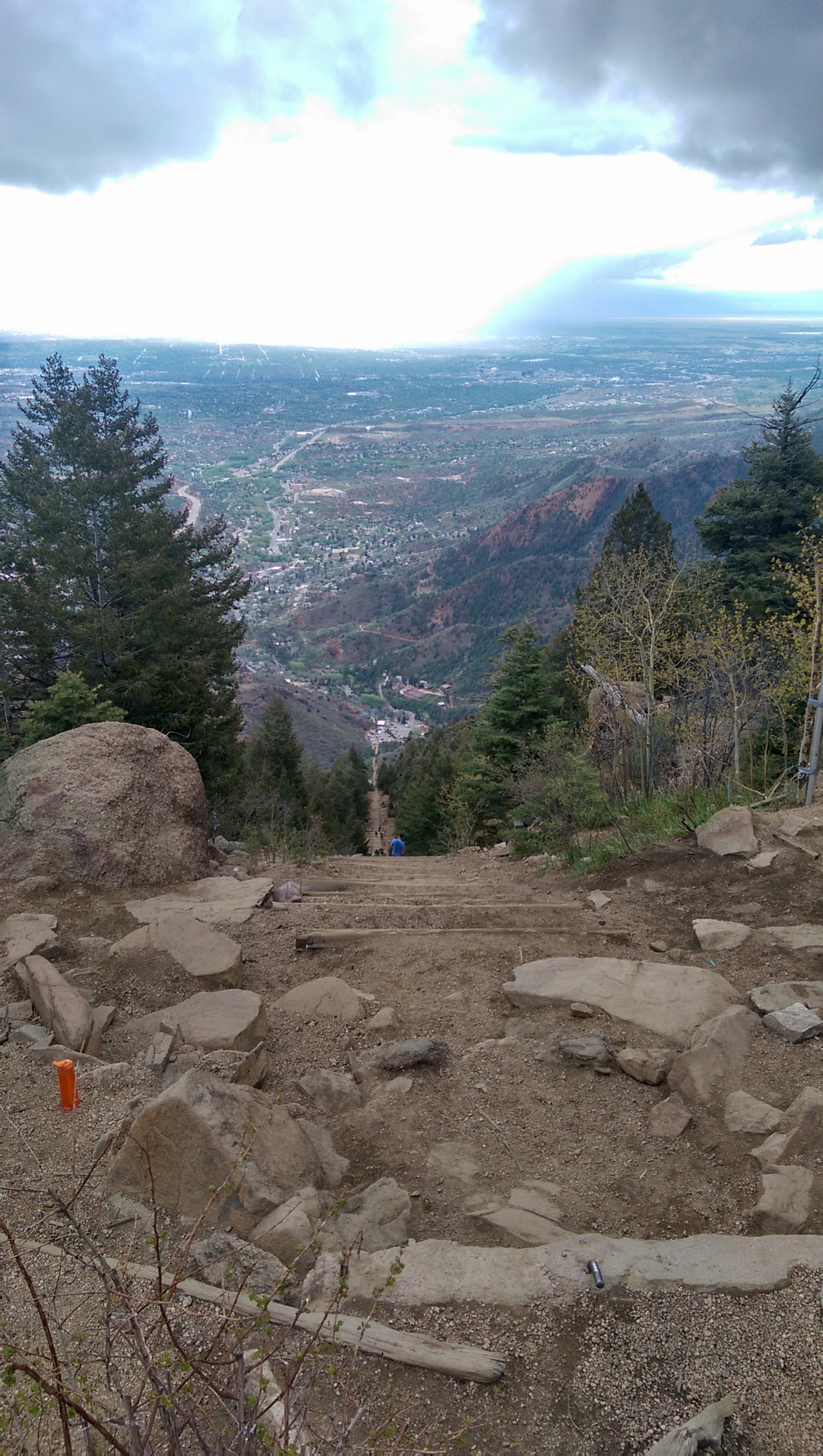
This was the inspiration for not sticking around on the mountain. Well, the low clouds, the fact that those clouds were starting to rain lightly, and also that it was cold enough my hands were going a little numb. I never did break out my rain jacket, but the slowly warming temperatures as I got farther down the mountain were greatly appreciated.

I took the Barr Trail down (it’s not as steep, and especially damp it’s dangerous to go down the incline), so I got back to the trailhead at 6:25. My pebble counted the full trip (from the bus stop to the top back down to the trailhead) at just over 11,000 steps. Of that 11.000 steps only about 3,000 were from the trip up.

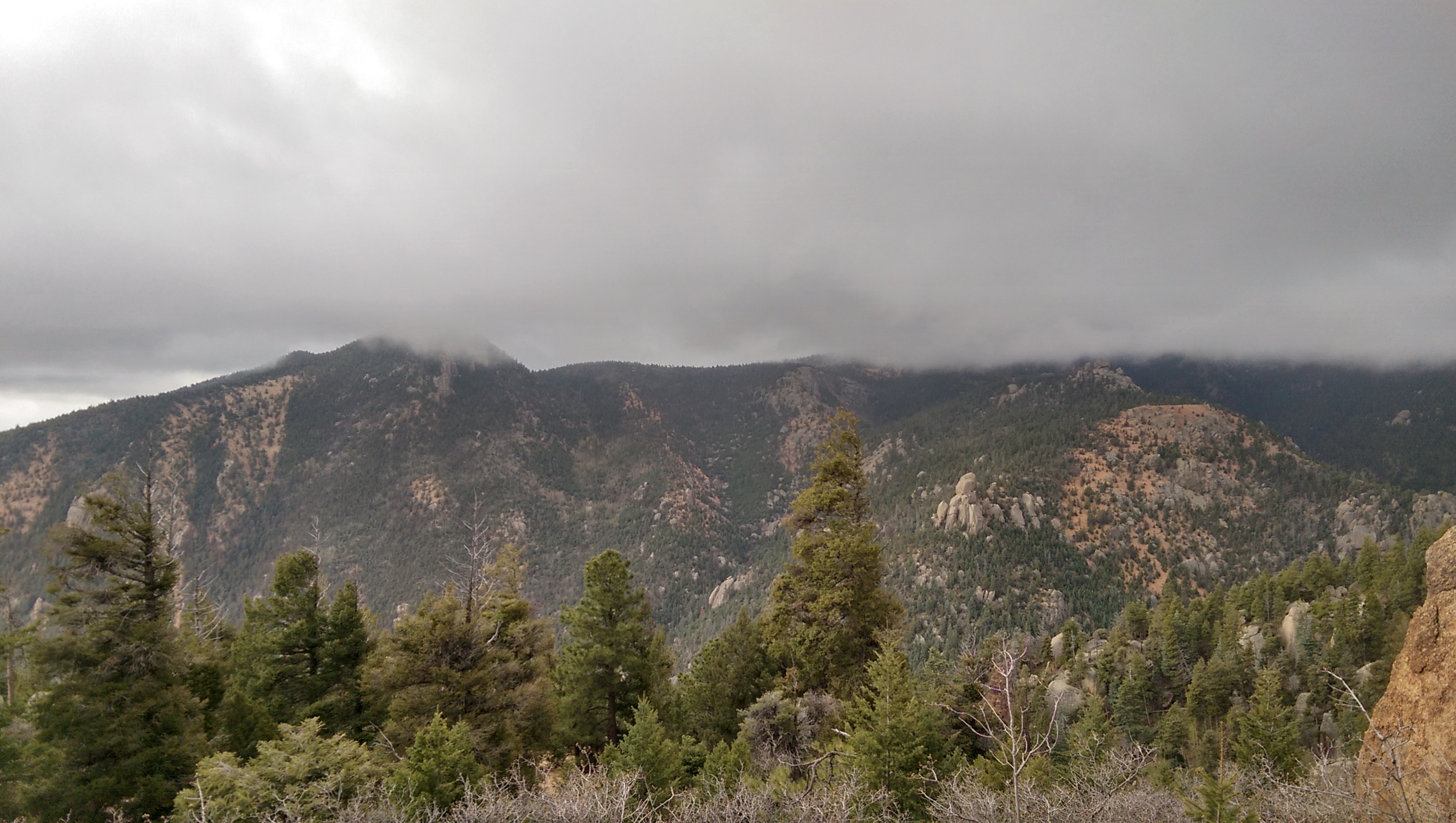
Here’s another picture of the Garden of the Gods and Colorado Springs taken from lower on the mountain on the way down:
Garden of the Gods

National Air and Space Museum

The one building I actually went in while walking around the Washington Mall (not counting monuments/memorials) was the Smithsonian National Air and Space Museum. I was somewhat pressed for time and hadn’t made it to the capitol yet so I didn’t spend nearly as much time here as I’d have liked to, but I did make it through the obvious rooms that had space artifacts in them.

I got scolded for trying to take a picture while standing in the line for security, so here’s my picture of Space Ship One from inside the security barrier:
Space Ship One

Of course the National Air and Space museum has the Apollo 11 (first manned moon landing) capsule. It’s in the lobby, along with the capsules from Mercury Friendship 7 (first manned US orbital flight) and Gemini 4 (first US space walk).
Apollo 11

Also posted as the header picture for this post, one of the several airplanes hanging from the ceiling in the lobby (aka the “Milestones of Flight” gallery) was an X-15 rocket plane:
X-15
You can see the Mercury and Gemini capsules underneath the rear of the plane.

At the east end of the ground floor hall is the ground test article for the Apollo Lunar Module:
Lunar Lander

I skipped the skylab exhibit (there’s one in Houston) and apparently didn’t take a picture of the Hubble mockup/model, but I did get a good picture of the Apollo-Soyuz Test Project display:
Apollo-Soyuz Test Project

Here’s a picture of a Nazi V-1, included largely because behind it to the left you can see the model of the Hubble Space Telescope.
V-1

Having posted a picture of a V-1 I might as well follow it up with a V-2:
V-2

Washington Mall

The last day of my trip to DC I had nothing specific planned and my flight didn’t leave till nearly 3pm so I spent the morning walking around the Washington Mall.

I started a couple blocks north of the White House. You can get a lot closer to the building itself from the North, and that’s where the protesters were (as well as a very visible police presence). The south side was just packed with tourists (including a surprisingly large group of people getting their picture taken in front of the Executive Office Building for some reason), but there was a nice view across the south lawn.
White House

The Washington Monument is visible from all over the area so I ended up with tons of pictures of it, but this is one of the few where it was actually the focus of the picture:
Washington Monument

Unfortunately you can barely see Lincoln at all from the picture I took from the steps of the Lincoln Memorial, so here’s the picture of the large room inside the monument:
Lincoln Memorial

I didn’t know it was there until I came across it walking from the Lincoln Memorial to the Jefferson Memorial, but there’s a rather large memorial to FDR along the west side of the tidal basin. Here’s the statue of FDR and his dog:
FDR Memorial
Several of the statues in the memorial had the patina worn off where people touch them: it made for an odd emphasis on certain spots.

Here’s the view of the Jefferson Memorial and the Washington Monument across the tidal basin where the FDR memorial ended:
Tidal Basin

The dome of the capitol building is currently being repaired. I didn’t remember that it was made of cast iron, but apparently it needs work every few decades.
Capitol Building

The library of congress is just south-east of the capitol. Once I figured out what it was I figured it was worth a picture:
Library of Congress

The supreme court is just north of the library of congress. There were a bunch of people with lawn chairs and sleeping bags on the sidewalk to the side, presumably in support of one side of something the court is deciding on, so I walked nearly to the front of the building to get a picture of the facade:
Supreme Court

Here’s the view of the mall from the west side of the capitol building. The Ulysses S. Grant Memorial is in the foreground with the Washington Monument in the background (and the Lincoln Memorial just visible behind it).
Washington Mall