Himeji Castle

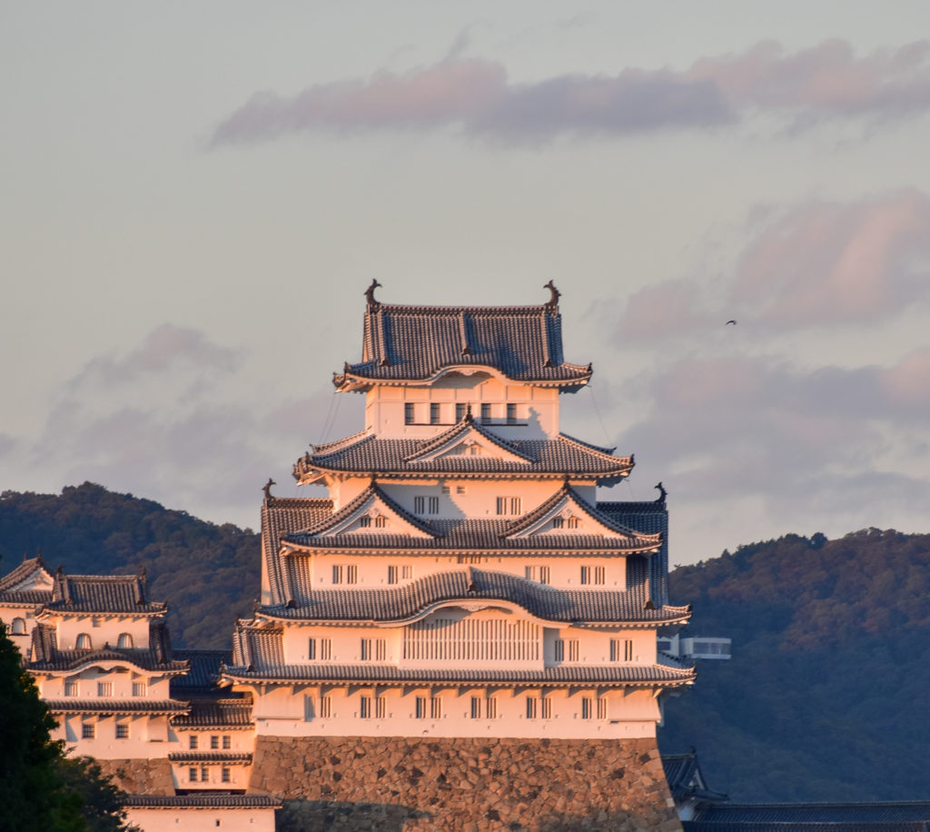
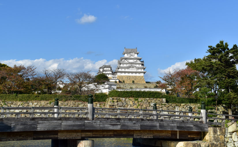
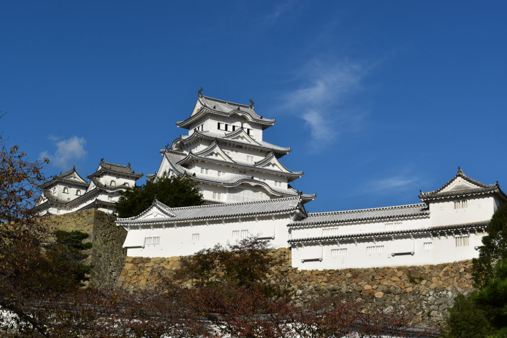
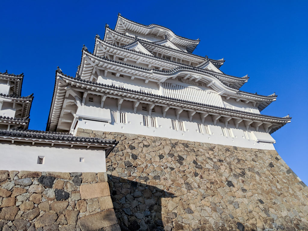
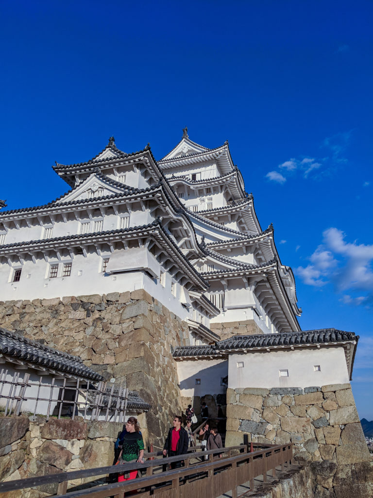
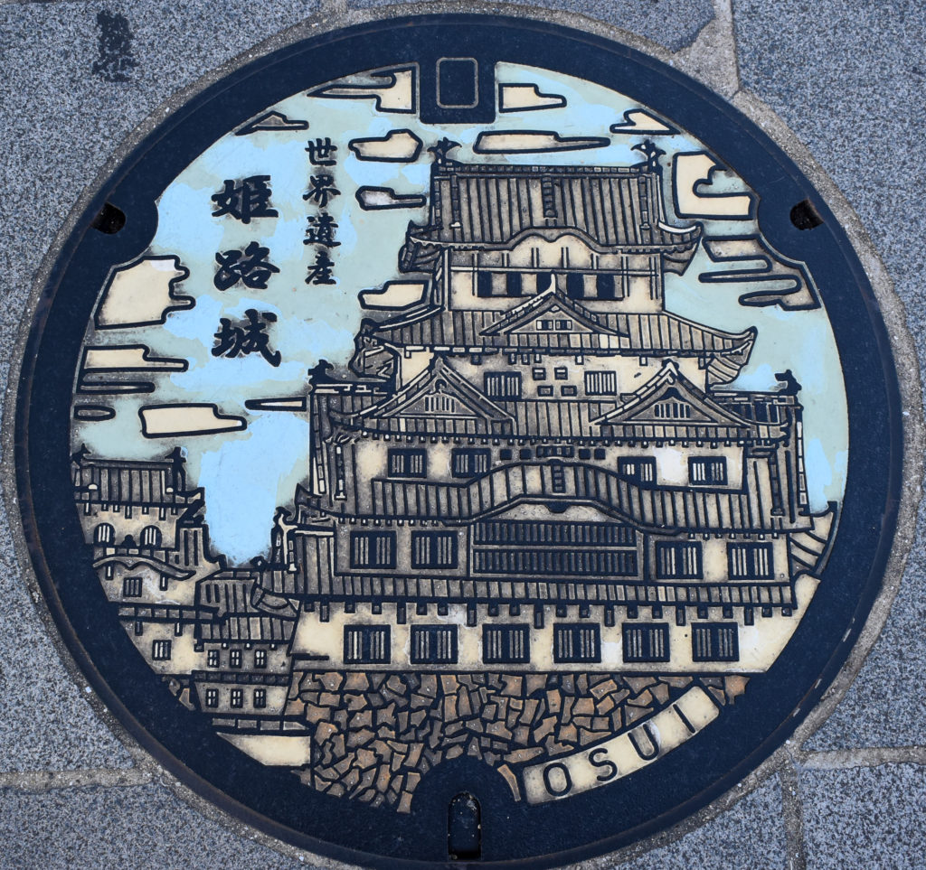
While we were in Japan last fall we stopped in Himeji to see Himeji Castle, also called “White Egret Castle” or “White Heron Castle” due to its distinctive white exterior.

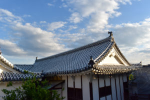
A significant part of the white look is the mortar that covers the seams of the tiles on the roof. Keeping it bright white requires periodic restoration, and we were fortunate to visit just a few years after extensive work was completed in 2015. Still, there was work being done on buildings around the castle, so here’s a closeup of a just-completed section of roof.

The featured picture at the top of this post is the view of the castle from the street just outside the garden/park area in front of the castle. Here are a few other shots we got of the exterior as we made our way to and around the castle:

The main gate to the complex was large and led straight into a courtyard, but the next gate into a passage leading up the hill toward the castle was not built with tall people in mind. Or perhaps more accurately: it was built with defense against tall or mounted visitors in mind. There was another gate later on that didn’t even clear my shoulders, but that one was well padded to keep visitors from bumping their heads too hard.

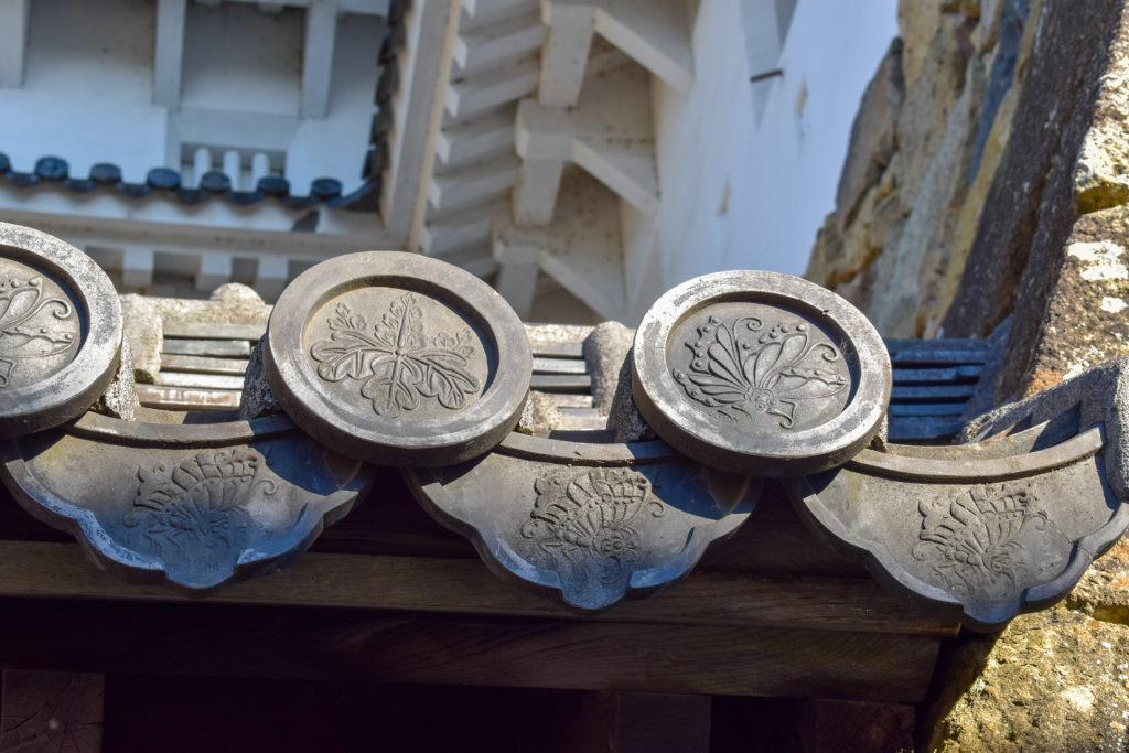
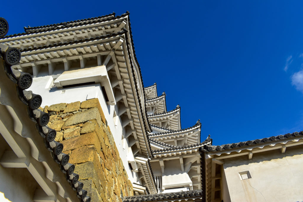
From a distance you can see the caps on the bottom of each row of roof tiles, but once you get close you can see the details on them. Every single one was stamped with a pattern of some sort: these appear to just be decorative but one spot was labeled to say it was the family crest.

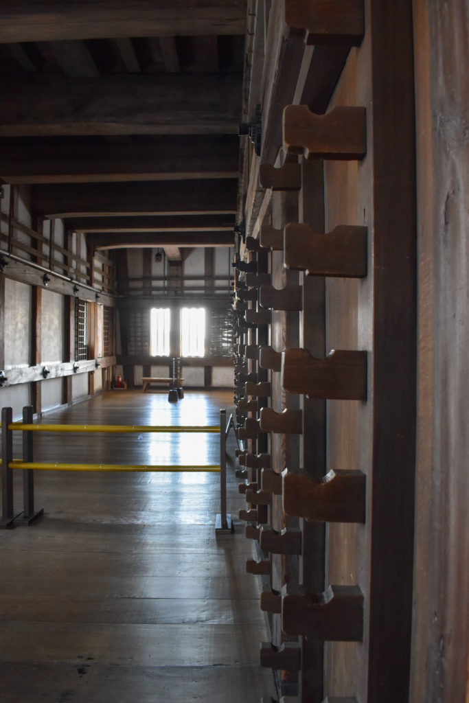
The inside furnishings were much more for defense and support of soldiers than for living quarters for nobles, which is how many surviving European castles tend to be designed. All the windows had platforms inside them for defenders to stand on, even the upper row on the taller floor at the bottom. Many of the walls were movable, so the space could be opened up or partitioned off, but in the solid walls there were lots of racks for weapons. There were also plenty of holes along the outer wall to drop things down on attackers below, especially in the corners under the eaves of the roof levels where the windows couldn’t see.

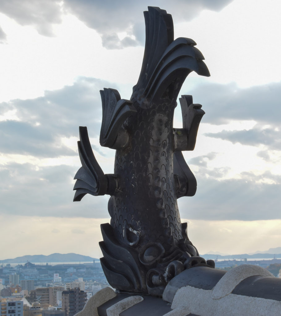
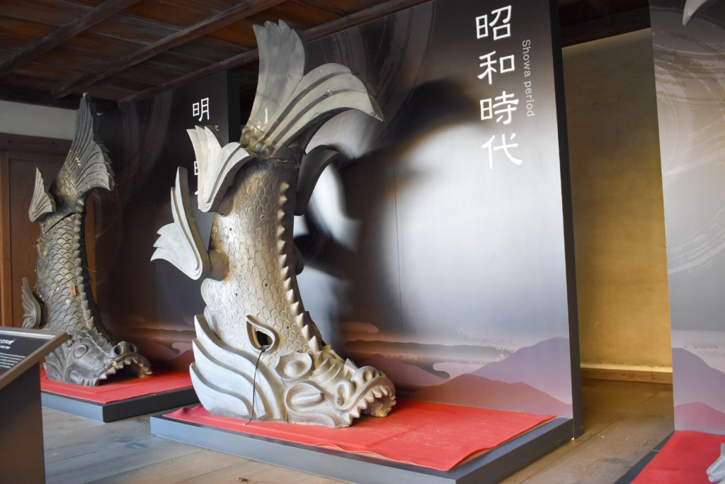
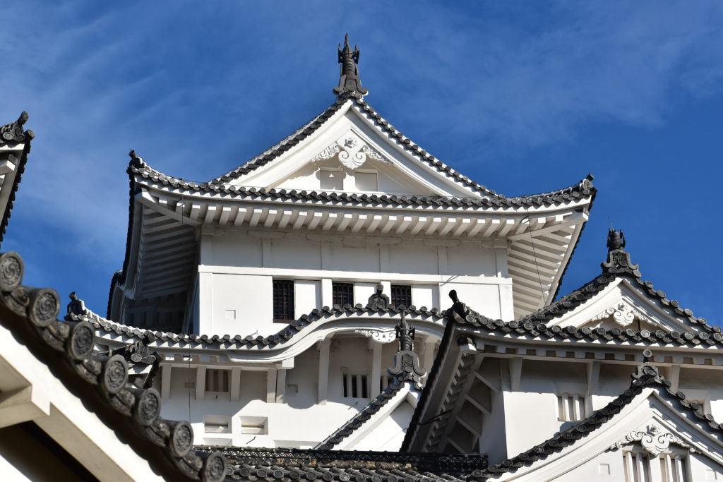
Once we were to the higher roof levels we could see just how big the fish that decorate the ends of the roof peaks are. Obviously there’s not much to get a sense of scale in the first picture of the fish with just the roof in the foreground, but the second picture is a full-size replica of the previous style of fish, and it reaches nearly to the ceiling inside the room in the museum section.

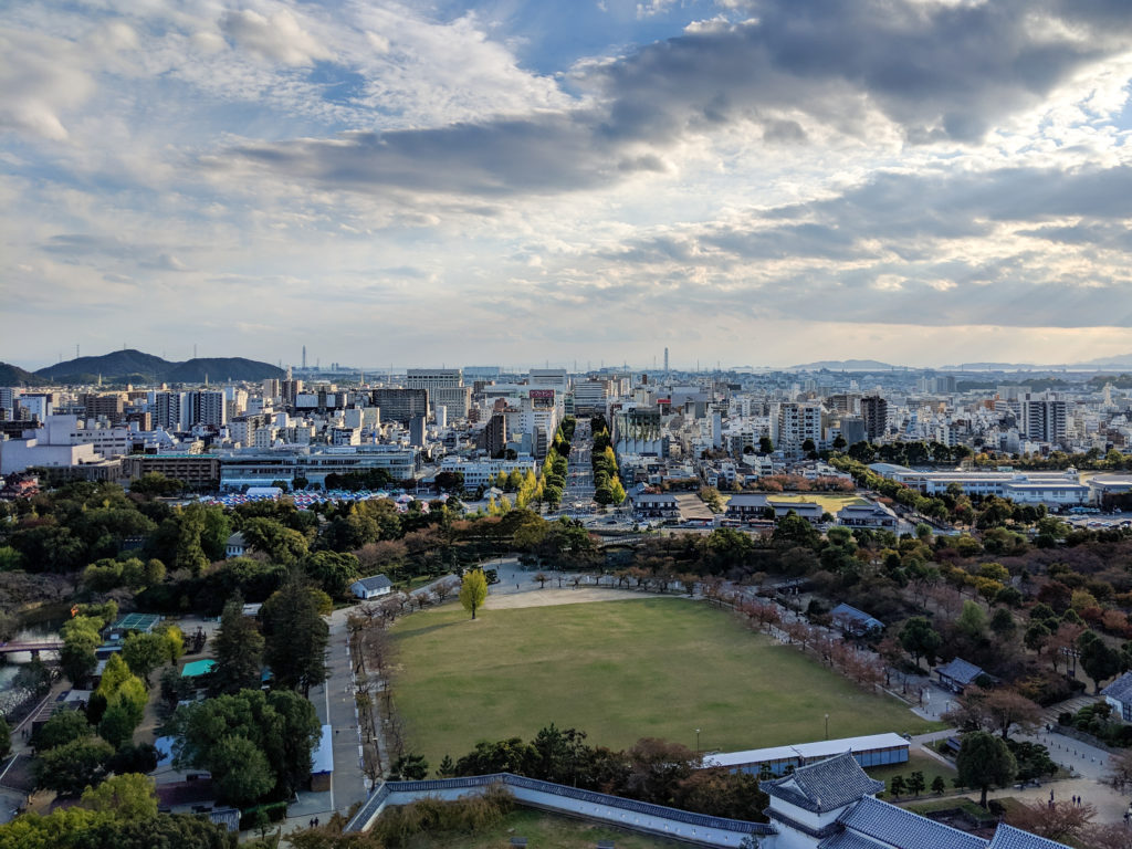
The view from the castle was also pretty impressive. It was built on a hill, so it started with a decent vantage, then it was tall enough to see over the city below it, even with modern buildings. The large road that’s centered in the picture links the train station to the castle complex.

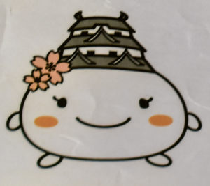
We didn’t know it till we got to Japan, but Japanese cities often have cute little city mascots (apparently called yuru-chara). They especially show up on souvenirs and signs, and Himeji naturally chose a representation of the castle. We didn’t get a great picture of the castle mascot, but to the left is a cropped down piece of a sign.

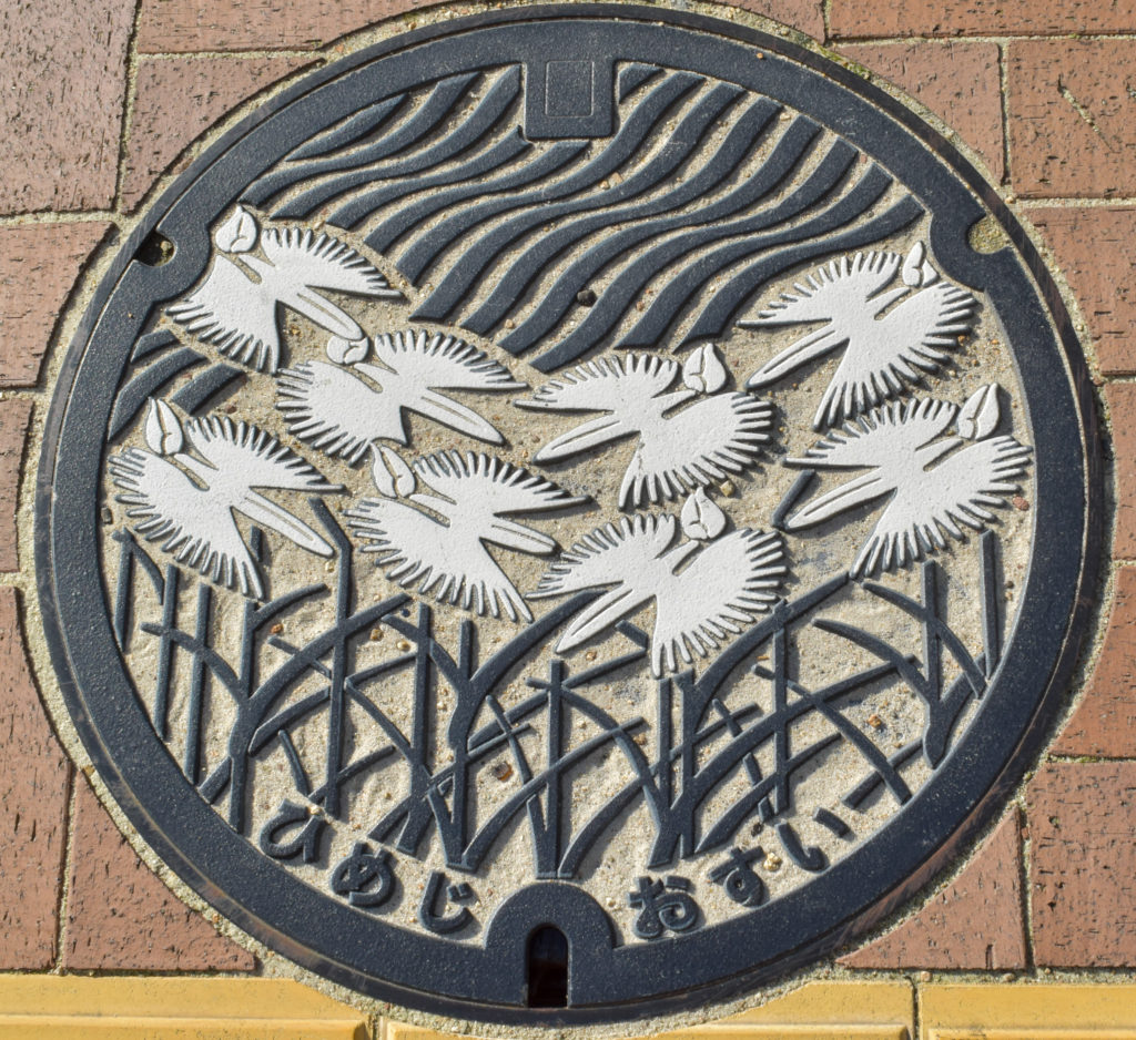
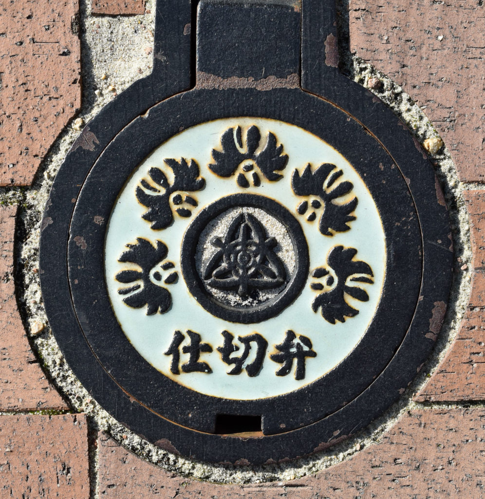
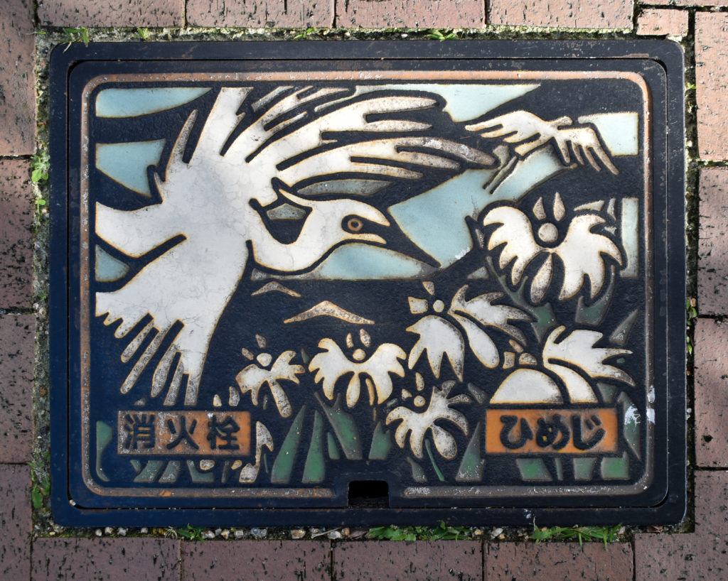
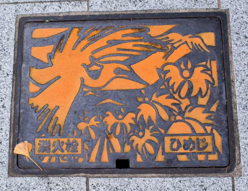
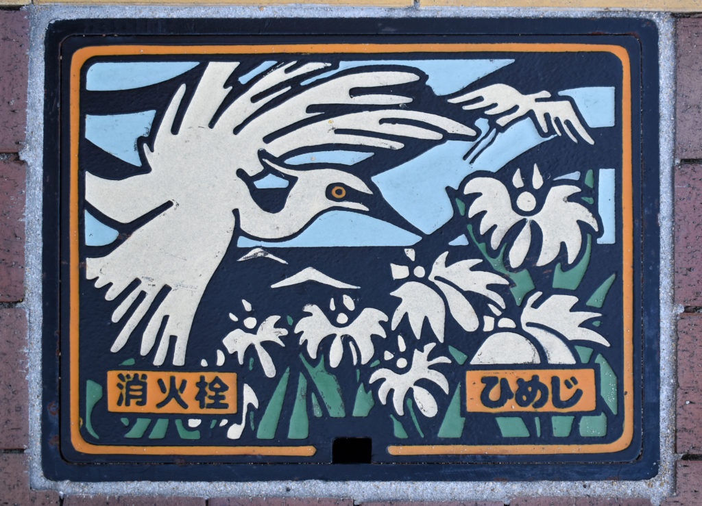
Another unique thing about Japan that surprised us was that the manhole covers were often designs unique to the city and colored in for extra style. Below are the various ones we found in Himeji. The only place we saw the castle was just outside the train station, but the other designs here showed up frequently as we walked around.

After we finished in the castle we made our way back to the train station. This was the view down the street from there near sunset, looking above the various stoplights and street signs:

Trier

Now seems like a good time to restart my blog with travel pictures. Well really, January would have been a good time, but since I didn’t take the time to make a post when I took the pictures, I’ll just make a post for them six months late. Unfortunately memories have faded, so I’ll mostly post pictures without much discussion of wandering the town.

Naturally, the first thing we went to see was the Porta Nigra:

After that we did a little shopping and I got a change holder and ear warmers, because Europe tends to use cash and change is useful, and because it was rather chilly wandering the streets in January.

We found a few interesting sights in our wandering, which I don’t remember context for besides what you can see in the pictures:

We also found our way over to St Peter’s Cathedral and the Basilica of Our Lady:

The first three pictures are of the cathedral. It was started in the fourth century, making it the oldest church in Germany. The brick wall is Roman brickwork.

The other pictures are of the basilica. which is the oldest Gothic church in Germany. It’s not as long as the cathedral, but it’s still a very tall building (and the wide angle lens emphasizes that).

Pike’s Peak (Again)

A couple weeks ago I was finally caught up on everything and had a Friday off work, so I decided to go backpacking and camp somewhere out in the national forest. I had a few options, but ended up going to the Crags trailhead on the west side of Pike’s Peak and hiking up the trail to Devil’s Playground.

It was definitely a good time for a hike in the mountains:
Nearby Aspens

As I neared treeline the view out across the valley just got better:
Distant Aspens

I camp in a hammock, so I had to stay below treeline. The trail leaves the trees around 11,700 ft elevation (according to my map, I didn’t check it), but there are trees up to a bit above 11,800 ft off trail to the north. I ended up hanging my hammock at 11,838 ft according to the GPS app on my phone.

Once I had camp set up, I scrambled up the rocks to get to a nearby ridge. Naturally, there were more views of the aspens, even if the light was fading as clouds rolled in:
Distant Aspens 2

Here’s a shot of the catamount reservoirs to the right and the crags to the left:
Catamount Reservoirs

Unfortunately, due to the elevation I was at the clouds rolled right in on top of me:
Cloud

The temperature dropped noticeably as that cloud enveloped me, which really made me wish I’d remembered to grab my gloves. I had scouted out a nice flat rock to cook supper on while I watched the sun set, but since I couldn’t actually see the sun setting I found a rather more protected spot to eat. By the time I’d finished eating it was getting dark, my hands were freezing, and I still hadn’t hung the bear bag. Fortunately there weren’t any hungry critters daft enough to be out in the cold: the bag was at most 2 feet off the ground since I just walked the cord around a couple trees not too far from camp and hoped for the best. A motivated raccoon or ground squirrel probably could have gotten into it without much effort, never mind a bear.

By the time I had everything stowed and got back to my hammock it was snowing:
Snow

The snow was really just a light dusting, though it did last through the night and well into Saturday. It was a reasonably windy night, but I was surrounded by enough trees that it was rare that I actually felt a gust. My undercover and sleeping bag were sufficiently warm that I was nice and toasty all night long, though I didn’t get a great nights sleep (partly because I went to sleep at 9:00 pm and woke up in the middle of the night like I’d just been napping).

The low was probably in the high 20s (there was still snow on the ground in the morning, but the water bottle I’d left out wasn’t frozen solid), which is apparently cold enough to affect propane: propane bottles are supposed to make a sloshing sound when you shake them; mine was more of a swish. I couldn’t get my stove to light until I’d warmed the bottle of propane up a bit. I managed to get enough water out to (eventually) cook oatmeal for breakfast, but rinsing out the cup clearly wasn’t going to happen (the water froze to the inside of the cup as I swished it around).

Pike’s Peak sure does have a big shadow at 7:00 am:
Shadow

When I struck camp and started hiking my toes were not quite numb but painful, so I figured I’d just get to the top of the ridge, get some morning pictures from over 12,000 ft, then head back down. After probably half a mile of hauling my pack up the mountain my toes were doing fine, but my hands were cold. I eventually crested the ridge and started walking through Devil’s Playground, so named because of how lighting jumps between the rocks during thunderstorms (which I thankfully didn’t witness):
Devil's Playground

Once I’d made it through Devil’s Playground I got to thinking about it and realized I’d already covered around half the distance and over half the elevation gain, so I might as well push on to the peak. The wind was pretty brutal (and I still didn’t have gloves), but surely it wouldn’t be all that bad. I got a good view of Crystal Reservoir and the south side of the end of Rampart Range:
Rampart Range

Then, disaster:
Frozen Hose
The lines across the hose are where the ice that’s filling the hose cracked as I extracted it from my pack. Once the hose had frozen (it was run across the top of my pack) it took me probably a quarter mile to find a spot that was sheltered at all, then I took off my rainjacket/shell, put the camelback on, then put the shell back on. By the time I got my pack on my hands didn’t even have the dexterity to manage the clip easily. It then took probably over half a mile of hiking before the hose had thawed enough for me to get a drink.

Road
The top half of the trail somewhat parallels the road. On the one hand it’s kind of frustrating to have cars driving by and have so many people on top, but on the other hand, there aren’t any other 14ers that have gift shops serving hot beverages on top.

After spending an hour sitting inside the summit house and eating a donut (they were out of hot chocolate…) I was feeling much better. This is me finally not feeling absolutely miserable:
Sign Selfie

By the time I started back down the wind had tapered off somewhat and it was warming up (enough so that the snow was mostly melted). It wasn’t nearly as miserable as the hike up, but it was still a long hike (especially because I was carrying my backpack the entire way). After nearly two hours I reached the top of the slope I’d camped on and finally got a well lit picture of the valley:
Sunlit Distant Aspens

By the time I got back to my car the afternoon storm clouds were rolling in. It was certainly a longer hike than I’d planned on, but if I hadn’t been hauling my fully-loaded backpack (~25 pounds) around it would have been much faster. I don’t plan on backpacking that route again, but given proper equipment (gloves, a scarf) it shouldn’t be too bad a day hike.