Rocky Mountain

I’m stopping with the “incline” puns, but I do have some alternate titles/subtitles:

  • This week in Place You Could Fall Off of and Die
  • Next in Places to Not Be During a Thunderstorm
  • Mount Manitou Attempt Two

First off, I got new hiking boots this weekend:
Boots
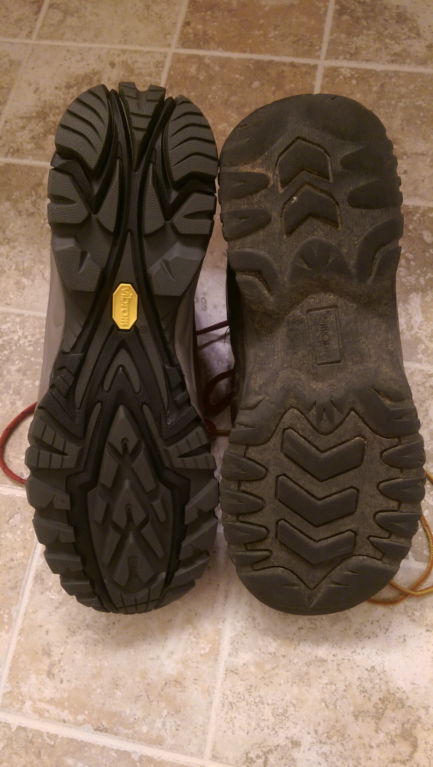
Not only were my old boots mostly worn through the tread, but the souls aren’t glued on at the arch of the foot any more (the toe/heel are attached well enough it’s not an issue, but it’s definitely a sign they should be replaced). The new boots could use some breaking in to make them more comfortable, but they did well enough on their first hike and I didn’t come away with any blisters so breaking them in shouldn’t be a problem.

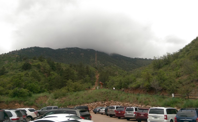
Starting out today I hadn’t really decided if I was going to try to find a way up Mount Manitou again or if I’d go elsewhere. The weather forecast said it was supposed to rain (and it was certainly humid enough for it) so I wasn’t sure I wanted to go to the top of anything in case of thunderstorm. Also, driving into Manitou Springs I got a flash flood warning on my phone and the path to Mount Manitou is alongside a creek.

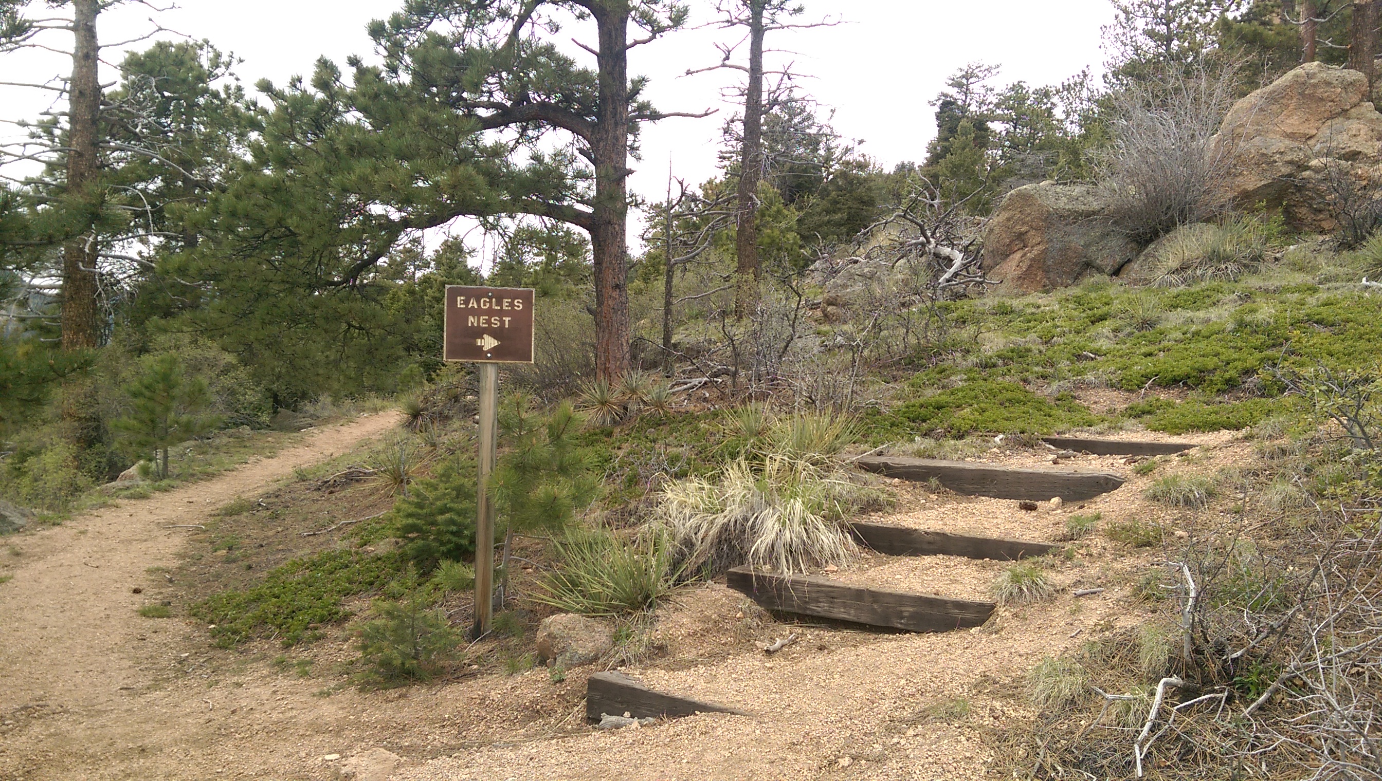
Since I wasn’t keen on hiking by the creek I decided to take the opportunity to explore the fork to the right of this picture:
Rocky Mountain fork 1
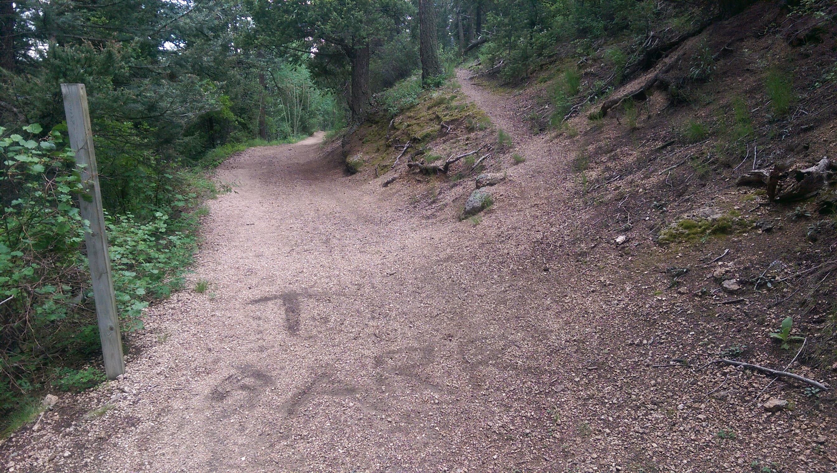
I’d noticed it before, including that there’s a signpost without a sign (does it still qualify as a signpost?). The arrow/label scratched in the dirt was new, but there was still no indication of where the fork went. It’s obviously not a well-traveled trail (there’s a tree fallen across it currently) but there were older logs that were cut where they fell across the path so it’s clearly somewhat maintained.

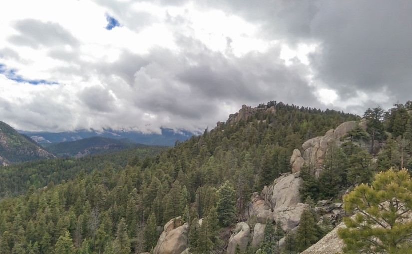
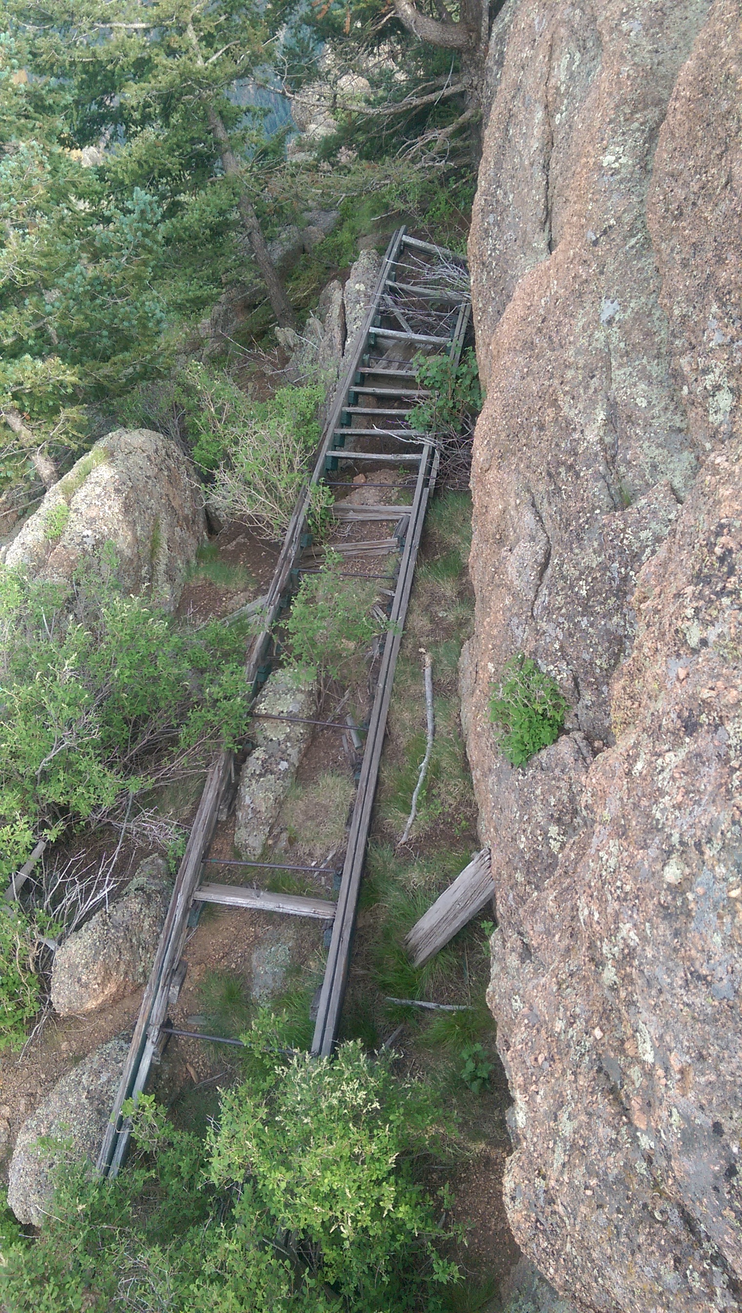
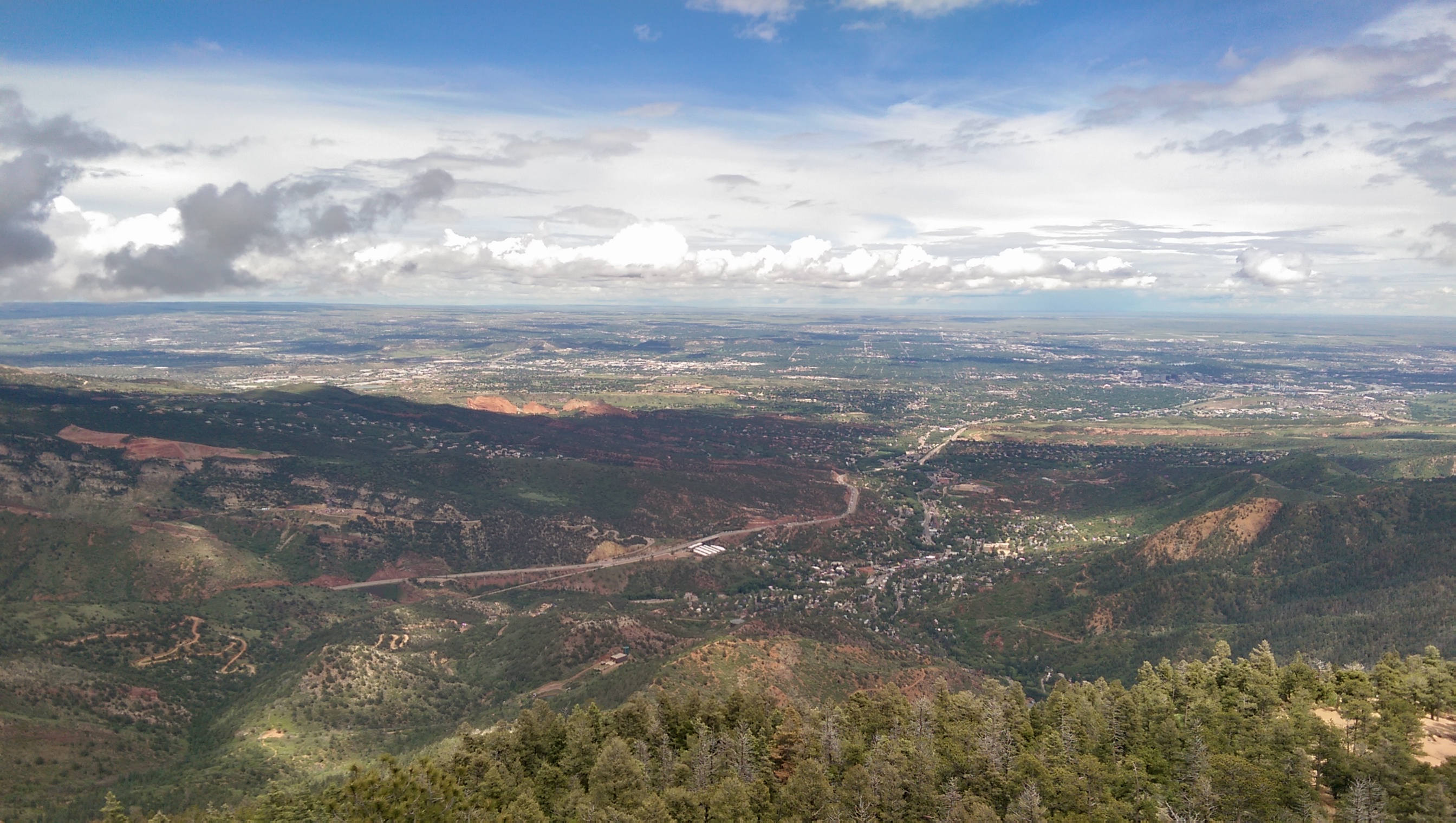
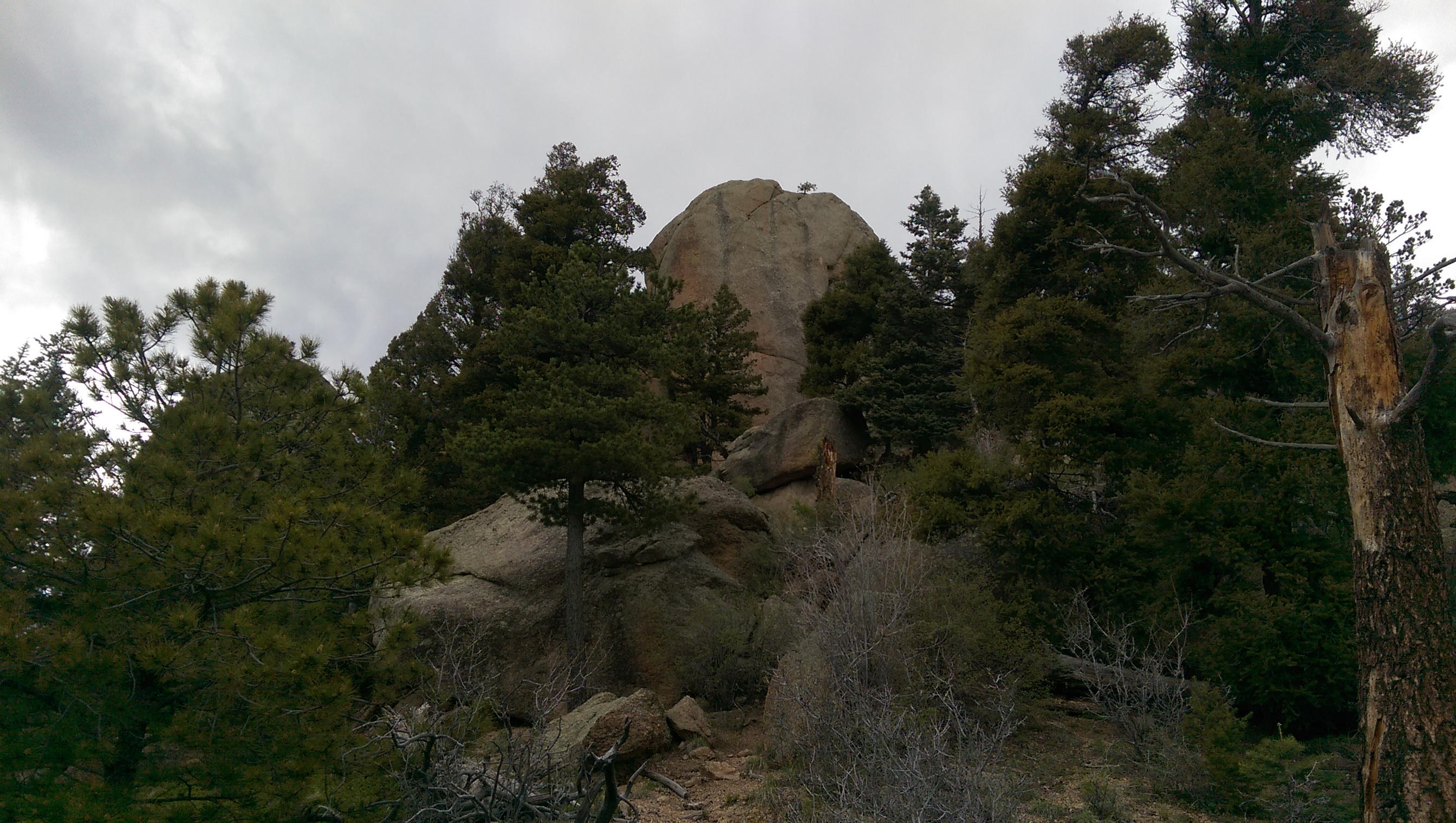
At the top of Rocky Mountain (at least the rocky peak that lives up to the name) it is in fact quite rocky (also, the other side of those rocks is a sheer drop):
Very Rocky

There are even stairs to help you get to the top. Unfortunately they’re laying on the ground, probably because so many steps are missing they didn’t help much:
Stairs

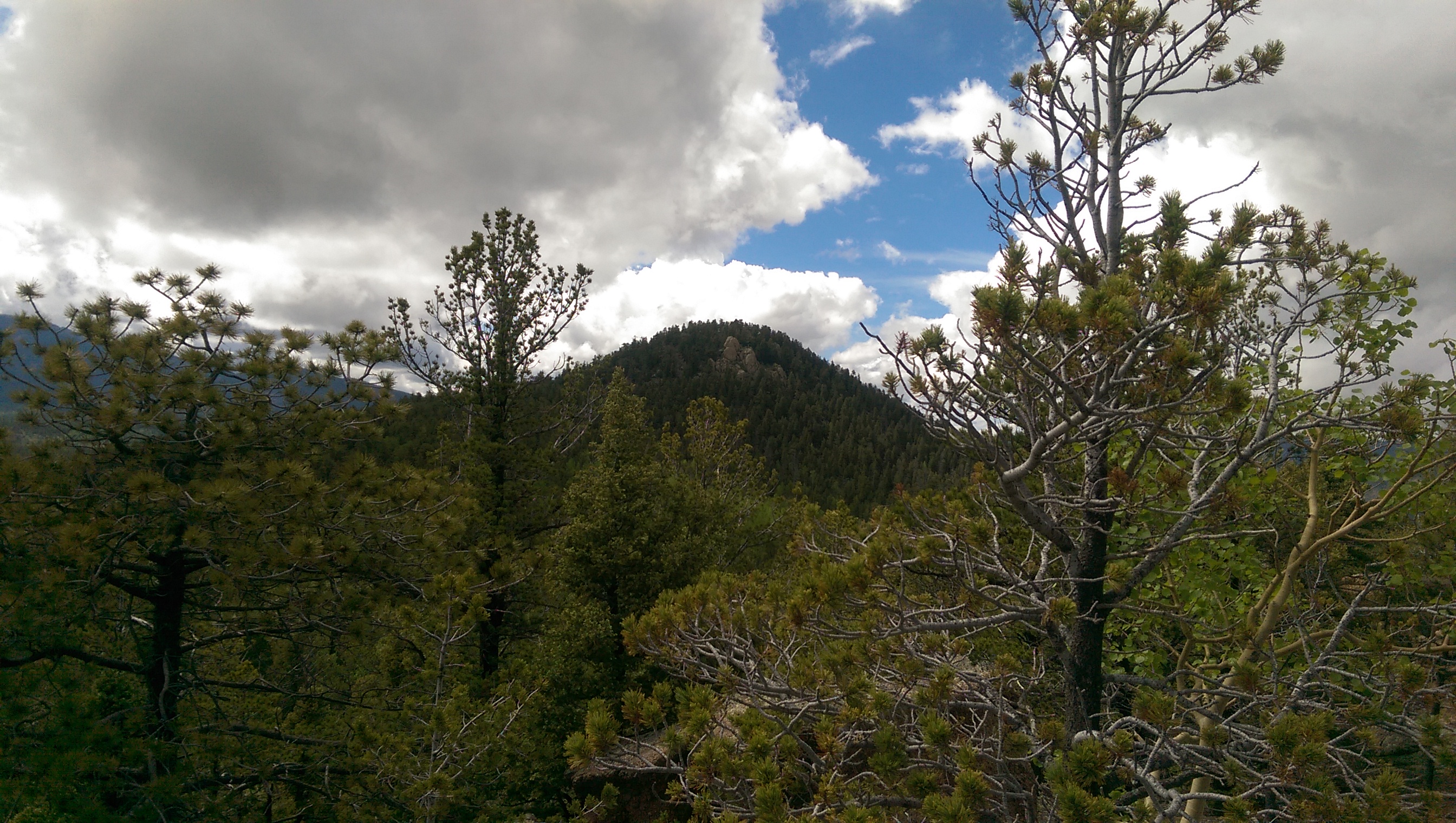
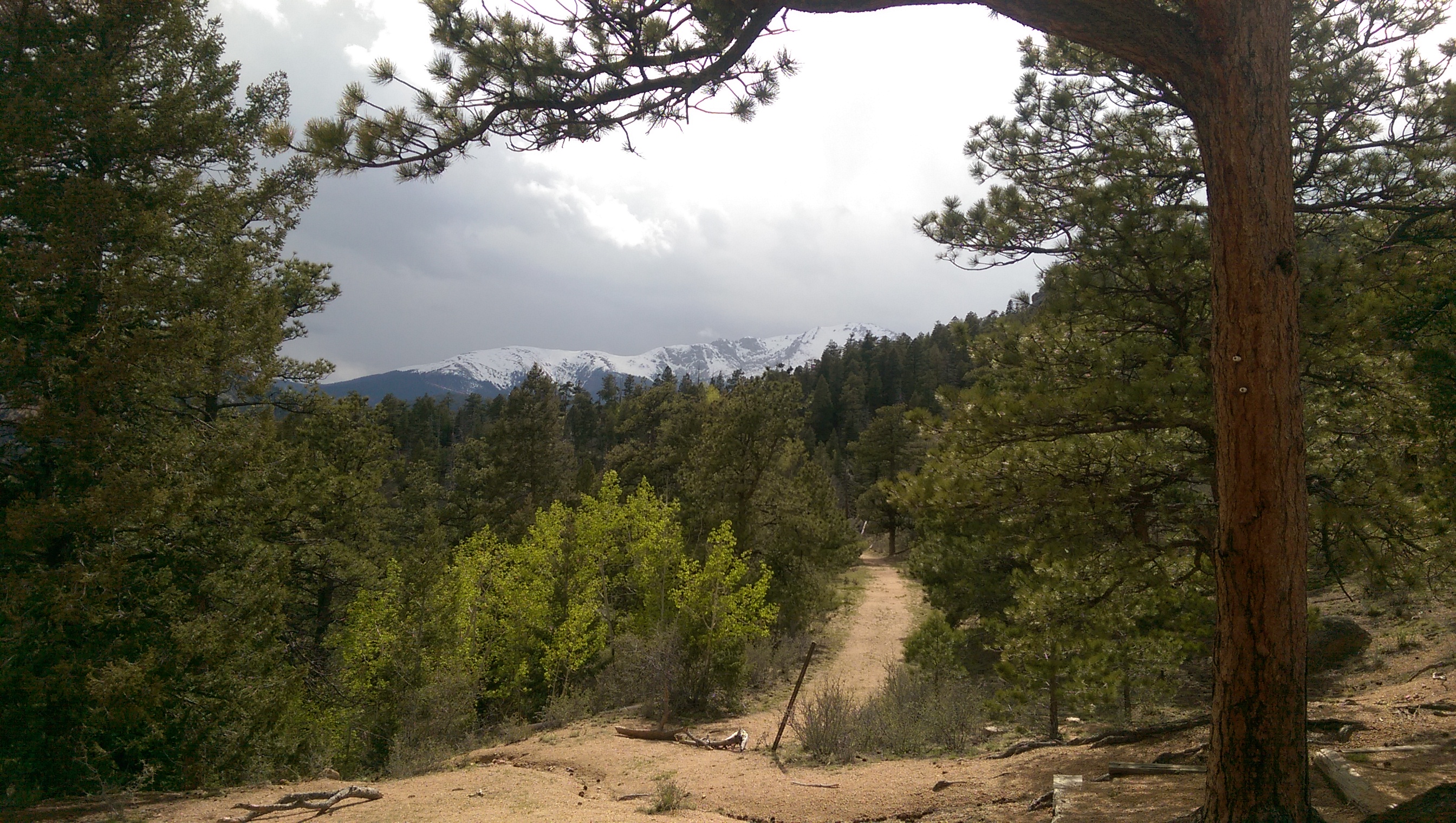
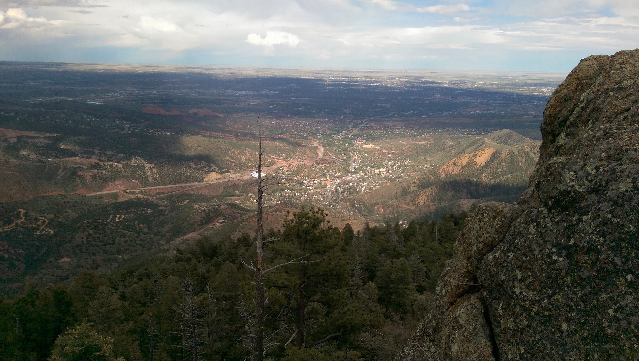
Mount Manitou (the taller one in the center, the bump just left of it is where I ended up last time):
Mount Manitou

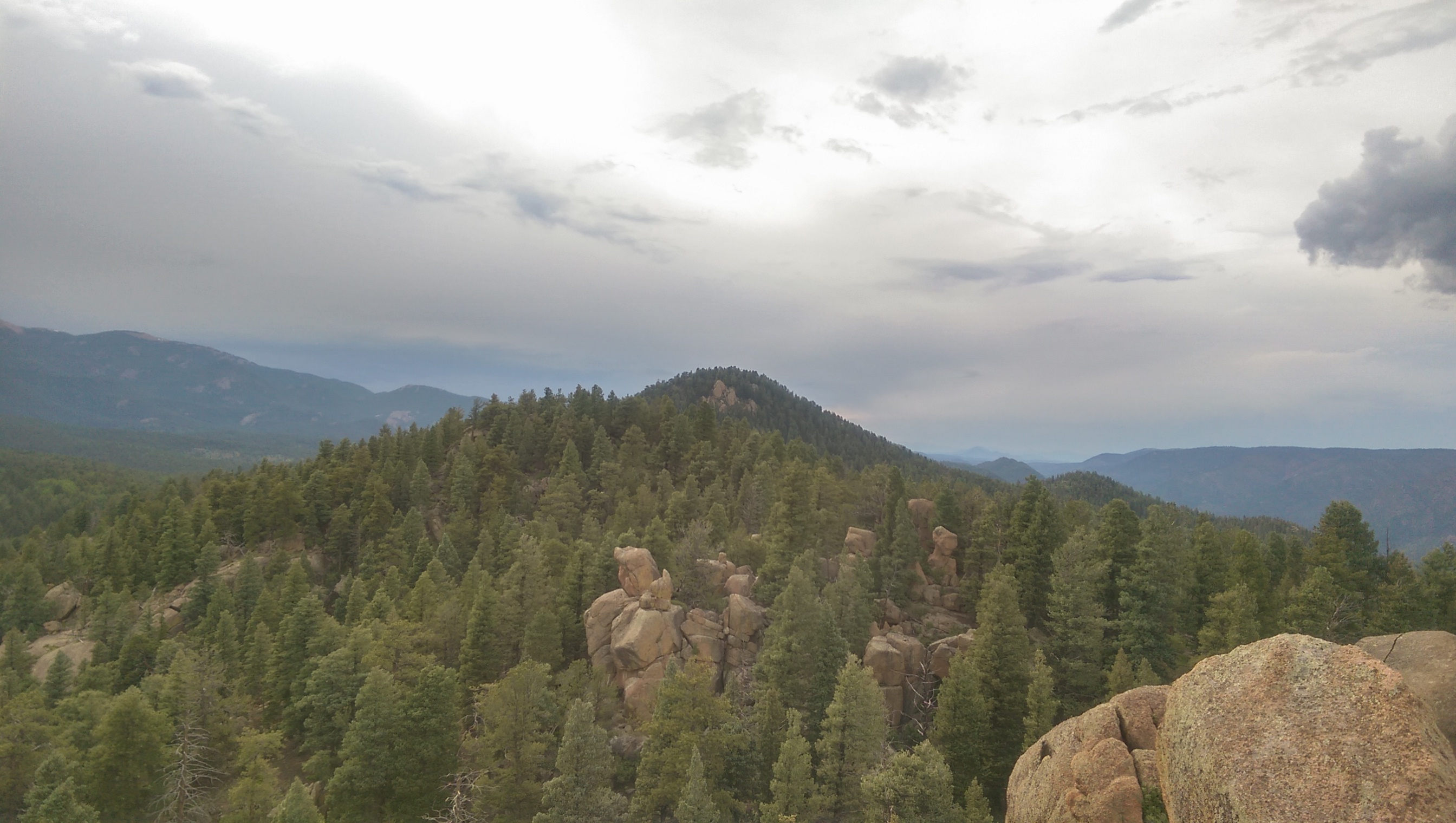
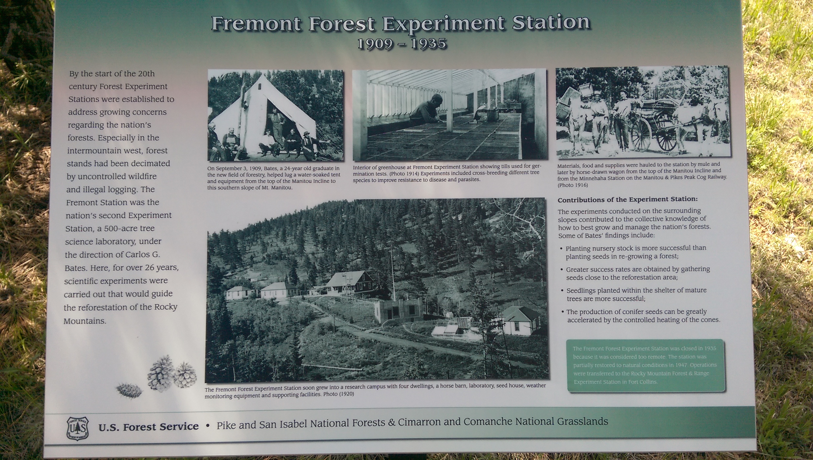
You can also see the experimental forest station (the clearing in the center):
Experimental Forest from above

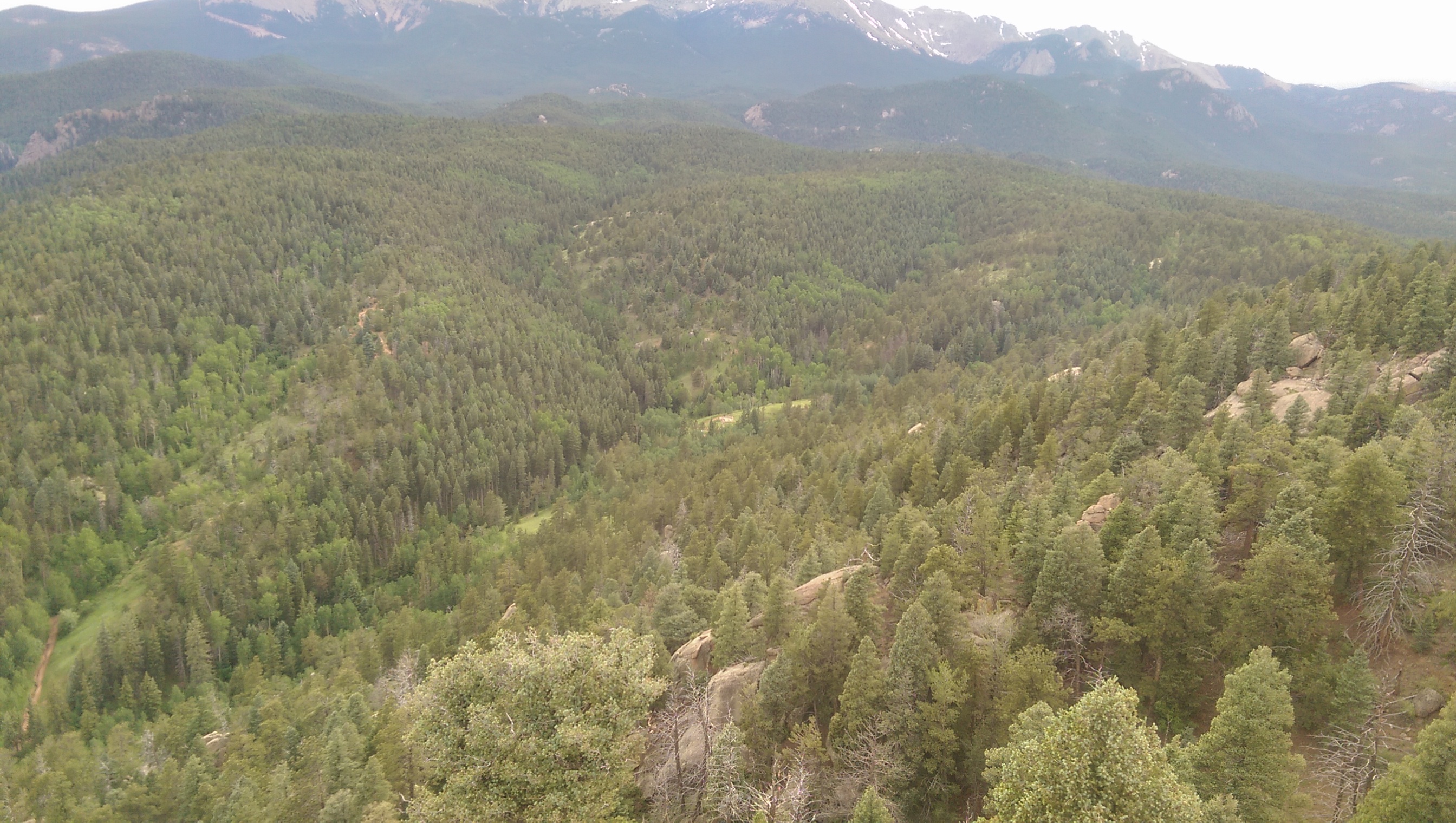
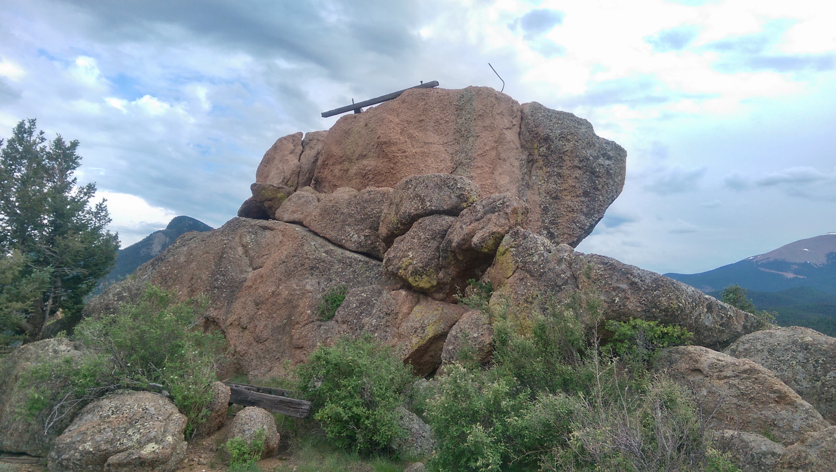
On the way down I made a quick detour over to the experimental forest (there was echoing thunder by this point, but it was from the downhill direction and it wasn’t raining) to get a picture from there looking up at the rocks I was taking pictures from:
Rocky Mountain
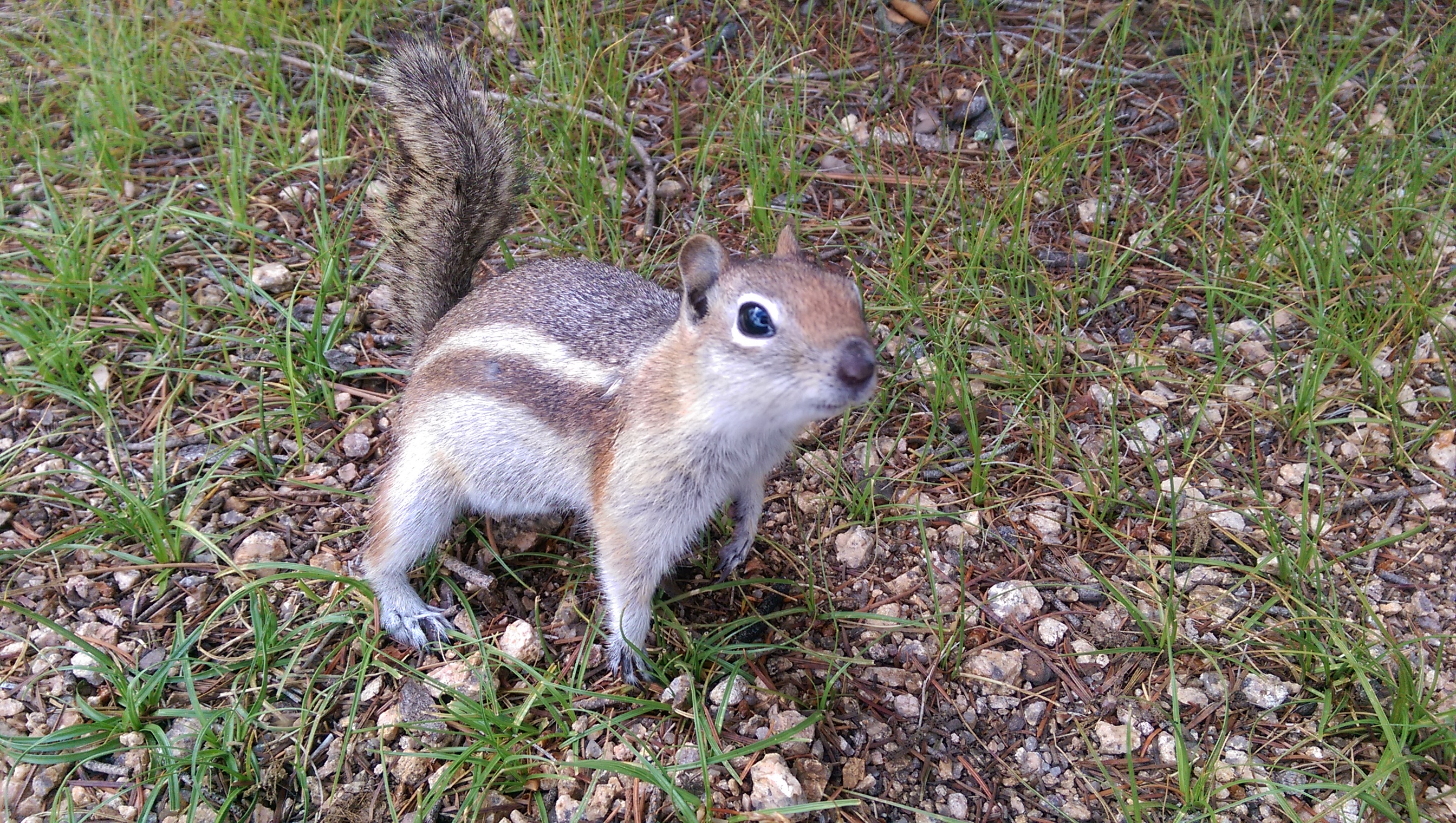
It’s shots like this that make me wish I had a real camera (with zoom). Also, zoom would have gotten me pictures of several types of birds (one of which made squeaking noises) and a rabbit.

I did get rained on a little bit on the lower part of Barr trail (thankfully after I was well away from the creek). There was lighting (and lots more rain) over Colorado Springs on the drive home, but my time on the mountain was mostly overcast with some sun and a little bit of drizzle.

Inclined to Climb the Wrong Mountain

The Friday before last (before I went on vacation) I left work early intending to hike to the top of Mount Manitou. It had been raining and before I left work looked like there were dark clouds still moving in so I took my rain jacket on the hike. Naturally, the sun was out by the time I got 3/4ths of the way to the top, but at least it wasn’t crowded at all.

For the first time I actually packed a snack to eat at the top. That made me friends:
Ground Squirrel

The ground squirrels (not a chipmunk – chipmunks stripes extend across their head) were actually fighting over who got to come and beg for food. I didn’t share but even with me holding it close and swatting at any critter that came close enough to make a grab for my cliff bar I got a number of close-up pictures.

Once I’d rested and snacked I made another trip to the top of Eagle’s Nest:
Eagle's Nest
Garden of the Gods is left of center along the line of shadow from clouds, and the clearing at the top of the incline is to the far right of the picture.

After I’d found a way back down (cautiously, there were indications that a bear had been there recently) I headed up Barr trail and took the turnoff to the Old Fremont Experimental Forest. The experimental forest is a site where they experimented on what trees would grow best in the Rocky Mountains and how best to get trees started and nurture them with reforestation in mind. Here’s a picture of the site as it stands today:
Fremont Station Remains

Past the forest station it should have been a straight shot uphill to the top of Mount Manitou, mostly along what I’m guessing are forest service roads. Unfortunately I had no map or data signal for my phone and I picked the wrong slope to climb when the road turned away. I didn’t see any other trails (or people, it’s apparently not a well-traveled area) so I just hiked uphill until I got to the local maximum:

The point labeled “Local Max” in the “Misc” layer is where I ended up. It’s either an unnamed bump on the ridge or it’s part of Rocky Mountain. Unfortunately it’s covered in trees and one of the few things visible was Mount Manitou in the distance:
Mount Manitou

I’ll have to try again sometime soon – I was out of time that evening and didn’t have time to explore more.

Inclined to Take Panoramas

Today was a sad day: the chocolate bar I had in my car for when I finished the incline melted. At least I still had a (warm) fruit cup. I need to stock up on energy bars and sports drinks, either to take with me or for when I get back off the mountain. There’s actually a little shop at the base of the incline, but both times I’ve been recently it was closed by the time I got down (so it closes before 5:45 pm).

For context for the post title, my dad asked me what to do with the Google Cardboard he ordered for us to play with on vacation this year. I heard about it when he sent me an email telling me to figure out what to do with it. It’s a virtual-reality glasses thing, so the first thing that came to mind was panoramic pictures so you can turn your head while wearing the goggles to look around the picture. I live in near a wonderfully-picturesque mountain range, I just don’t typically think to take that kind of picture (nor do I go hiking all that often…).

I’d already been planning to hike the incline again for exercise, so I just had to make sure to take some good panoramas. The problem is that it takes time to fill out a photo-sphere (which angles up and down, not just around) and the incline is typically fairly busy so I didn’t want to be standing in the middle of the trail taking a bunch of pictures, especially when to the sides are just dense trees. Fortunately I was able to find an excellent view at the top.

Here’s a picture from the top of the incline:
Incline Top
The weather was nicer this weekend (at least when I took this picture, I got rained on later), but the view is framed by trees so I didn’t think it made a good candidate for a panorama.

I hadn’t looked around at the top of the incline before. Here’s a nice view of Pike’s Peak with a trail leading in that general direction, which made me think there might be a good overlook farther up the mountain.
Pike's Peak

A short way up the trail I found this, which certainly looked promising:
Eagles Nest

It was pointing towards this, even better (I have no idea if this actually is Eagle’s Nest or if that’s a higher outcropping – there were a number marching up the ridge and I just stopped at the first):
Eagles Nest

Unfortunately it’s late and I haven’t found an easy way to post a photosphere such that you can actually look around in it, so here’s the view from sitting on the side of the big rock in the previous picture (not standing because it was cold and windy and there were large drop-offs on either side):
View from the top

Testing something new, here’s a map with the incline and other point of interest for this trip marked:

The title image is the view of the Manitou Incline from Memorial Park in Manitou Springs.