Blodgett Peak

This afternoon I hiked up Blodgett Peak. More accurately: today I got lost on a mountain but eventually made it to the top of Blodgett Peak.

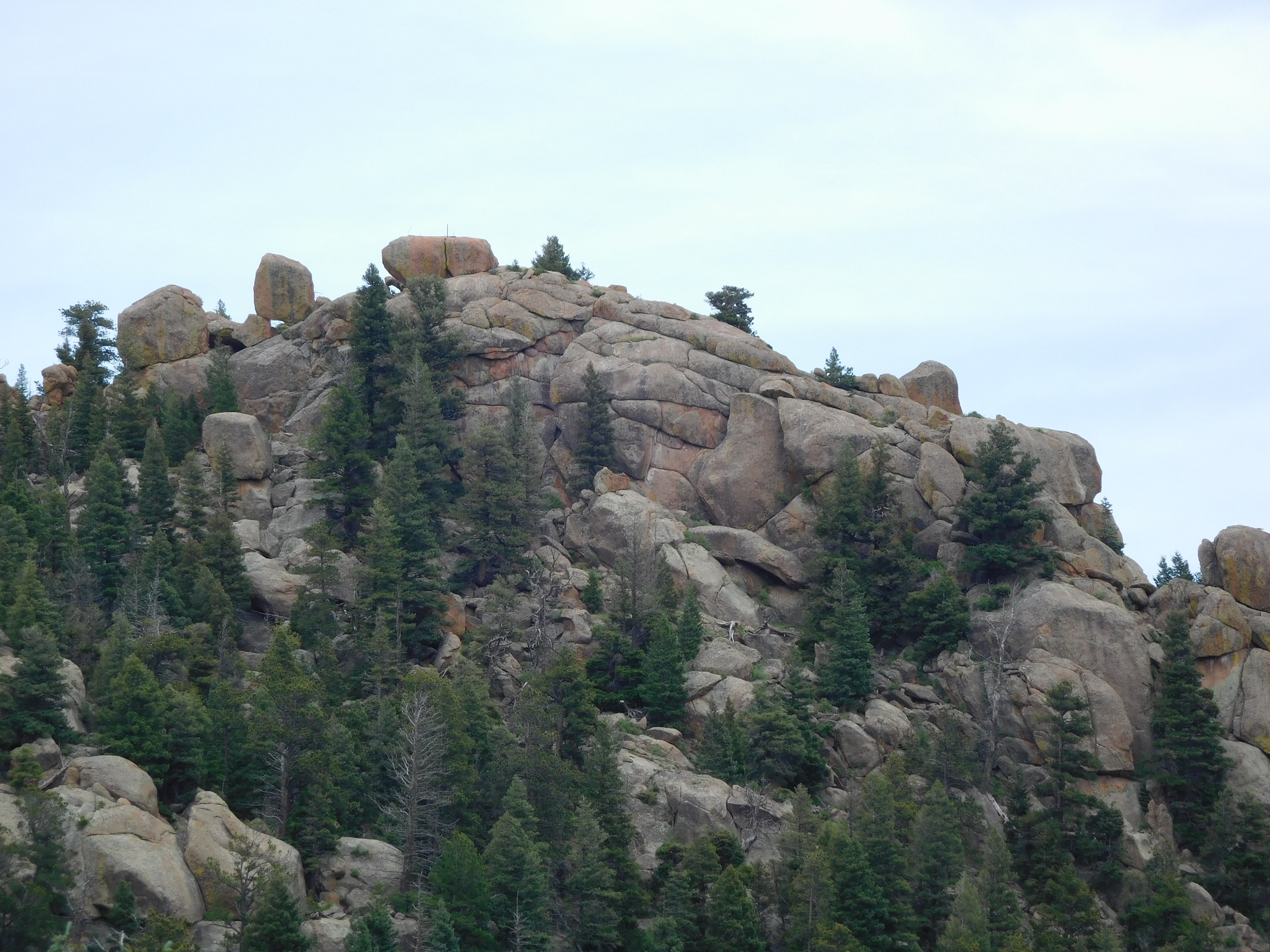
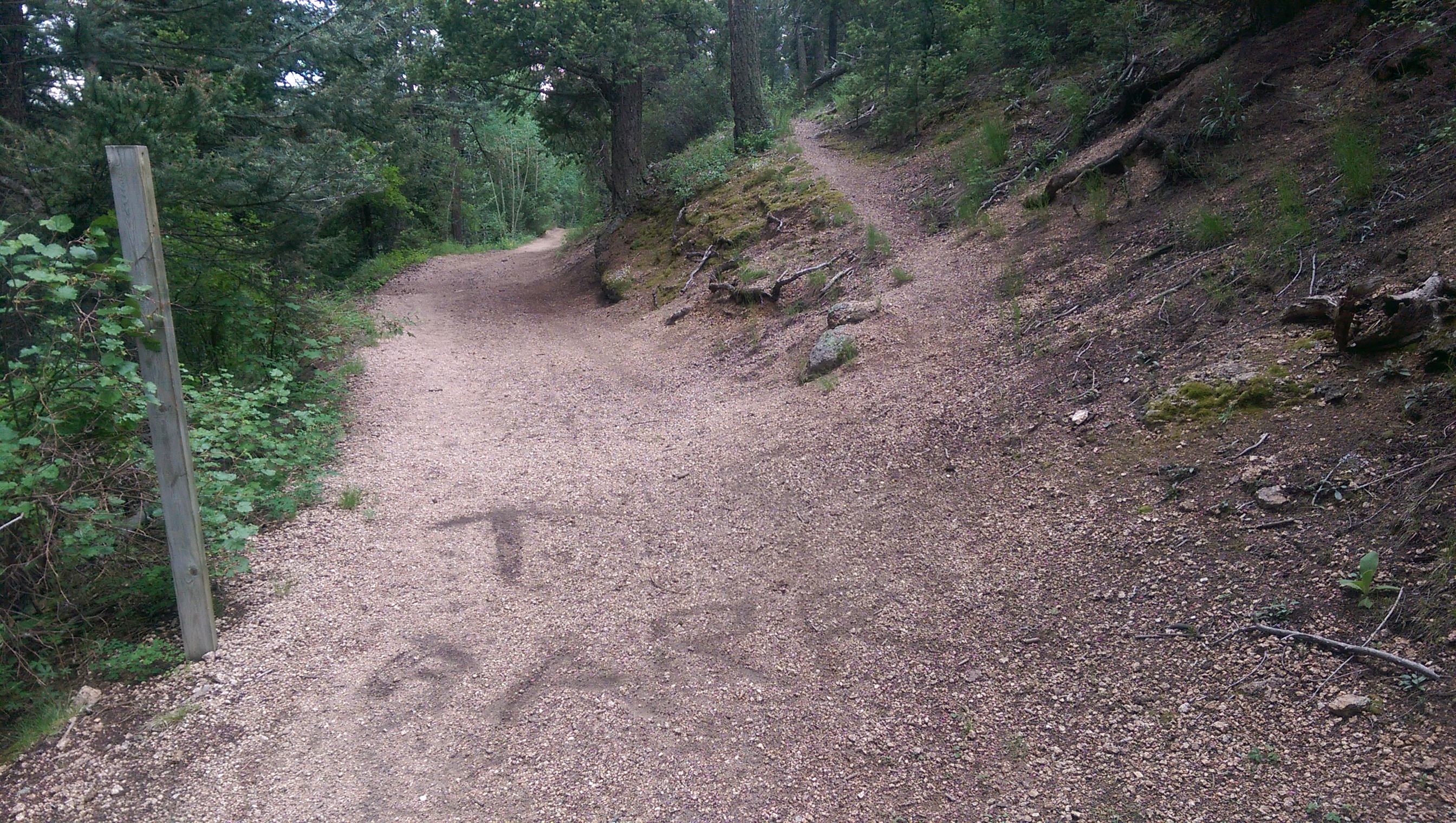
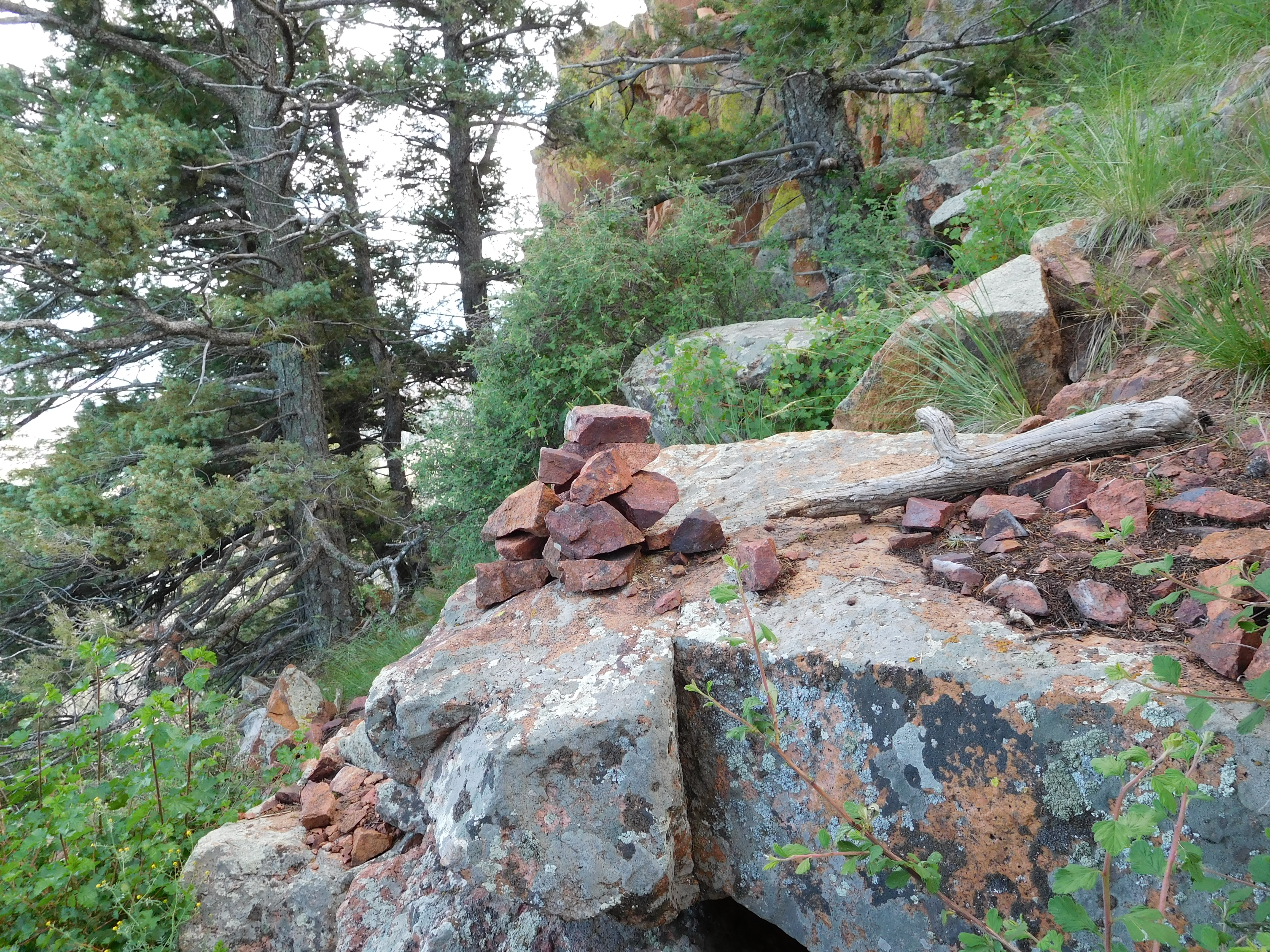
The directions I had described how to get to the parking lot, what forks to take after leaving the road up the water tower, but ended with: “The trail gets faint and hard to follow. Proceed to the peak on one of the informal trails.” I should have recognized that as being a bad sign. Trails here tend to be granite gravel where the plants are worn away. Drainage washes also tend to be granite gravel with no plants. The map shows the trail loosely following a stream and approaching the peak from the north side. I followed a trail that split away from the stream (it had a couple switchbacks and couldn’t have fully been formed by washing out) until it entered a boulder field, at which point I lost it and just started climbing the 45 degree slope of the boulders. I ended up approaching the peak from the east having climbed up the south side of the ridge. The best part was that occasionally I’d see little cairns (intentionally placed piles of rock for markers) indicating that someone thought my route was a valid path (note the slope of the ground behind that pile of rocks):
cairn

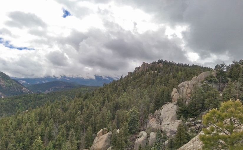
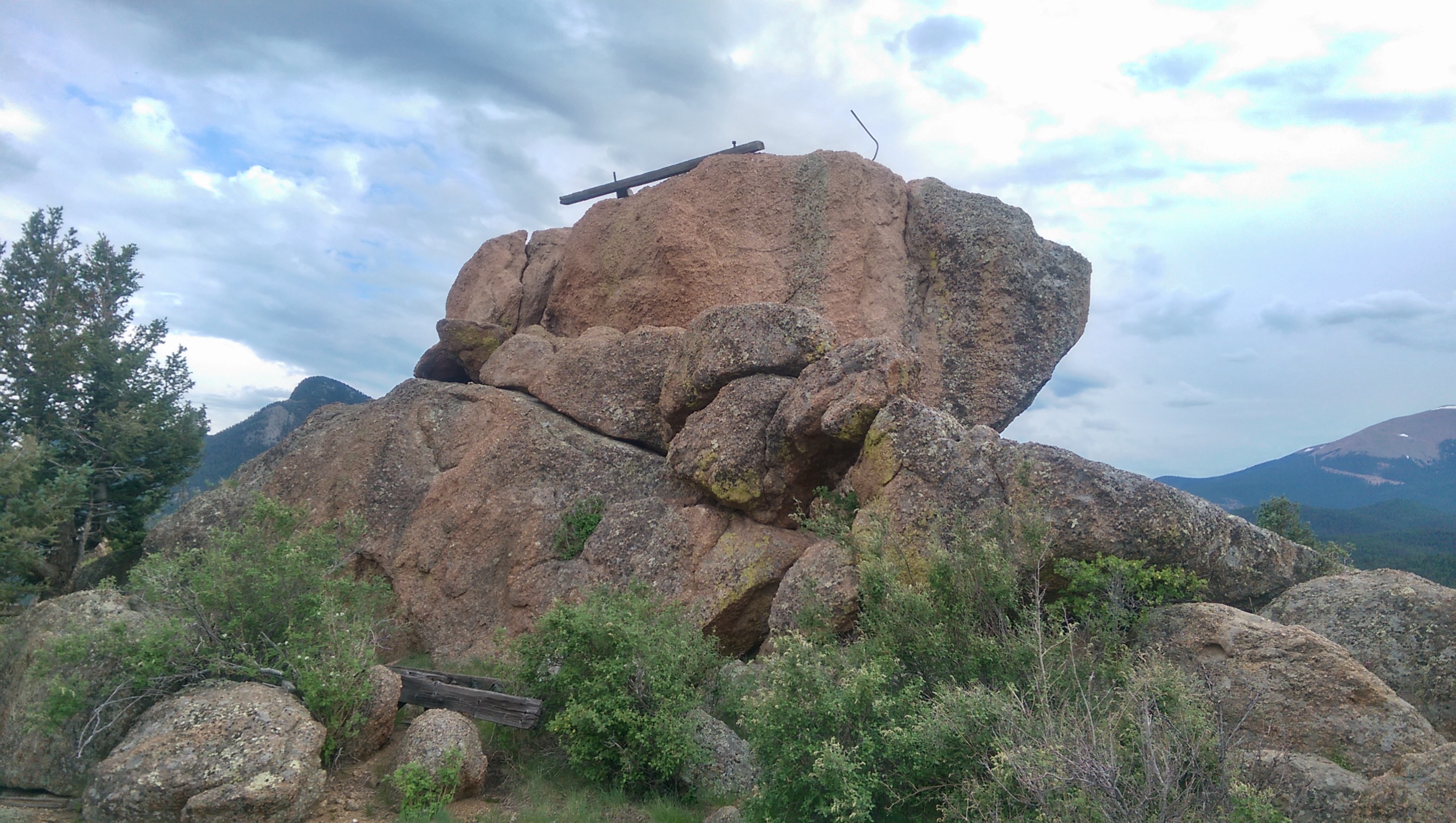
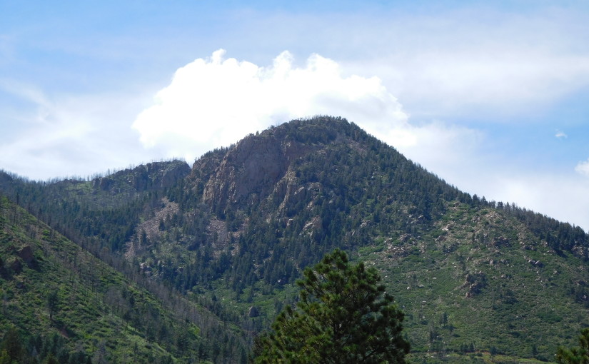
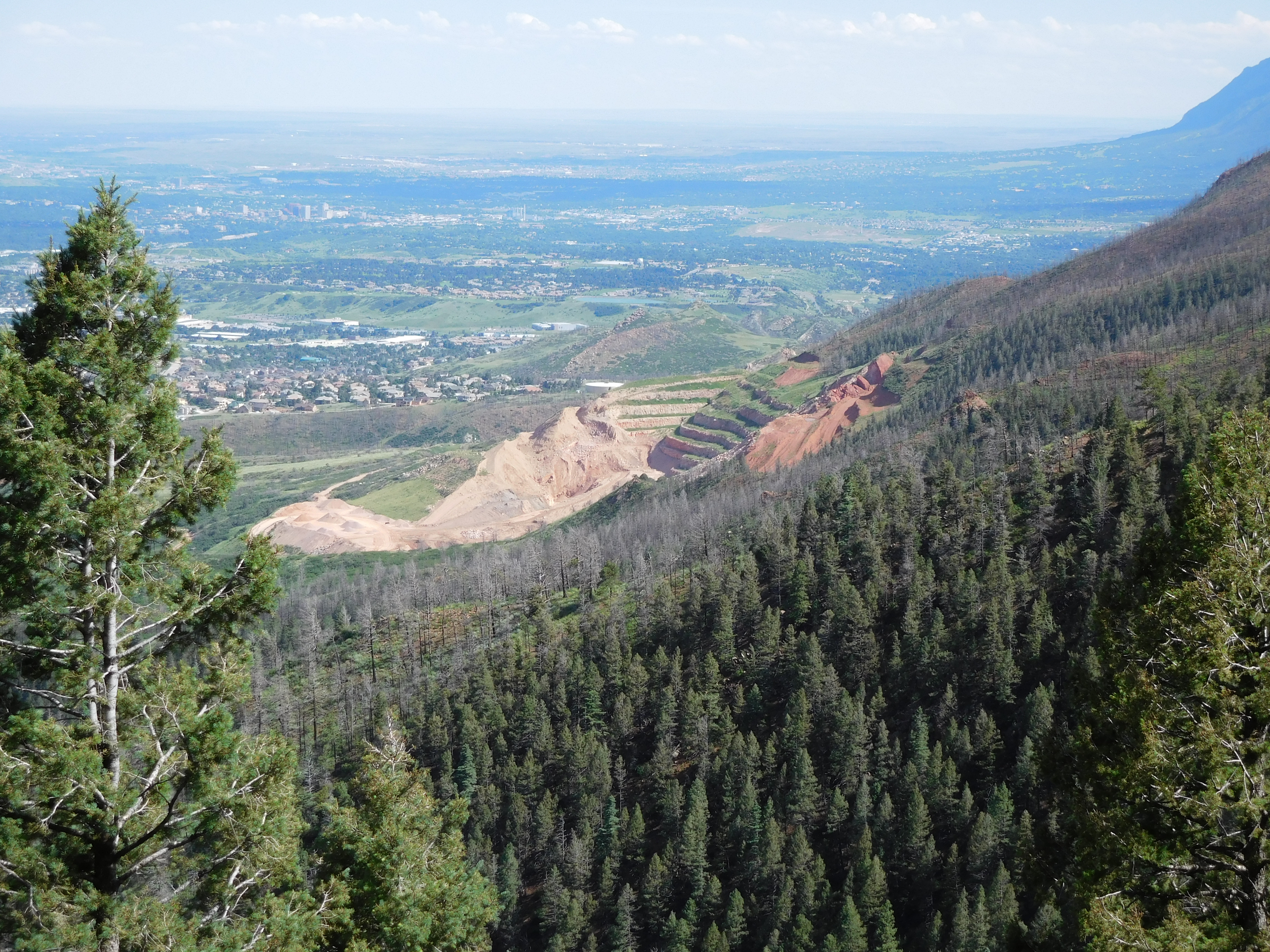
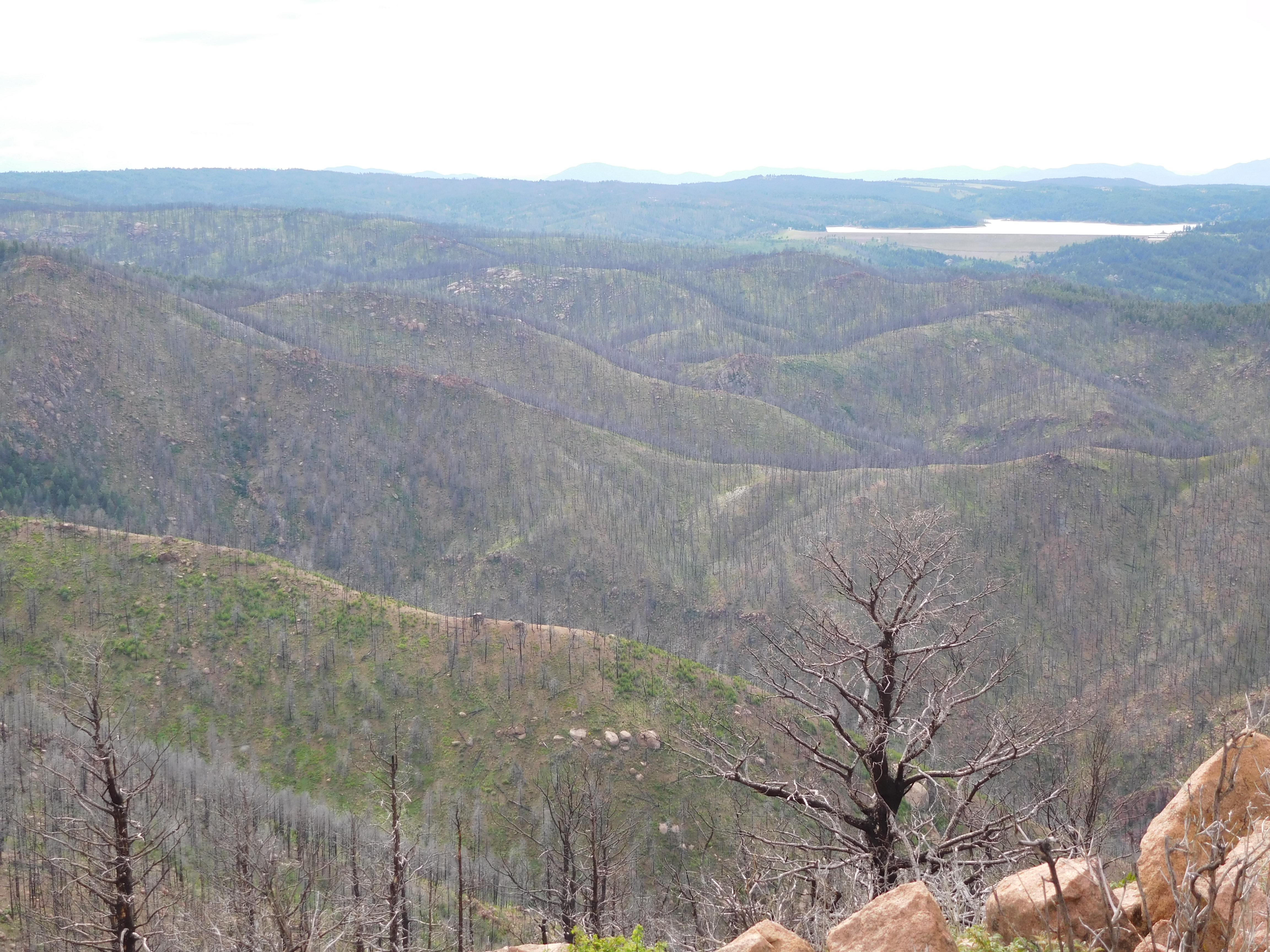
Thankfully that route only required a lot of scrambling over rocks and no actually rock climbing to get to the top, though I think I would have gone much faster on a proper trail. On the other hand, I got some good views that weren’t as visible from the top, like this picture of the quarry a little south of Blodgett (also note the burned spots from the Waldo Canyon Fire):
quarry

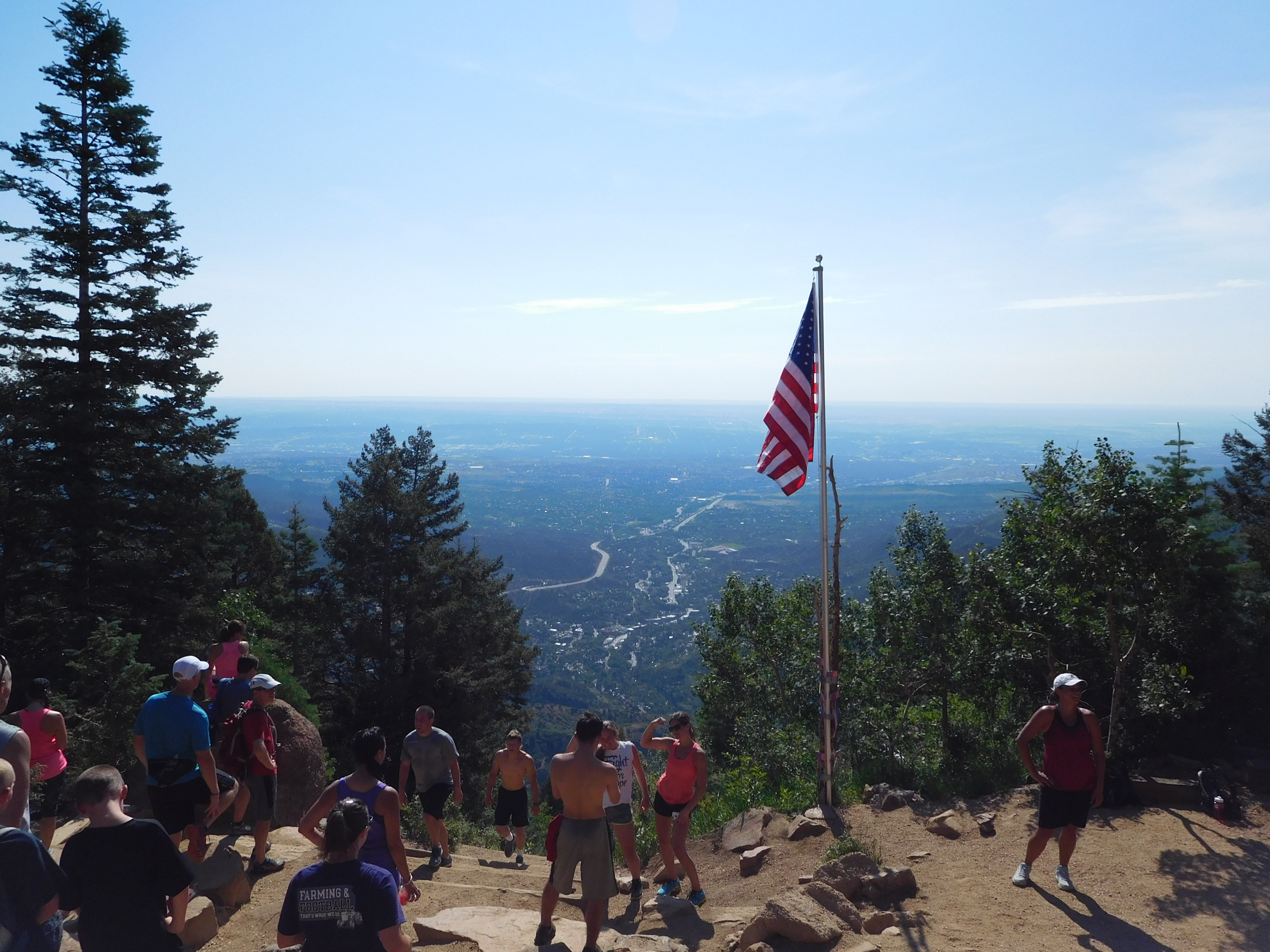
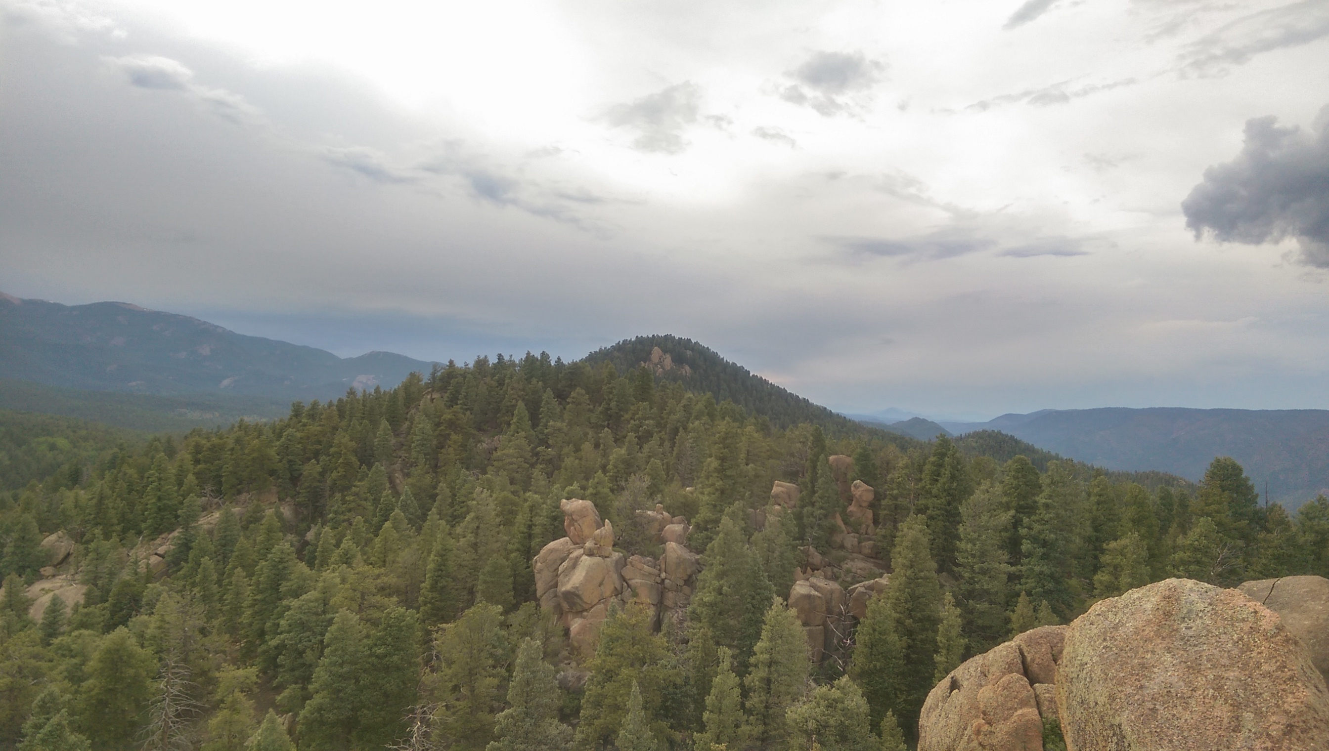
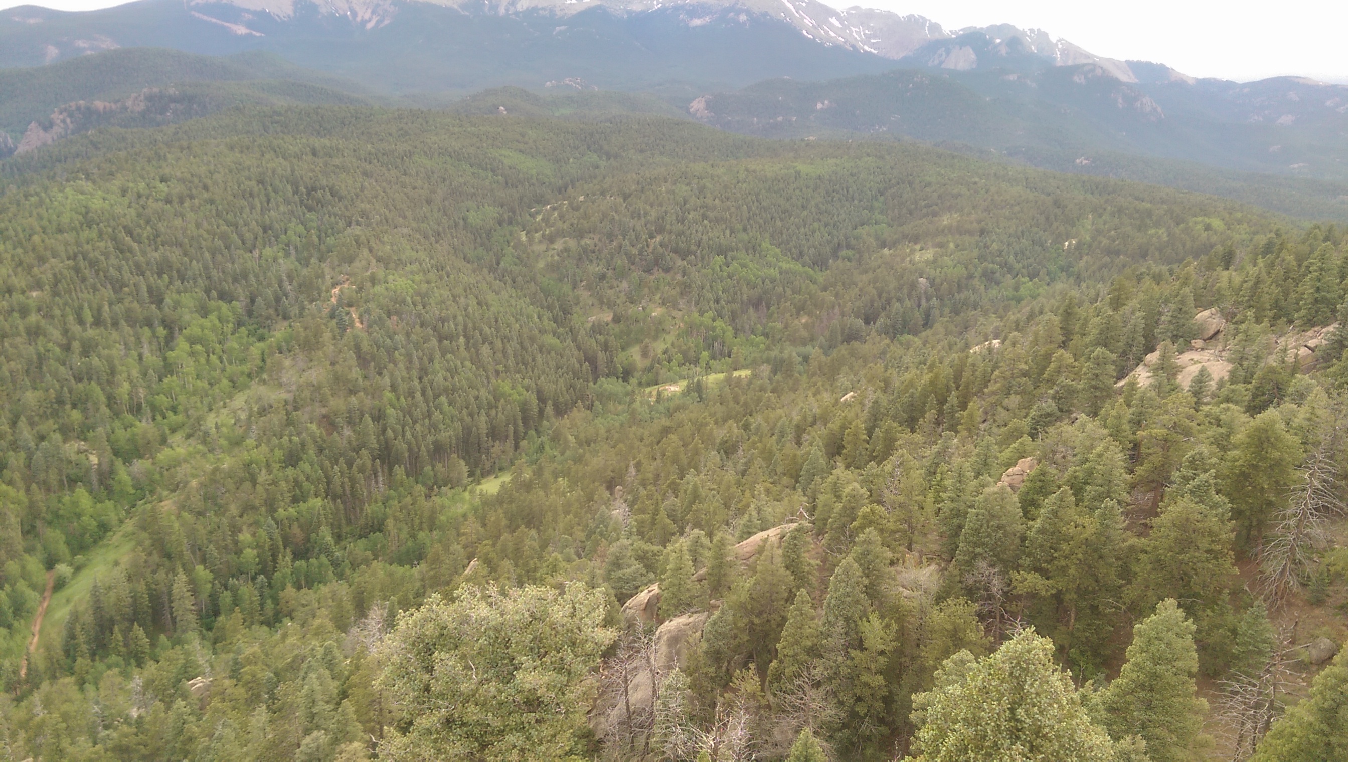
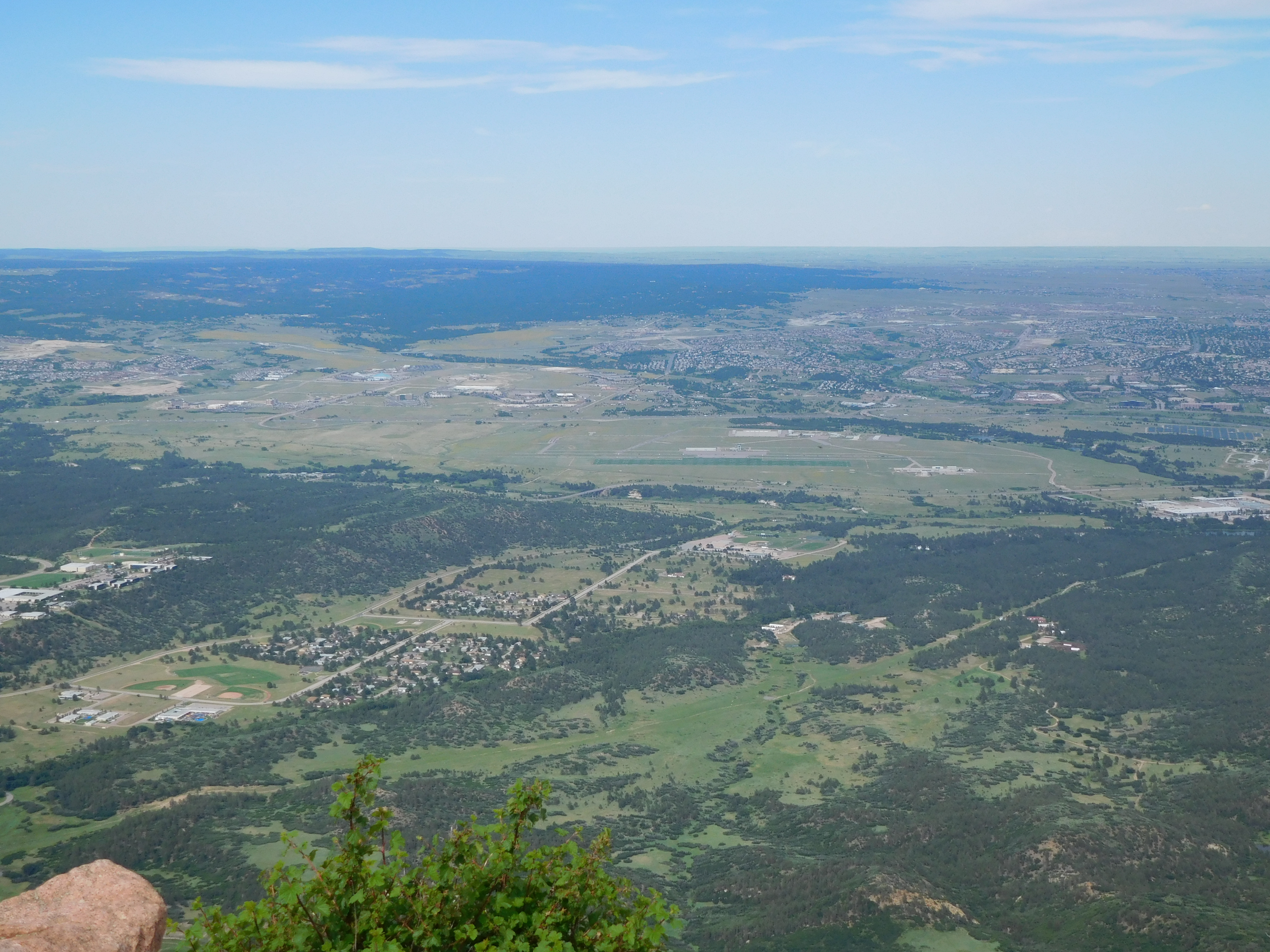
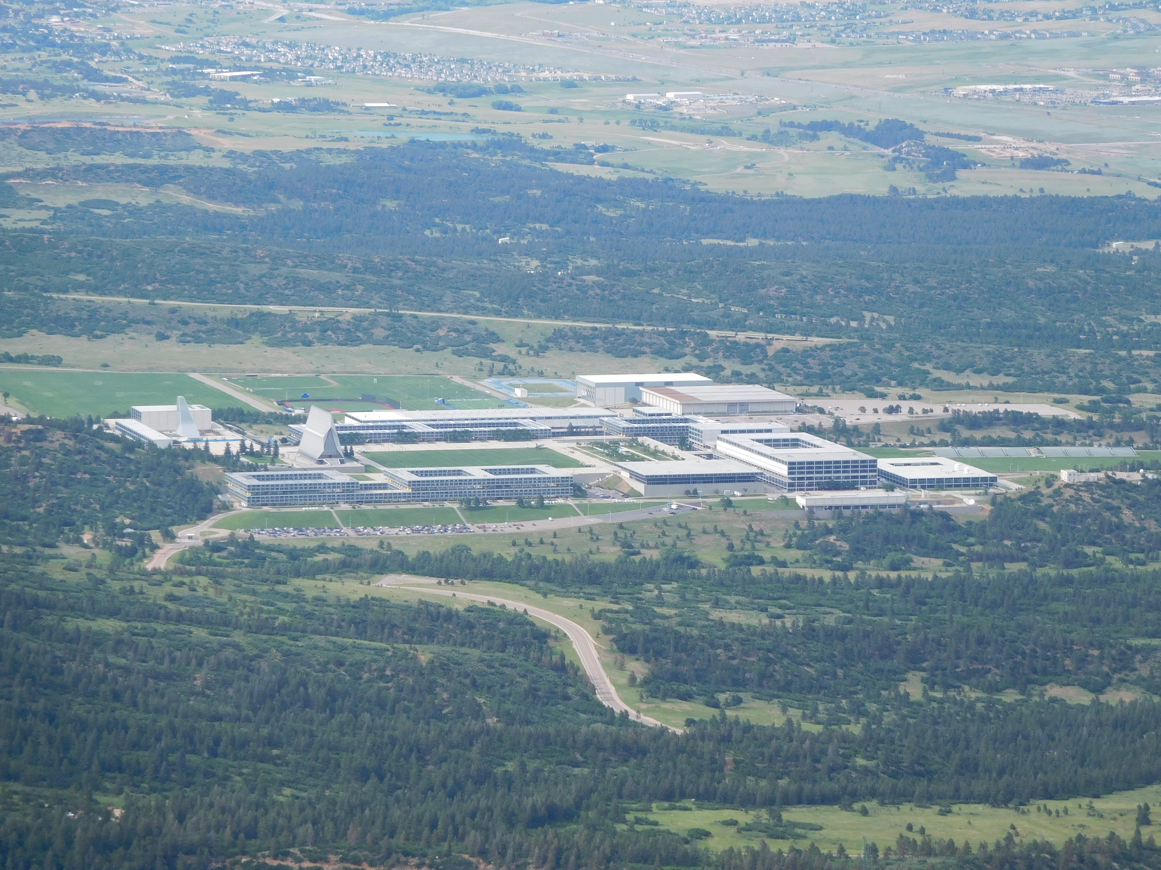
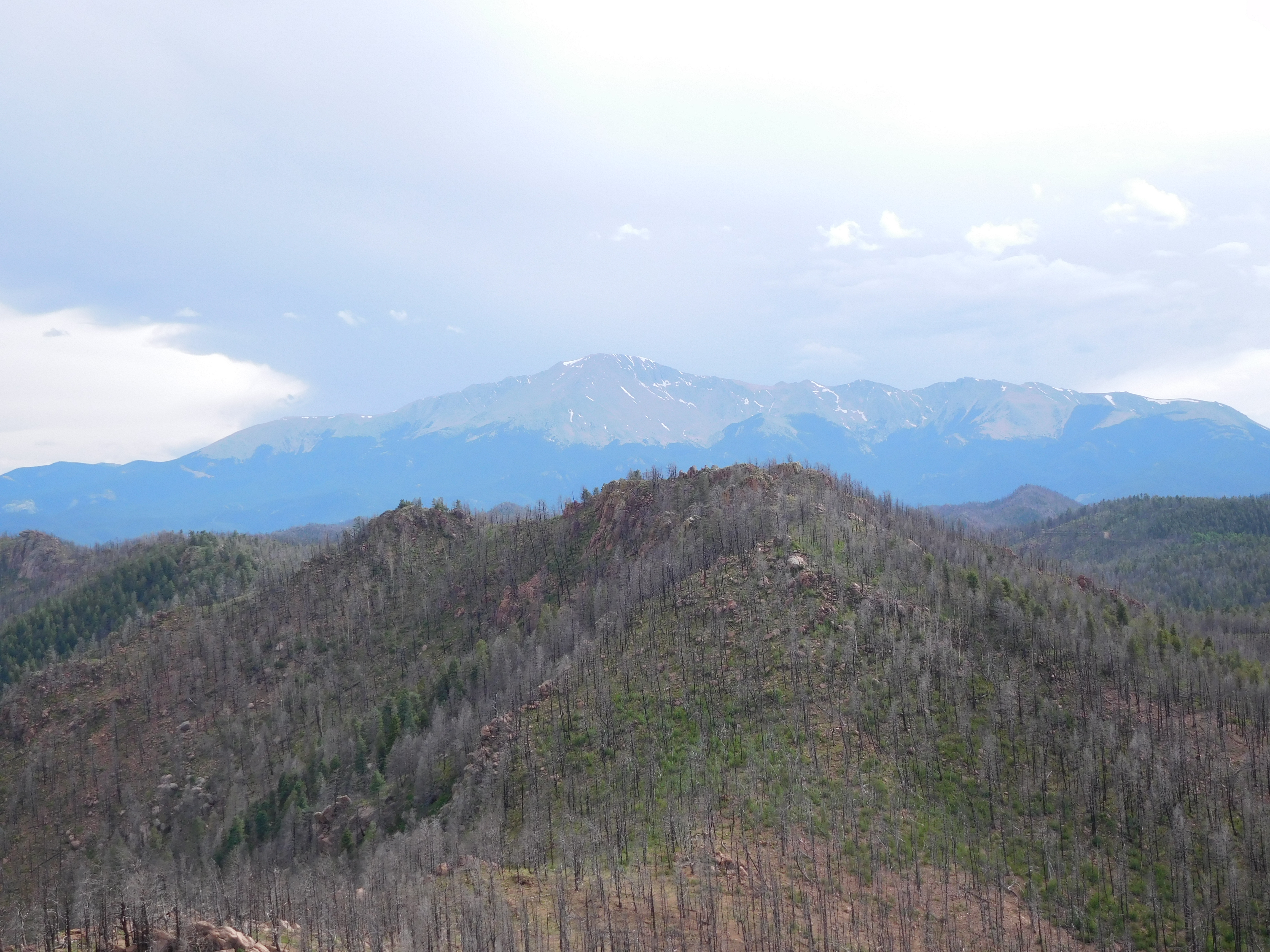
The view from the top was rather impressive for only ~2500 feet of elevation gain from the trailhead:

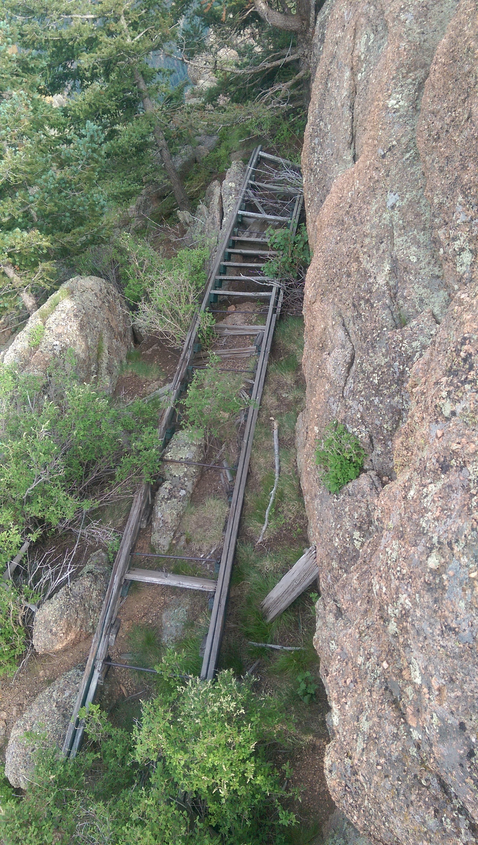
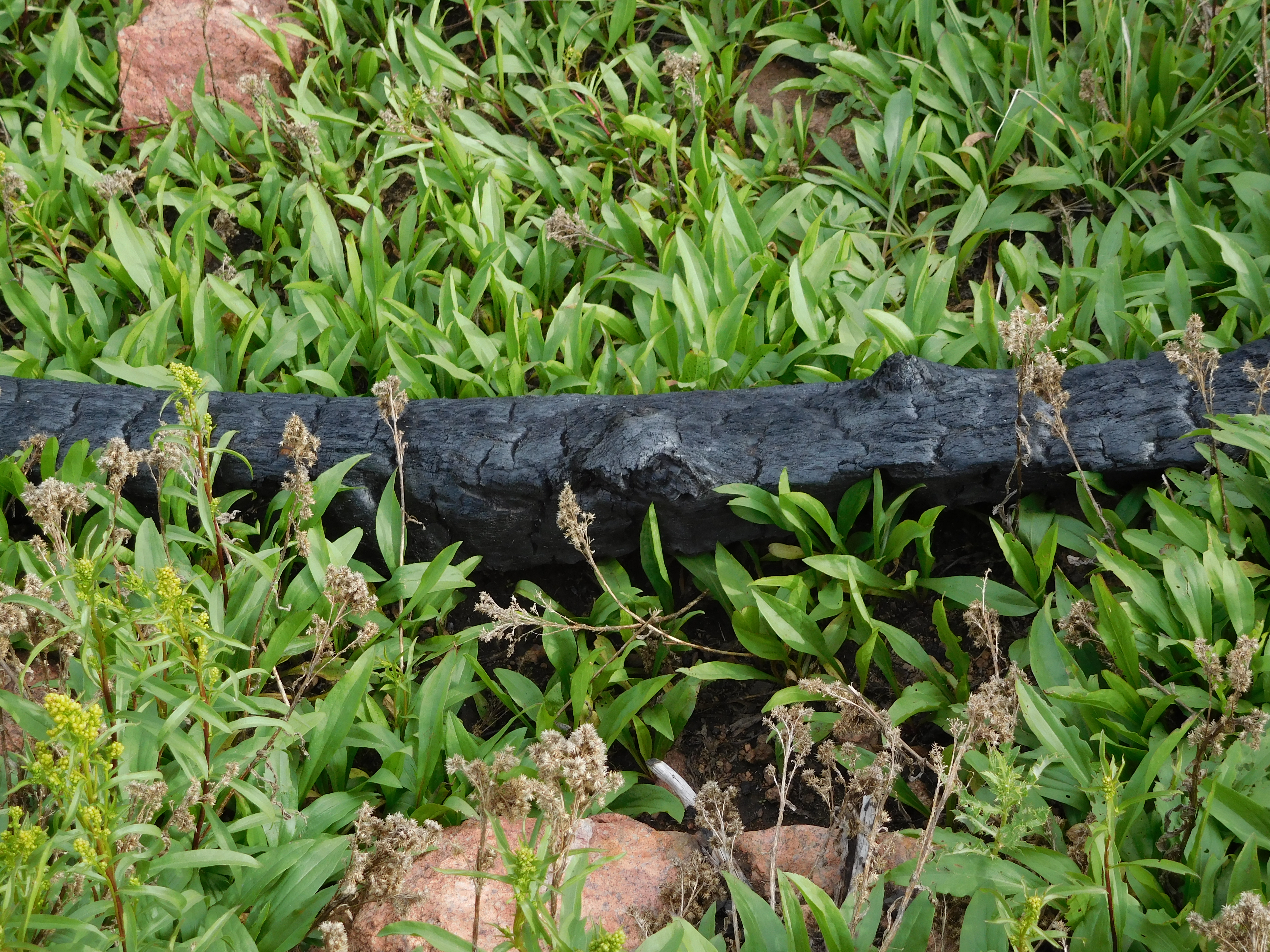
On the way back down I actually found a well defined trail (at least until it got to where it blended in with the generally washed out terrain thanks to the burn scar). Where the trees were all burned and dead the underbrush tended to be doing rather well.
Burned Log

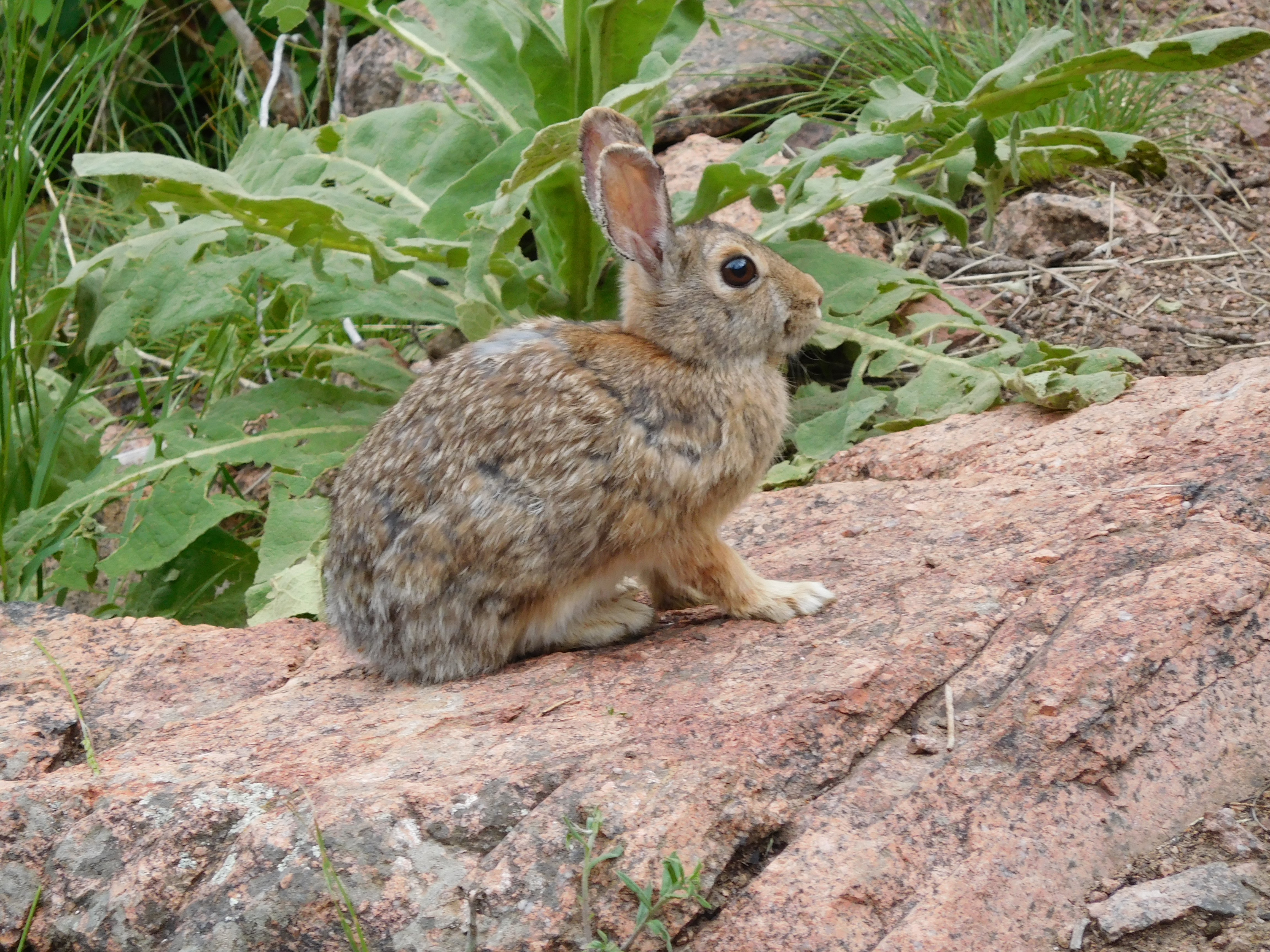
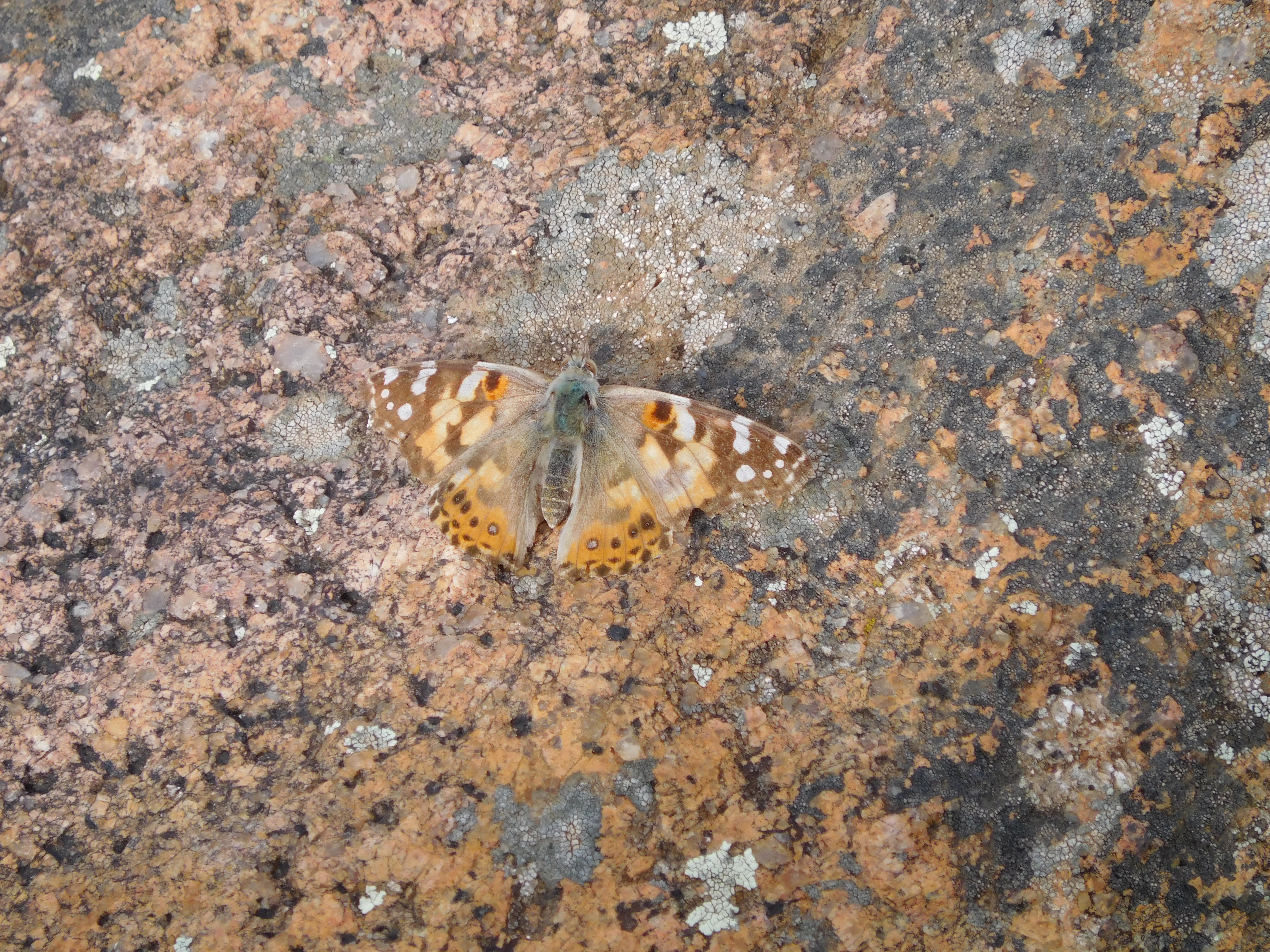
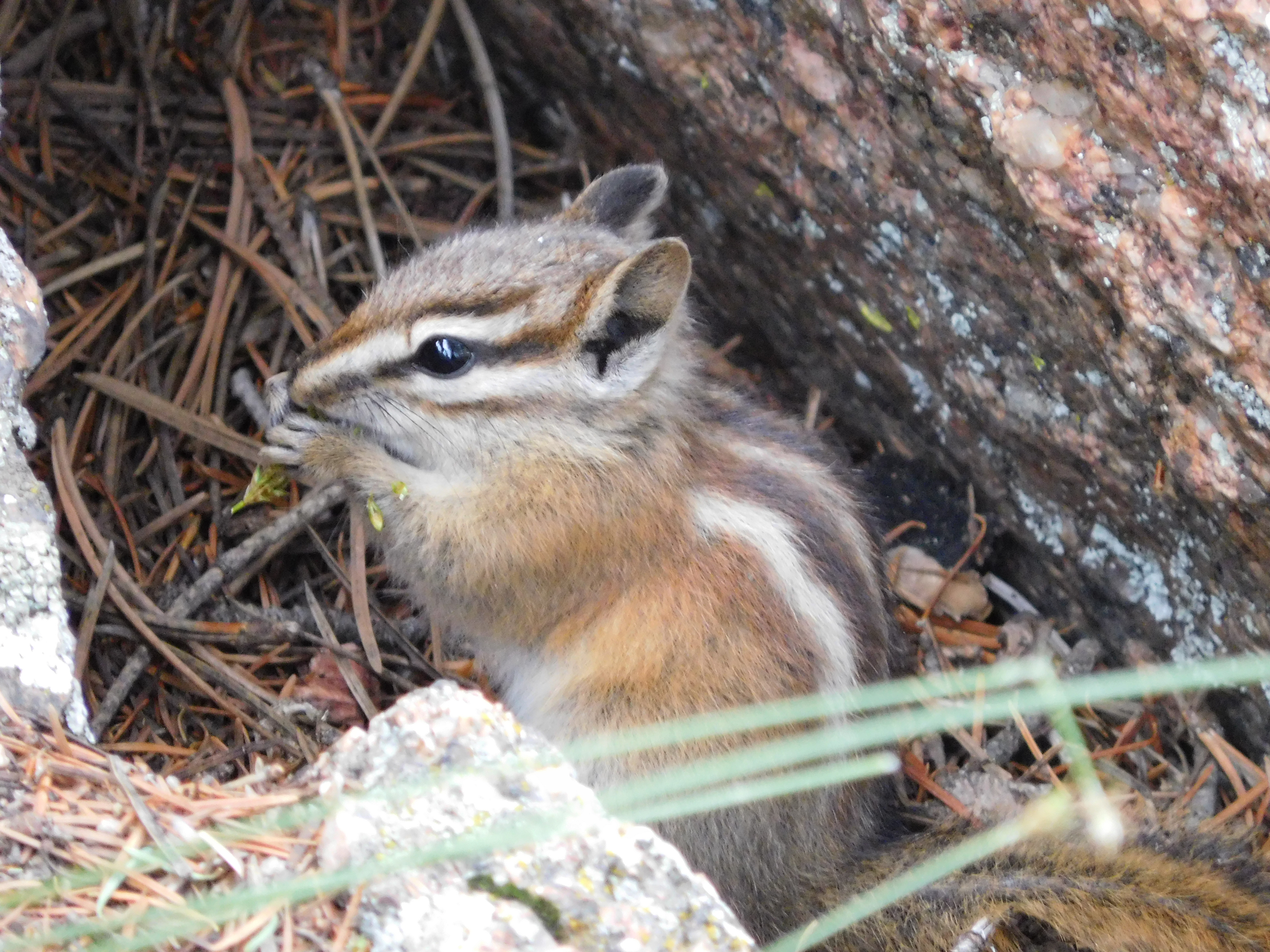
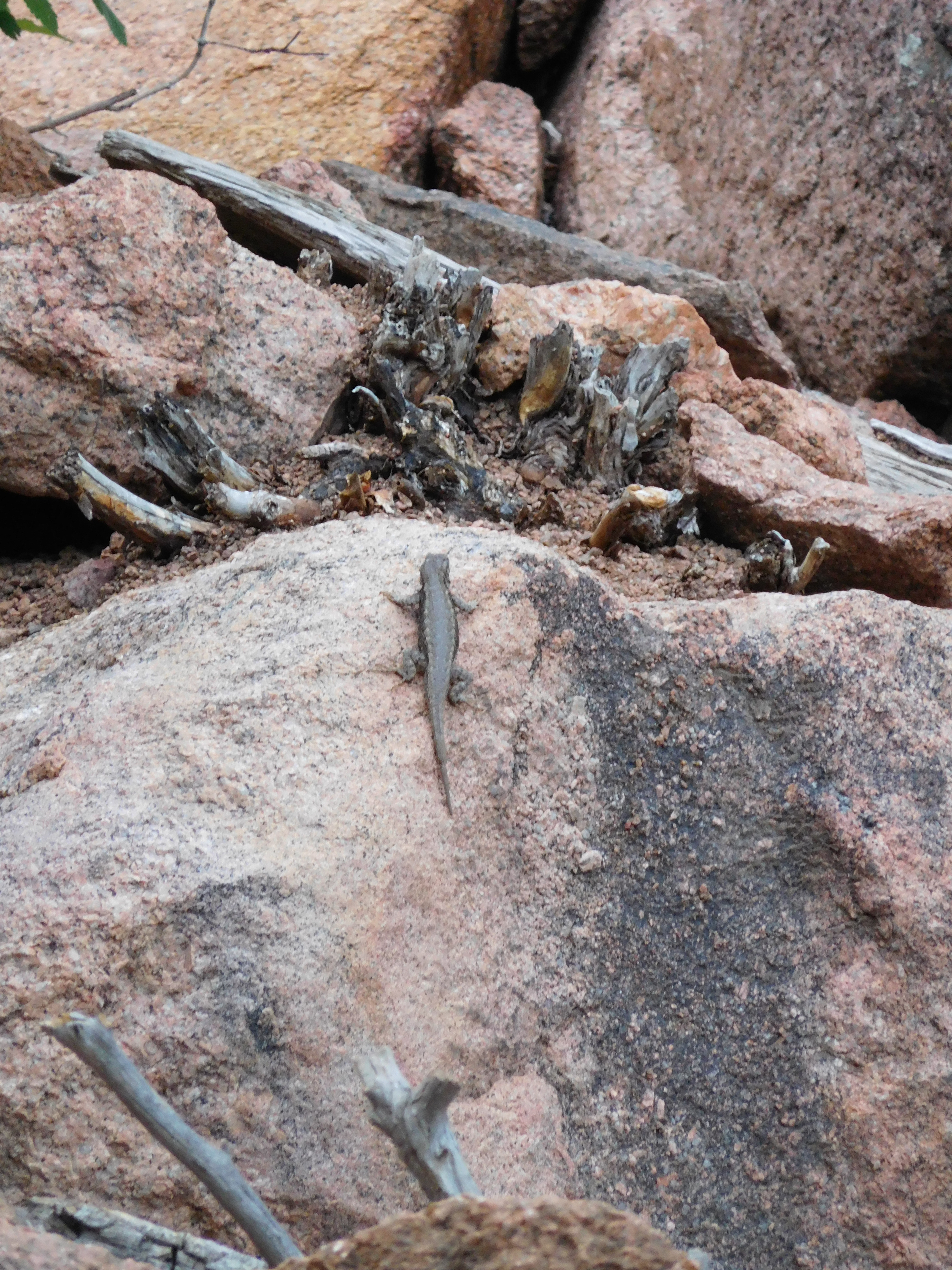
There was also plenty of wildlife to be seen. The magpies flew away before I got a good picture and the tiny birds living in the rocks of the boulder field were similarly camera shy, but I did catch some of the critters:


I saw a deer too, but that was in my rearview mirror in town while driving home. It made it across the street without getting hit.

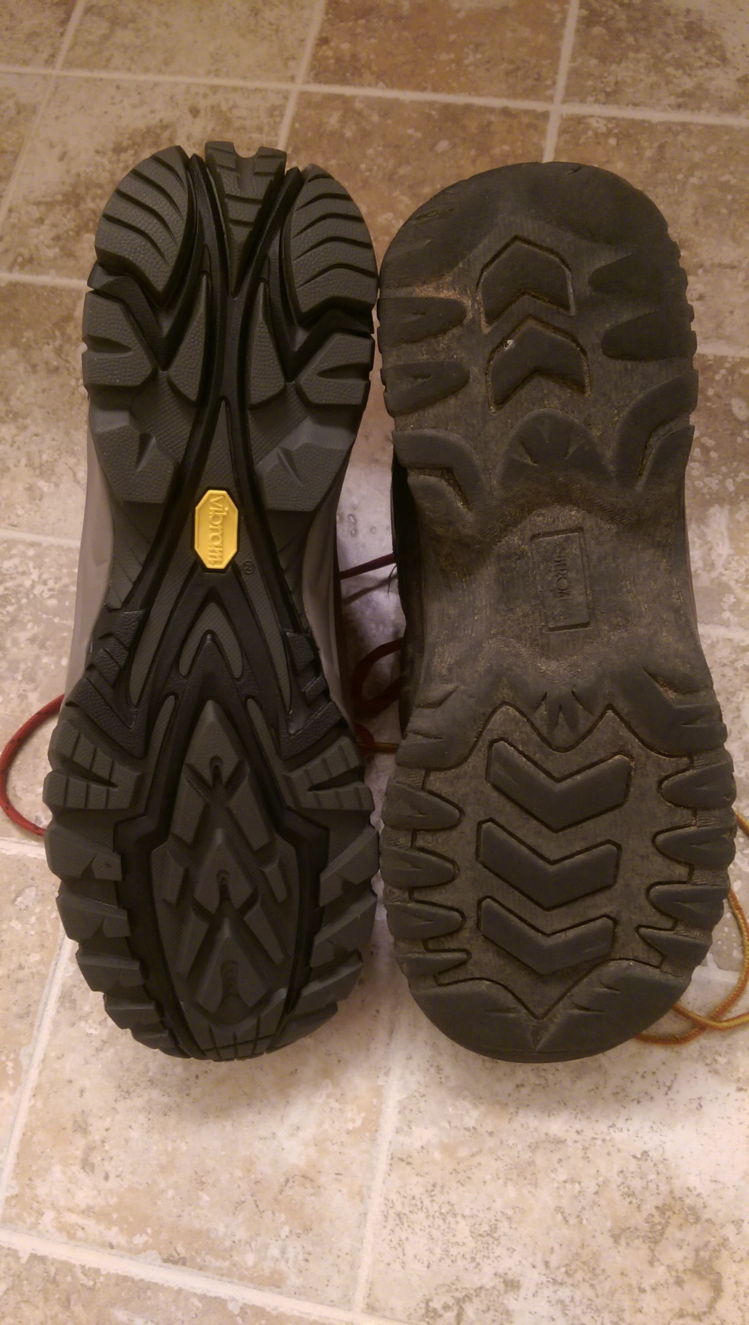
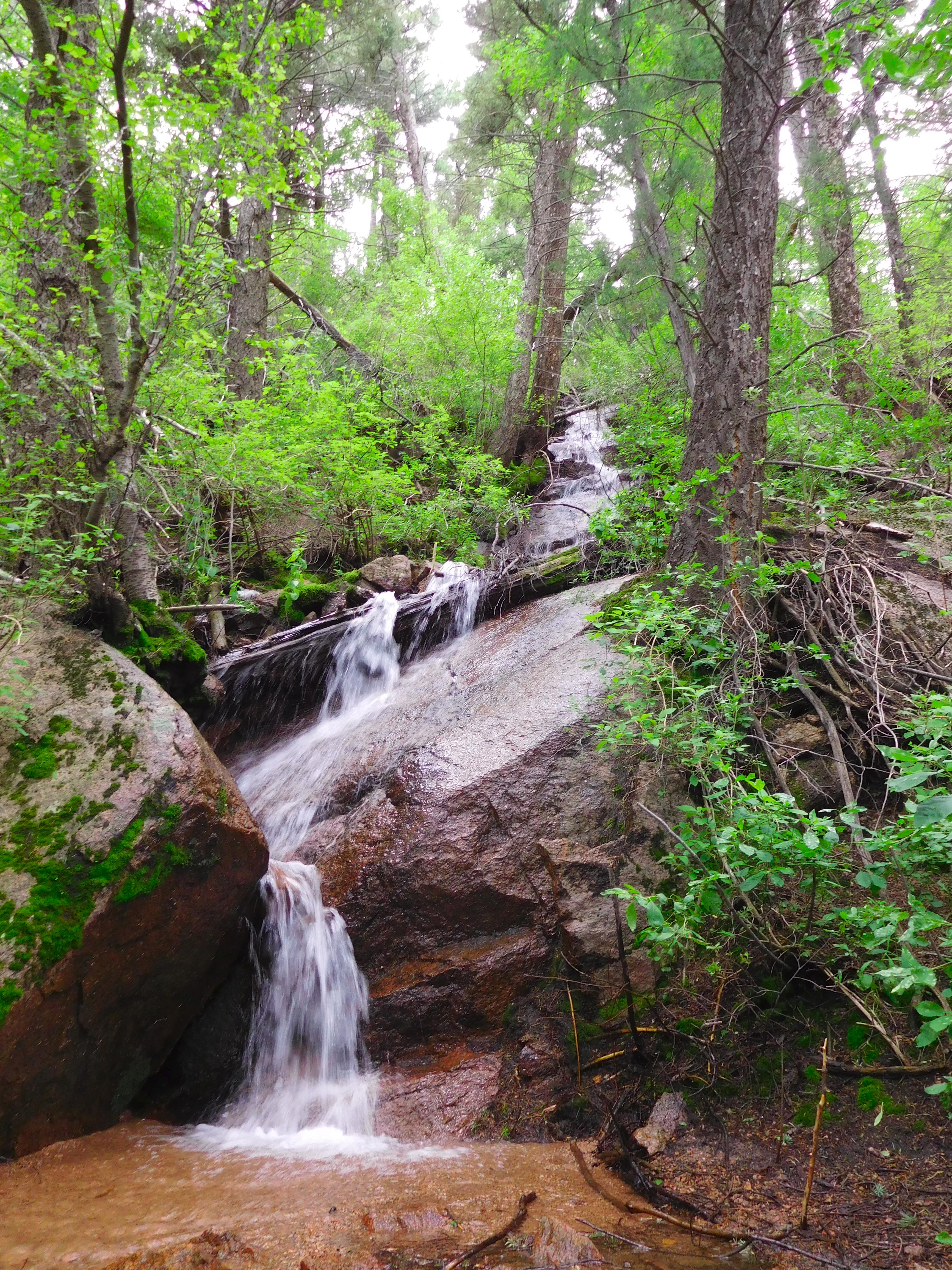
I also decided it was worth standing in the middle of the stream (it was very shallow and my new boots are waterproof) to get this picture of the waterfalls:
waterfall

As much as I’m sure it’s bloating the storage required for my blog I’m not regretting buying a new camera at all.

New Toys

As the header picture indicates I hiked to over 10,000 feet elevation on Thursday. That’s half way from Manitou Springs to the top of Pike’s Peak along Barr Trail. The cabin was bigger than I expected (not that I really knew what to expect).

I got a new camera this week so now I have an actual zoom. That means I can actually get reasonable pictures of the birds I see along the trail. Unfortunately few of the more interesting ones were out and I’m still learning how to use the camera effectively, but I did get a picture of this one:
Bird carrying grass

This is the top of rocky mountain, I was taking pictures from right next to the pipe sticking out of the big rock with a crack through the middle (you might need to enlarge the picture to see that detail):
Rocky Mountain

I also went up the incline the morning of July 4th:
July 4th Incline
They had it all decorated for the 4th of July with flags and such spread along the trail-side. The flagpole at the top is new – someone must have hiked it up earlier that morning. It was also the most crowded I’ve ever seen: the shuttle bus was standing room only and it looked like all parking up Ruxton Avenue was full at around 8:00 am. It turns out 8:00 isn’t a great time to be hiking it because there’s practically no shade on the trail itself and it’s starting to get hot. Considering the sun comes up at like 5:45 it’s probably well enough lit at 6:00 and doubtless much cooler.

Rocky Mountain

I’m stopping with the “incline” puns, but I do have some alternate titles/subtitles:

  • This week in Place You Could Fall Off of and Die
  • Next in Places to Not Be During a Thunderstorm
  • Mount Manitou Attempt Two

First off, I got new hiking boots this weekend:
Boots
Not only were my old boots mostly worn through the tread, but the souls aren’t glued on at the arch of the foot any more (the toe/heel are attached well enough it’s not an issue, but it’s definitely a sign they should be replaced). The new boots could use some breaking in to make them more comfortable, but they did well enough on their first hike and I didn’t come away with any blisters so breaking them in shouldn’t be a problem.

Starting out today I hadn’t really decided if I was going to try to find a way up Mount Manitou again or if I’d go elsewhere. The weather forecast said it was supposed to rain (and it was certainly humid enough for it) so I wasn’t sure I wanted to go to the top of anything in case of thunderstorm. Also, driving into Manitou Springs I got a flash flood warning on my phone and the path to Mount Manitou is alongside a creek.

Since I wasn’t keen on hiking by the creek I decided to take the opportunity to explore the fork to the right of this picture:
Rocky Mountain fork 1
I’d noticed it before, including that there’s a signpost without a sign (does it still qualify as a signpost?). The arrow/label scratched in the dirt was new, but there was still no indication of where the fork went. It’s obviously not a well-traveled trail (there’s a tree fallen across it currently) but there were older logs that were cut where they fell across the path so it’s clearly somewhat maintained.

At the top of Rocky Mountain (at least the rocky peak that lives up to the name) it is in fact quite rocky (also, the other side of those rocks is a sheer drop):
Very Rocky

There are even stairs to help you get to the top. Unfortunately they’re laying on the ground, probably because so many steps are missing they didn’t help much:
Stairs

Mount Manitou (the taller one in the center, the bump just left of it is where I ended up last time):
Mount Manitou

You can also see the experimental forest station (the clearing in the center):
Experimental Forest from above

On the way down I made a quick detour over to the experimental forest (there was echoing thunder by this point, but it was from the downhill direction and it wasn’t raining) to get a picture from there looking up at the rocks I was taking pictures from:
Rocky Mountain
It’s shots like this that make me wish I had a real camera (with zoom). Also, zoom would have gotten me pictures of several types of birds (one of which made squeaking noises) and a rabbit.

I did get rained on a little bit on the lower part of Barr trail (thankfully after I was well away from the creek). There was lighting (and lots more rain) over Colorado Springs on the drive home, but my time on the mountain was mostly overcast with some sun and a little bit of drizzle.